
Fog before the forties; brief weekend warmup
Temperatures fall Sunday in sharp cooldown

Go Deeper.
Create an account or log in to save stories.
Like this?
Thanks for liking this story! We have added it to a list of your favorite stories.


A brief weekend warmup will push temperatures into the 40s before a sharp cooldown arrives Sunday. The associated cold front will bring a slight chance of snow, mainly across eastern Minnesota.
Foggy conditions continue
Dense fog is expected to persist tonight as mild temperatures and light winds continue across the region. A dense fog advisory remains in effect for the southwestern corner of the state until 9 a.m. Saturday, though many other areas are also reporting reduced visibility.

Mild overnight temperatures in the 20s and 30s will keep moisture trapped near the surface, allowing foggy conditions to continue into the weekend.

Gloomy, dreary conditions are expected Saturday, with very mild temperatures ranging from the upper 20s and low 30s in the north to the 40s and even 50 in southern areas. Periods of drizzle are expected to develop throughout the day.
Turn Up Your Support
MPR News helps you turn down the noise and build shared understanding. Turn up your support for this public resource and keep trusted journalism accessible to all.

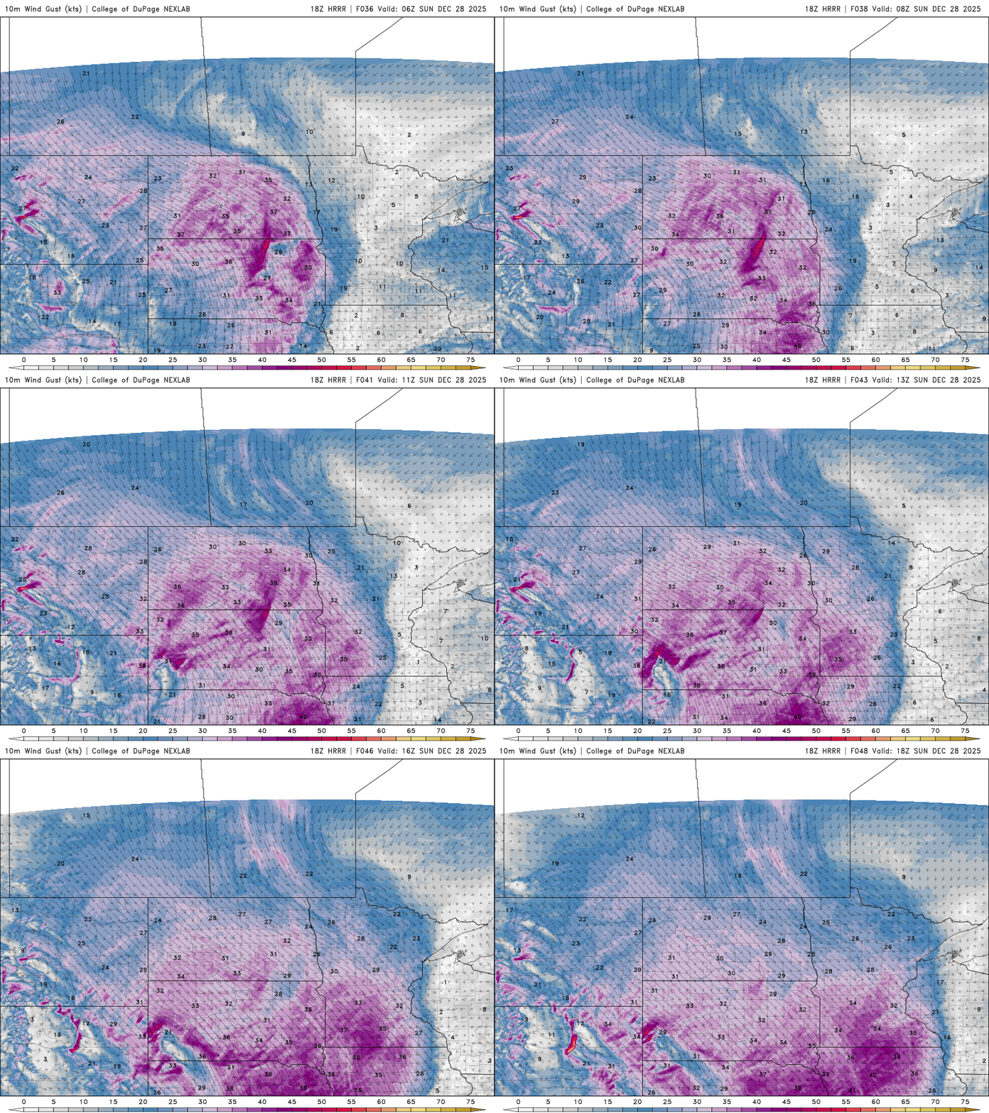
Attention turns to Sunday, when a strong Arctic front will move through the region. Northwest winds will increase, gusting up to 40 and possibly 50 mph, with a chance of accumulating snowfall.
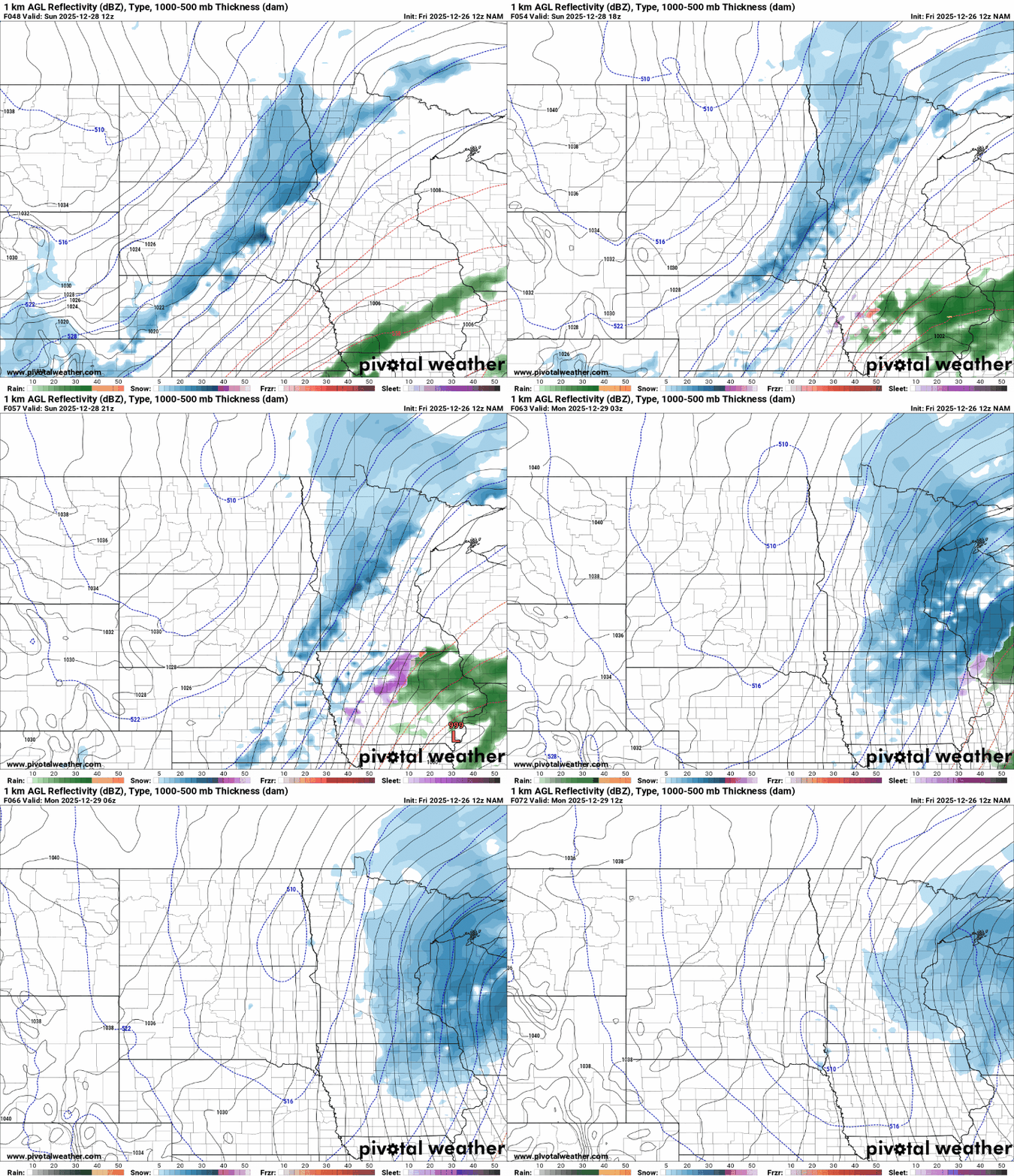
The exact location of snowfall remains uncertain, but forecast models suggest a potential for snow from east-central Minnesota into western Wisconsin. Several inches of accumulation are possible.
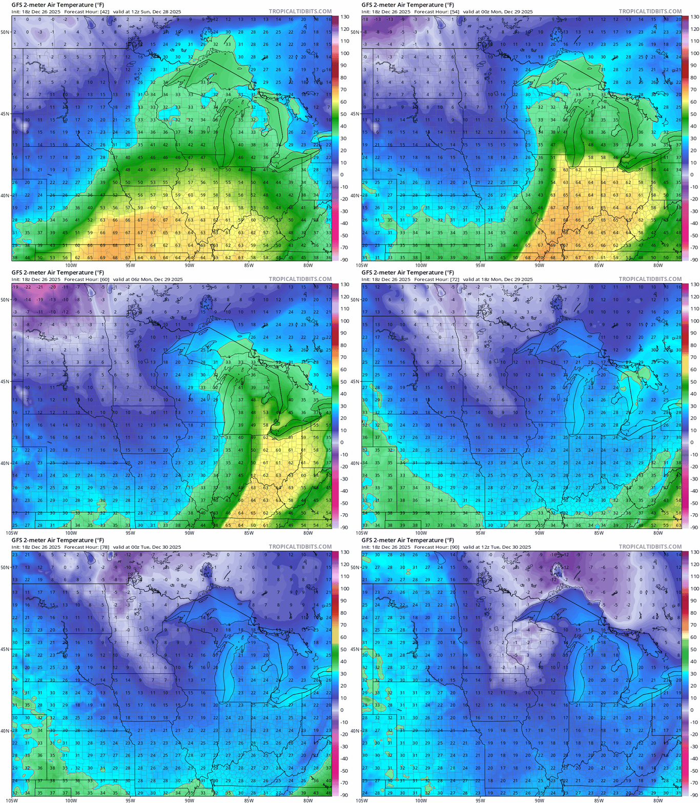
A surge of Arctic air will send temperatures plunging Sunday into the teens and single digits, while wind chills are expected to drop below zero Sunday night into Monday.
Temperatures are expected to fluctuate next week, with a chance for passing clipper systems

