
Very mild Friday, Saturday with falling temps Sunday
A potentially more active pattern develops next week
Go Deeper.
Create an account or log in to save stories.
Like this?
Thanks for liking this story! We have added it to a list of your favorite stories.


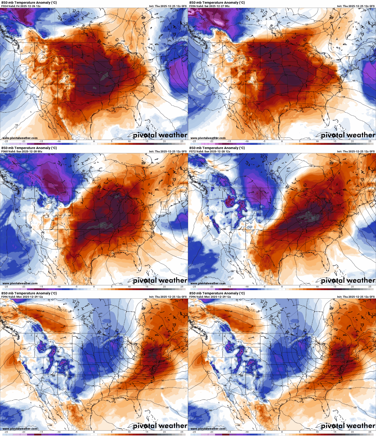
Very mild temperatures persist through Saturday with falling temps Sunday as arctic air moves in, producing some snow showers also.
More melting today and tomorrow before cold air moves in Sunday
Low clouds will linger much of Friday but fog and haze should improve as drier northwest winds blow. It will be very mild with above freezing afternoon highs. Southwest Minnesota will see highs in the low to mid 40s.

Temperatures will dip back below freezing for the northern half of the state Friday night into early Saturday. Watch for fog to redevelop and it could be freezing fog in central Minnesota where temperatures will drop just below freezing.
Temperatures will be the warmest yet this week on Saturday with highs near 50-degrees in southwest Minnesota and low 40s throughout central and southern Minnesota.
Turn Up Your Support
MPR News helps you turn down the noise and build shared understanding. Turn up your support for this public resource and keep trusted journalism accessible to all.

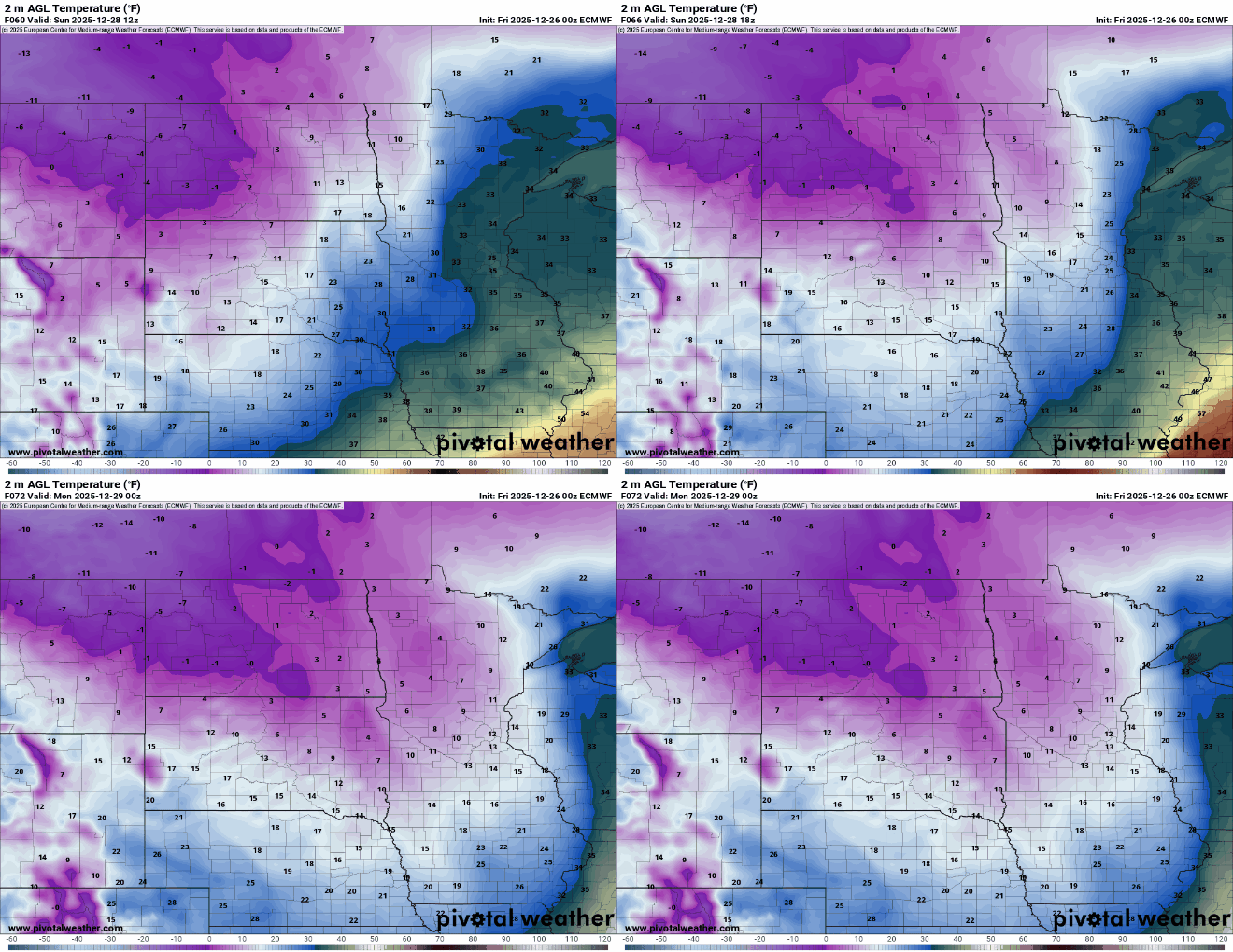
Temperatures will fall through the day Sunday from near-freezing in the morning into the teens by evening with temperatures dropping below zero in northwest Minnesota.
Ahead of the Arctic front we’ll also see snow showers develop through the day Sunday into Sunday night.
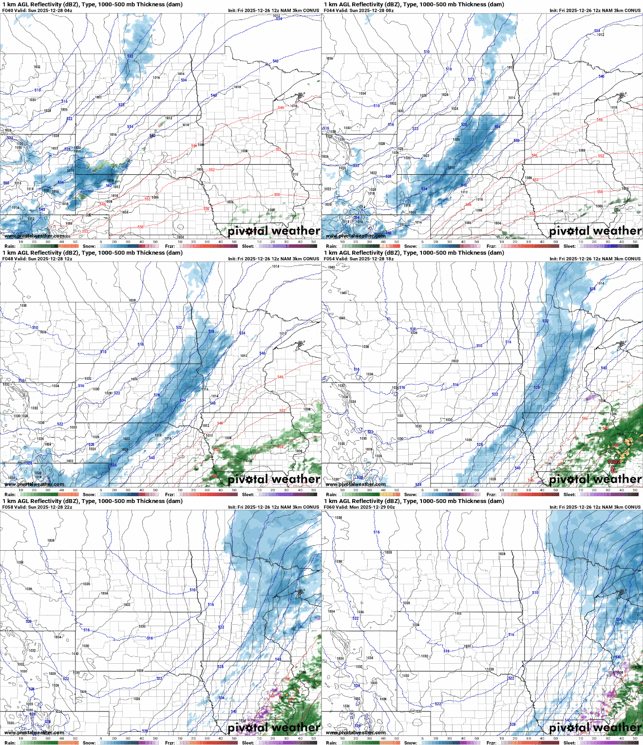
Most snowfall accumulation will be confined to eastern Minnesota into Wisconsin. At least an inch or two of snow is likely.

Several forecast models are starting to trend higher for Sunday snowfall in eastern Minnesota. Here’s the European Centre for Medium-Range Weather Forecast model. It shows the potential for several inches in northeastern and far eastern Minnesota into western Wisconsin.

Highs Monday will be in the teens and single digits but sunshine will also return thanks to the cold, dry air.

Temperatures will pop back up into the 20s and 30s for southern Minnesota by Tuesday but then cool off again midweek. It will be a roller coaster of temperatures and a potentially more active pattern with the jet stream overhead. There could be a couple of snowfall chances Tuesday and Wednesday.

