
Gloomy skies, mild temperatures to start the weekend
High-impact winter storm to close the holiday weekend

Go Deeper.
Create an account or log in to save stories.
Like this?
Thanks for liking this story! We have added it to a list of your favorite stories.


A gray and foggy start to the weekend will give way to mild late-December temperatures Saturday, but much more impactful weather is waiting just around the corner.
Dense fog, cloud cover, freezing drizzle
Widespread dense fog is blanketing the state to start the weekend, prompting a Dense Fog Advisory through noon Saturday. Visibilities of one-quarter mile or less are common, and areas of freezing fog are creating slick travel conditions, particularly across northern Minnesota.
A Winter Weather Advisory remains in effect until noon Saturday for northern Minnesota, extending as far south as Bemidji, Walker, Hibbing, and areas just north of Duluth, where sub-freezing temperatures lingering early this morning are allowing freezing rain and freezing drizzle to develop.
Turn Up Your Support
MPR News helps you turn down the noise and build shared understanding. Turn up your support for this public resource and keep trusted journalism accessible to all.
Low cloud cover remains locked in place today, with temperatures climbing into the upper 20s and 30s across northern Minnesota and the 40s farther south. A few 50-degree readings are possible near the Buffalo Ridge.

Winter storm Sunday into Monday: travel impacts likely
Attention now turns to a high-impact winter storm expected to arrive Sunday and continue into Monday, with potential impacts on holiday travel. Forecast models indicate that heavier snow accumulations are becoming more likely, particularly across eastern Minnesota and western Wisconsin.

Strong northwest winds gusting between 35 and 45 mph could produce blowing snow, sharply reduced visibility and brief whiteout conditions, with the strongest winds expected in western Minnesota. Combined with falling snow, these winds will create hazardous travel conditions, particularly Sunday into Monday. Blizzard-like conditions are most likely in western and southern Minnesota, but brief whiteouts are possible across much of the region.

The heavier snow amounts and blustery winds have prompted a winter storm watch from Sunday morning through Monday morning for the entire region, including the Minnesota River Valley, central and southeastern Minnesota, the Twin Cities metro area and western Wisconsin.

Behind the cold front, temperatures will fall through Sunday and remain cold into Monday. Monday morning lows are expected in the single digits above and below zero, with highs recovering only into the teens by Monday afternoon.
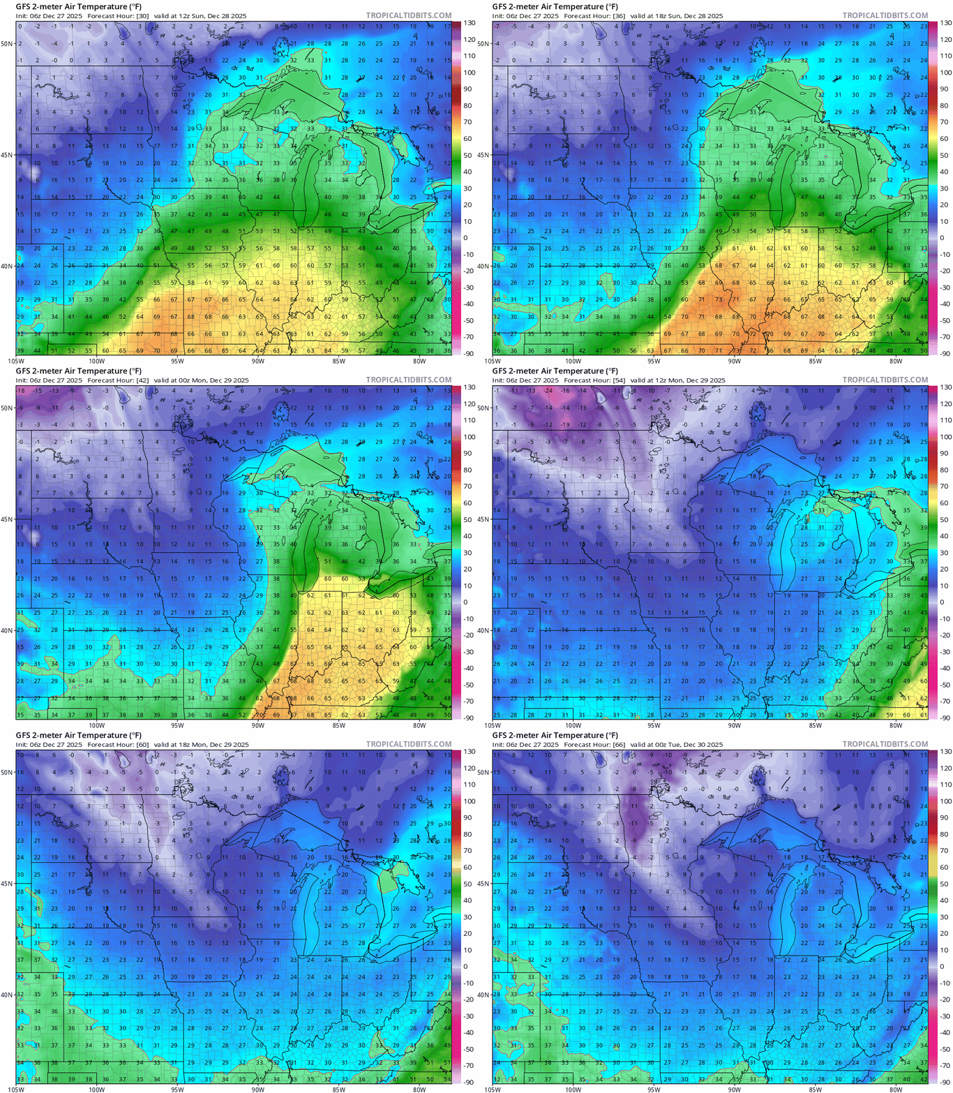
After a brief warmup Tuesday into the upper 20s and low 30s, temperatures are trending colder at the start of the New Year, meaning any snowfall is likely to stick around for a while.

