
Dangerous, life-threatening storm to create hazardous travel
Heavy snowfall, blustery winds and blizzard conditions expected

Go Deeper.
Create an account or log in to save stories.
Like this?
Thanks for liking this story! We have added it to a list of your favorite stories.


Dangerous, potentially life-threatening travel conditions are expected to develop today across Minnesota and Wisconsin and persist into early Monday morning as a major winter storm impacts the region.
Major winter storm system moving in
A powerful, strengthening low-pressure system will track from the central Plains into the Great Lakes, placing much of the Upper Midwest in a favorable position for heavy snowfall and strong winds.
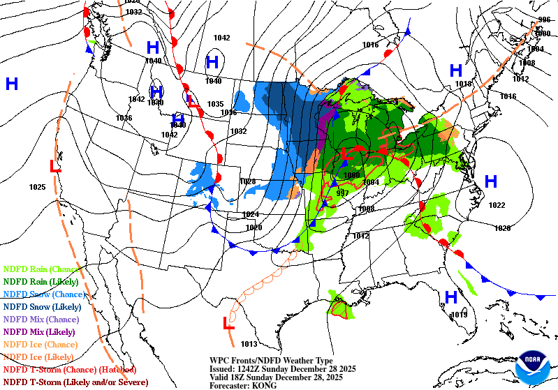
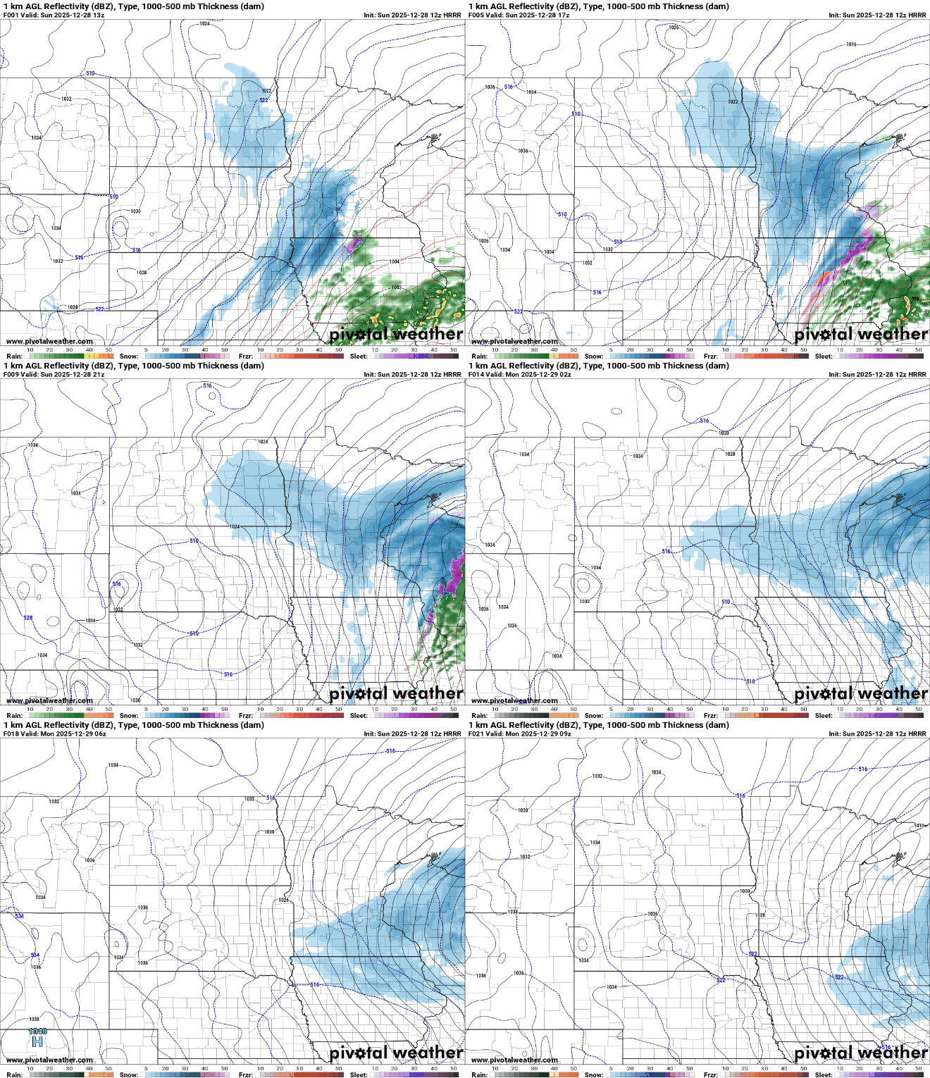
Snow ongoing across western Minnesota will spread east Sunday morning, reaching the Twin Cities between 9 and 10 a.m. and western Wisconsin by early afternoon. Snowfall rates will briefly become heavy during the initial surge, reaching up to an inch an hour and reducing visibility, creating hazardous travel conditions.
Light to moderate snow will then continue through the afternoon and evening, with additional snowfall overnight into Monday morning as the storm slows to the east.
Turn Up Your Support
MPR News helps you turn down the noise and build shared understanding. Turn up your support for this public resource and keep trusted journalism accessible to all.
A blizzard warning is in effect for much of western, central and southern Minnesota, where the combination of snow and powerful winds will create the most dangerous conditions.
A winter storm warning remains in effect for east-central Minnesota, including much of the Twin Cities metro area and western Wisconsin, where heavier snowfall and periodic whiteout conditions are expected.
A winter weather advisory is in effect for areas just west and east of the blizzard warning, where snowfall totals will be lower but blowing snow could still create hazardous conditions.
Widespread snowfall totals of 6-10 inches are expected across central and eastern Minnesota and western Wisconsin, with locally higher amounts possible. Snowfall totals will decrease farther west, ranging from 1-5 inches in northern and southwestern Minnesota and 4-6 inches in the blizzard warning area.


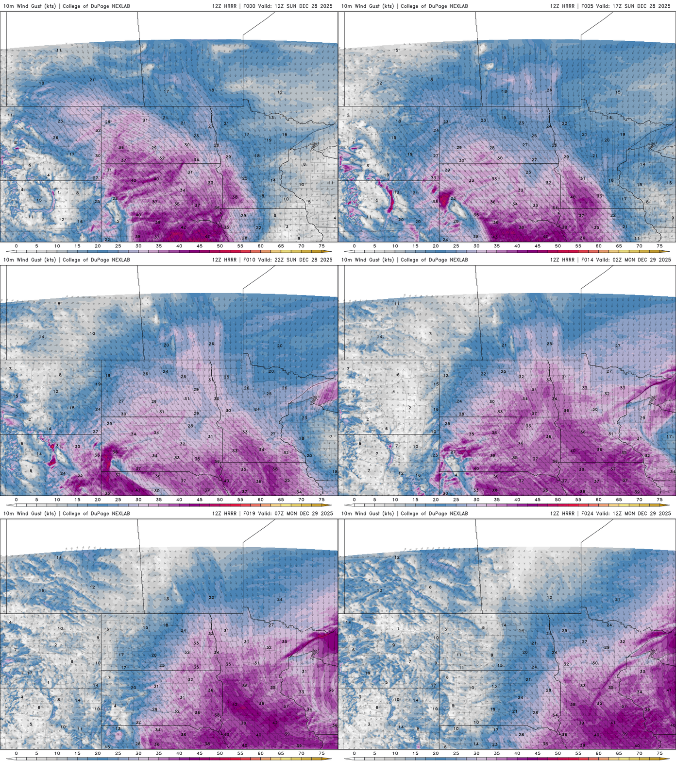
Strong northwest winds will develop as the storm intensifies. Sustained winds of 30-35 mph, with gusts reaching 50-55 mph, are expected across western, central and southern Minnesota. These winds will cause widespread blowing and drifting snow, leading to near-zero visibility at times, especially in open areas.
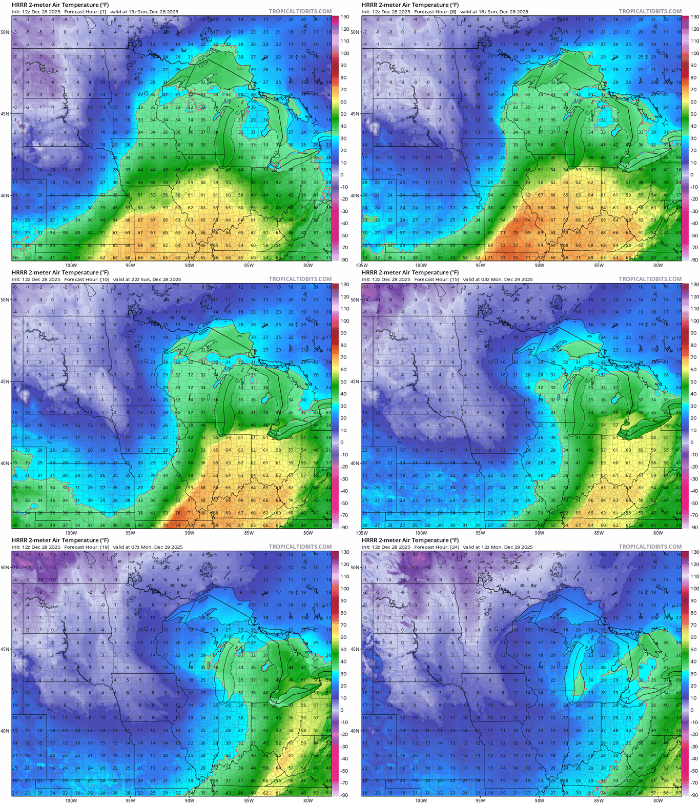
Behind the cold front, temperatures will drop sharply, with many areas seeing a 20- to 30-degree drop. This rapid cooling could lead to a flash freeze in areas that saw rain earlier, quickly turning wet surfaces icy and creating hazardous travel conditions.
Stay safe out there!

