
Tracking light snow and falling temps to end the year
Go Deeper.
Create an account or log in to save stories.
Like this?
Thanks for liking this story! We have added it to a list of your favorite stories.


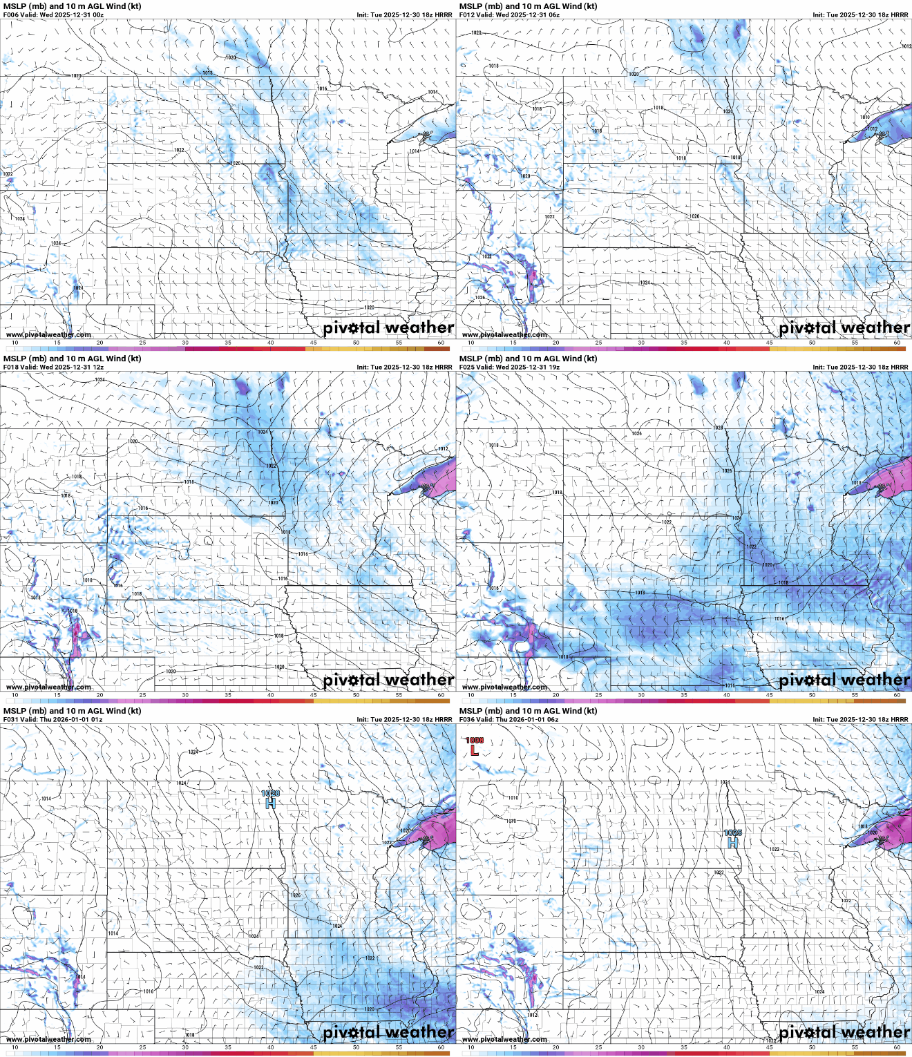
Expect travel to be slow moving at times this evening as areas of light snow and freezing drizzle taper off. Another widespread chance for near an inch of snow or under will similarly impact travel Wednesday morning and afternoon.
That's it for snow in the current forecast for much of the region. Northern Minnesota may receive a dusting of snow on New Year's Day.

Temperatures will trend cooler overall through New Year's Day then gradually rise near normal through the weekend. In the short term, it will briefly get warmer before the cold air settles in.
Tuesday's high temperatures will be set late this evening as temperatures slowly rise, then falling temps will lead to Wednesday's highs being set around midnight.
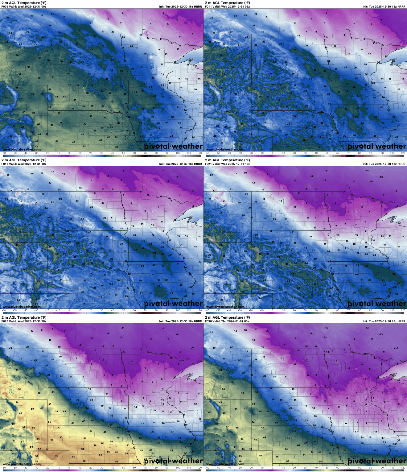
It will be chilly for those celebrating New Year’s Eve. Temperatures bottom out Wednesday night ranging from near zero to the negative teens looking north. Wind chill values will fall between -10 and -30 across the region.

Thursday features highs in single digits and teens under partly sunny skies.

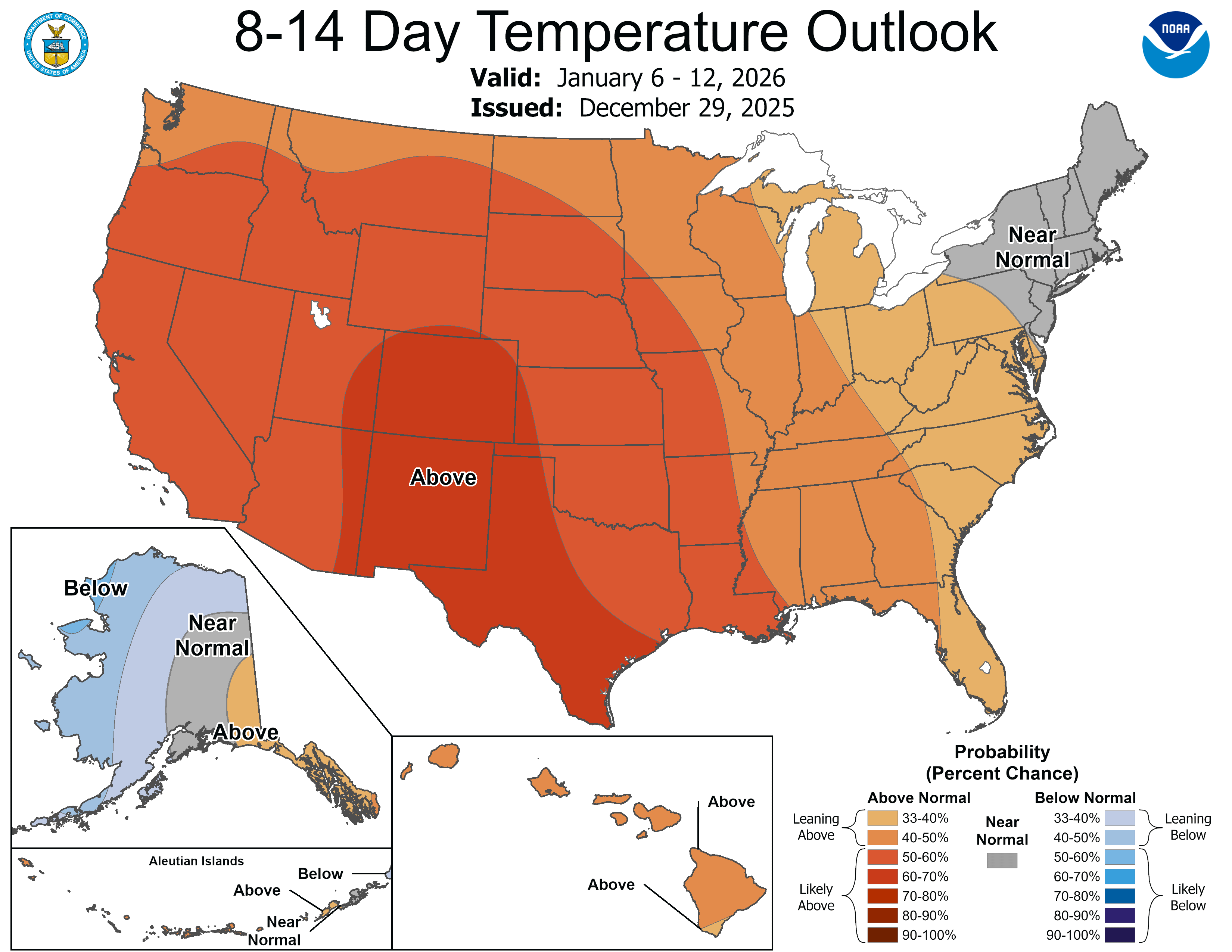
2026 will kick off cold and relatively quiet, but the long-term trend is for temperatures to return to normal by Sunday and remain on the mild side overall for the first week or two of January.
Turn Up Your Support
MPR News helps you turn down the noise and build shared understanding. Turn up your support for this public resource and keep trusted journalism accessible to all.

