
A chilling countdown to the New Year
Cold weather advisory for extreme northern Minnesota

Go Deeper.
Create an account or log in to save stories.
Like this?
Thanks for liking this story! We have added it to a list of your favorite stories.


A frosty start to New Year’s Eve celebrations is expected across the region. A cold weather advisory is in effect for northern Minnesota through New Year’s Day.
Cold weather advisory for New Year’s Eve
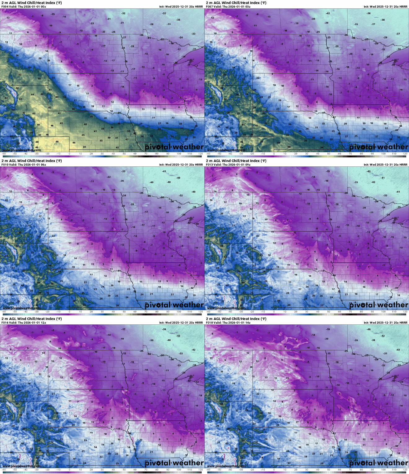
A cold weather advisory has been issued for northern Minnesota as a surge of Arctic air filters into the region. Overnight lows are expected to drop well below zero, with cold conditions persisting into the morning hours.

Wind chill values are expected to drop into the 20s and 30s below zero across northern Minnesota, despite relatively light winds under high pressure.
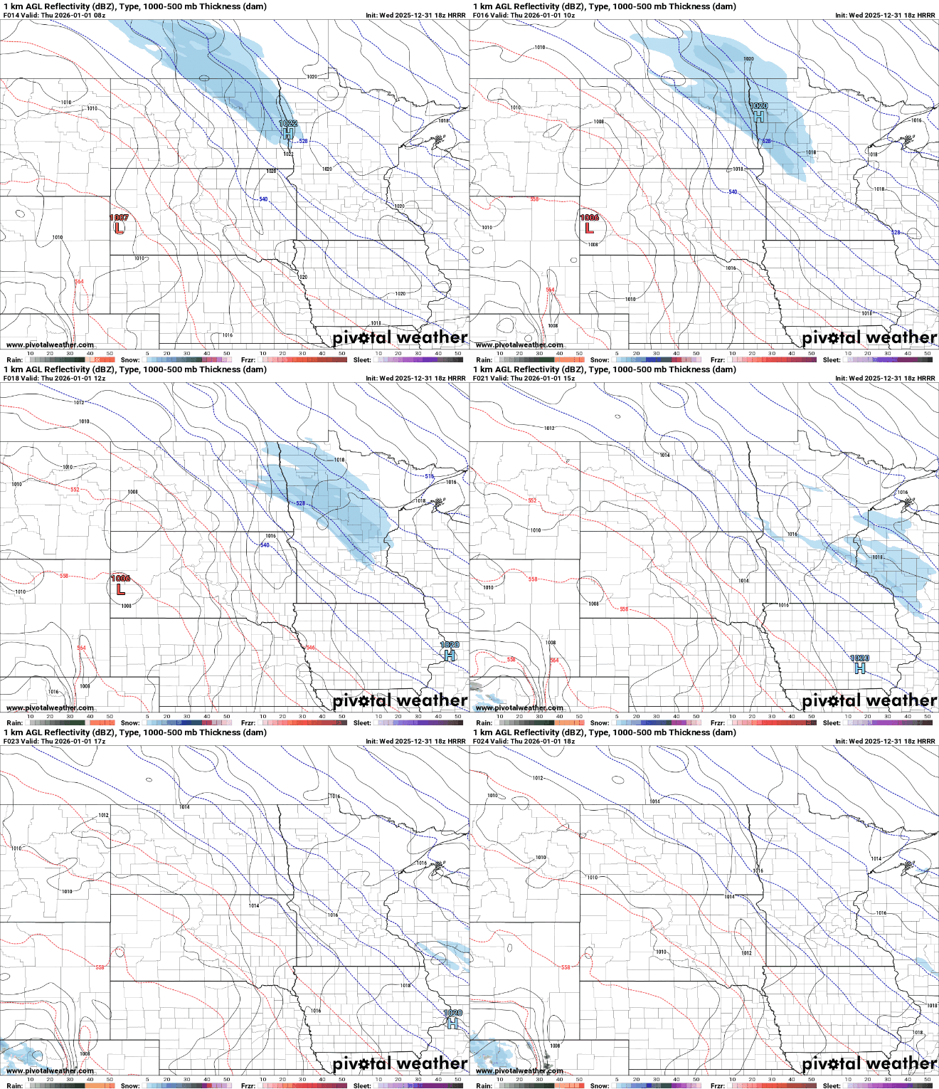
New Year’s morning into early afternoon, light snow may develop, especially along and north of I-94. Additional accumulations are expected to remain light, generally between one-half inch and 1 inch.
A nicer stretch ahead
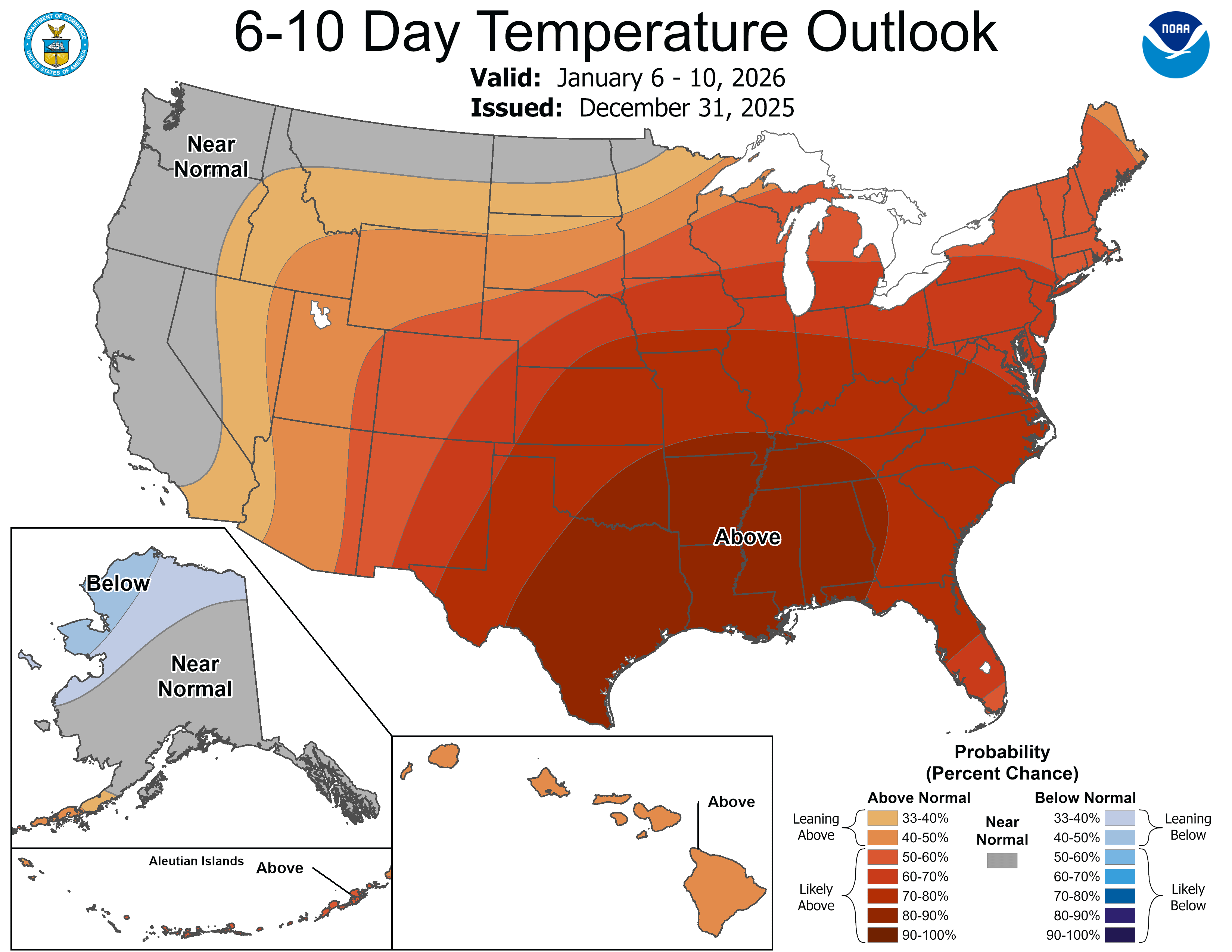
By Sunday into next week, the weather pattern shifts as winds aloft turn more westerly. This will allow temperatures to moderate into the 20s, with some areas reaching the 30s. Overnight lows will trend milder, generally in the teens.
Weak disturbances may bring light snow Saturday and again Monday, though accumulations are expected to remain minor, ranging from a trace to a few tenths of an inch.
Wishing you a safe and happy New Year’s Eve!
Turn Up Your Support
MPR News helps you turn down the noise and build shared understanding. Turn up your support for this public resource and keep trusted journalism accessible to all.

