
Minnesota's top 5 weather events of 2025
Go Deeper.
Create an account or log in to save stories.
Like this?
Thanks for liking this story! We have added it to a list of your favorite stories.


The Minnesota State Climatology Office has announced the top five weather events of 2025, based on votes from a variety of weather enthusiasts, including the National Weather Service, the University of Minnesota and state agencies.
5. A mess of heavy snow, slush and ice, Dec. 9-10, 2025
A strong “Clipper” system brought a mix of heavy snow, sleet, freezing rain and rain across much of Minnesota from Dec. 9 into Dec. 10, 2025.
Snowfall totals ranged from 3 to 8 inches along a northwest to southeast axis, with higher amounts reported in central Minnesota, including more than 10 inches near Park Rapids, Ottertail and Cass Lake. Lighter totals fell farther south and east, with 4.4 inches in the Twin Cities and just over an inch in Rochester and Duluth.
The storm helped establish snow cover statewide, with central Minnesota seeing the deepest accumulation of 12 to 16 inches in areas such as Aitkin, Brainerd, Little Falls, Long Prairie and Milaca.
Turn Up Your Support
MPR News helps you turn down the noise and build shared understanding. Turn up your support for this public resource and keep trusted journalism accessible to all.
4. Hot, fiery weather, May 10-14, 2025
A hot, dry air mass settled over Minnesota from May 10-14, bringing record high temperatures and an outbreak of wildfires.
International Falls set a record early-season high of 96 degrees F on May 11 and remained at or above 90 for four straight days, the first such stretch in May at the station. Daily records were also set in St. Cloud, the Twin Cities and Duluth.
The combination of dry heat, low humidity and gusty winds fueled several large wildfires in St. Louis and Pine Counties, causing property damage and evacuations. Conditions eased on May 15 as storms, rain and cooler air moved into the state.
3. The latest run of summer-like days on record
Most of Minnesota experienced a warm spell from late September into early October 2025, but in western parts of the state, the streak of summer-like days occurred more than three weeks later than any comparable period on record.
Milan in Chippewa County saw 11 straight days with highs of 85 degrees or more from Sept. 25 to Oct. 5, the latest such streak in over 130 years of records.
The spell began with dry heat and low humidity, then became more humid at the end, producing unusually warm nights as well as days. This late-season warmth highlighted the ongoing trend of summer-like conditions extending further into the fall.
2. The great Minnesota smoke-out of 2025
Minnesota experienced one of its smokiest summers in decades in 2025, as wildfire smoke from Manitoba and Saskatchewan degraded air quality and kept many residents indoors. From June through August, the state recorded 15 days with an air quality index in the "Unhealthy" category and nine more days over 100, far exceeding recent years.
Three major smoke events occurred: late May into early June, July 11-13, and a nine-day stretch from late July into early August. Observations suggest 2025 was likely the smokiest year in Minnesota in at least 50 years.

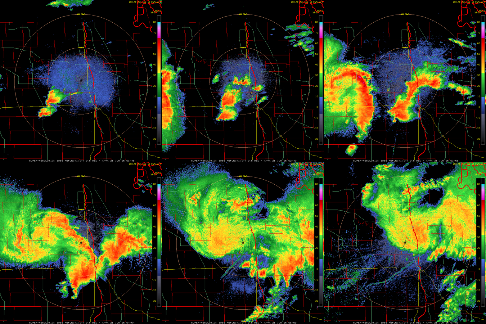
1. Bemidji blowdown: derecho and other severe thunderstorms, June 20-21, 2025
Waves of intense thunderstorms on June 20 and 21 produced a major severe weather outbreak across Minnesota, with catastrophic wind damage near Bemidji from the strongest measured gusts in the state since 2012.
The storm, part of a long-track system known as a derecho, produced wind gusts exceeding 100 mph, snapped and uprooted trees, damaged roofs and left nearly 60,000 residents without power for days.
The outbreak followed a weekend heat wave and merged storms from North Dakota and Montana, which included an EF-5 tornado near Enderlin, North Dakota, the first EF-5 tornado in the U.S. since 2013. Other storms in northern Minnesota produced very large hail before the main storm system moved through, making this one of the most destructive severe weather events in Minnesota in recent memory.
A huge thank-you to Kenneth Blumenfeld and Pete Boulay of the Minnesota State Climatology Office for their research and for providing the narratives on these events.
For the full article and more details on these weather events from the Minnesota State Climatology Office, click here.

