
Light snow as clouds increase; temperatures trend up this weekend
Minor disturbances bring precipitation chances through early next week

Go Deeper.
Create an account or log in to save stories.
Like this?
Thanks for liking this story! We have added it to a list of your favorite stories.


Clouds increase Friday night with light snow possible. A warmer weekend follows with occasional precipitation chances into early next week.
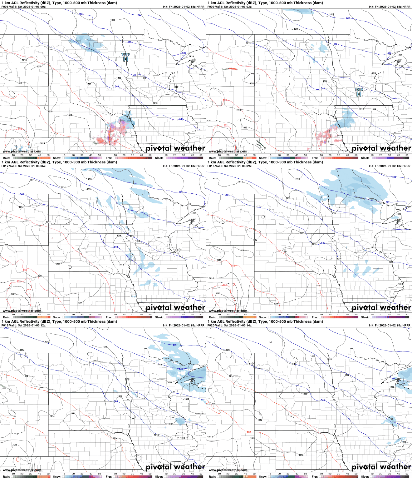
Light snow chances through Saturday morning
A weak and mostly dry system will bring spotty snowflakes to much of the state Friday night into Saturday. Southwestern Minnesota may see some freezing drizzle, while northeastern Minnesota could pick up around an inch of snow.
Single-digit temperatures are expected across northern and central Minnesota with teens farther south.

Below-average temperatures will continue Saturday, with highs in the teens and lower 20s. Highs in southwestern Minnesota are expected to reach the upper 20s to around 30 degrees.
Turn Up Your Support
MPR News helps you turn down the noise and build shared understanding. Turn up your support for this public resource and keep trusted journalism accessible to all.
Some sunshine may develop late Saturday afternoon as high pressure moves across the region Saturday night.

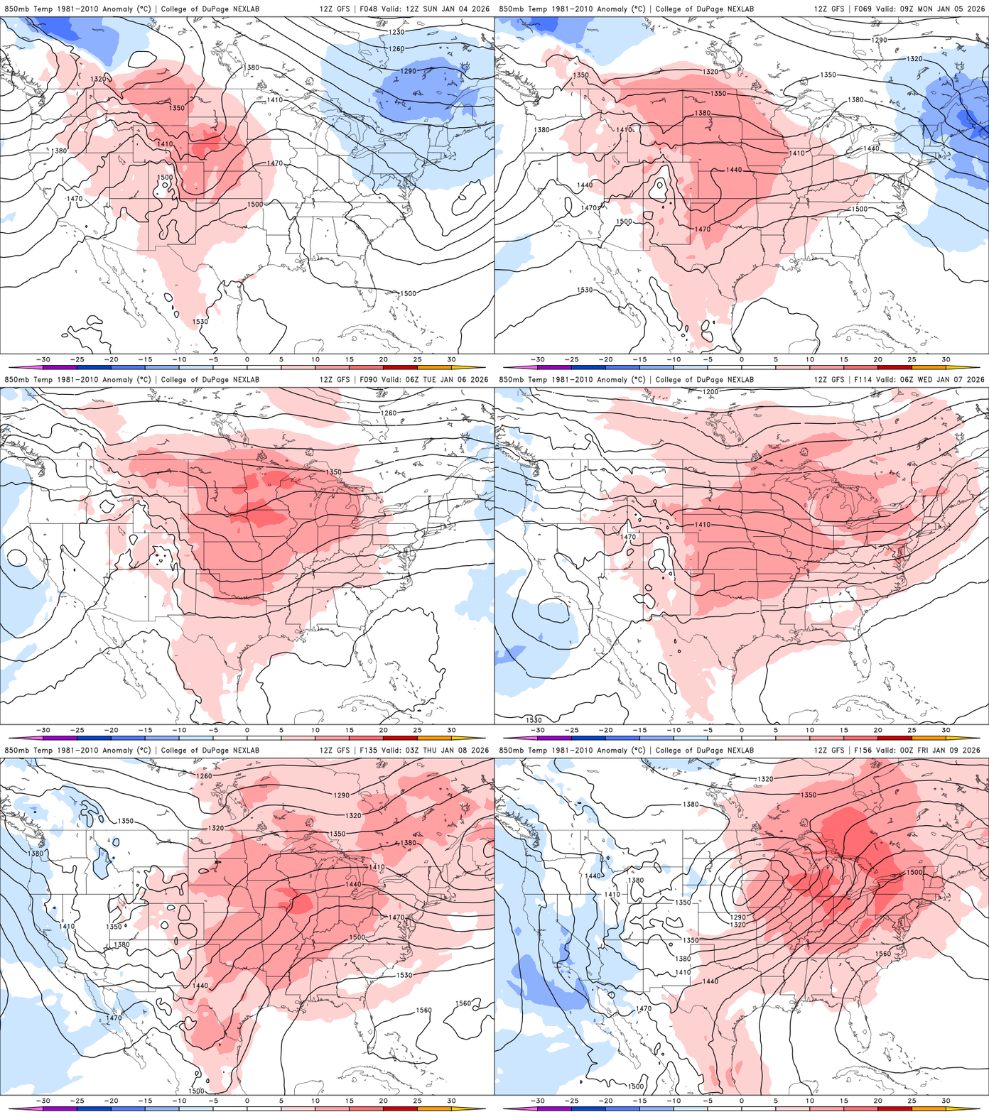
A prolonged stretch of above-average temperatures is expected during the first week of the new year with highs running 10 to 15 degrees above normal.
Another round of mixed precipitation Sunday
A second weather system moves in Sunday, bringing another round of precipitation from midday through Sunday night.
The exact locations and timing will depend on how the system develops, but the highest chances for precipitation appear to be across northern and eastern Minnesota and into northern Wisconsin.
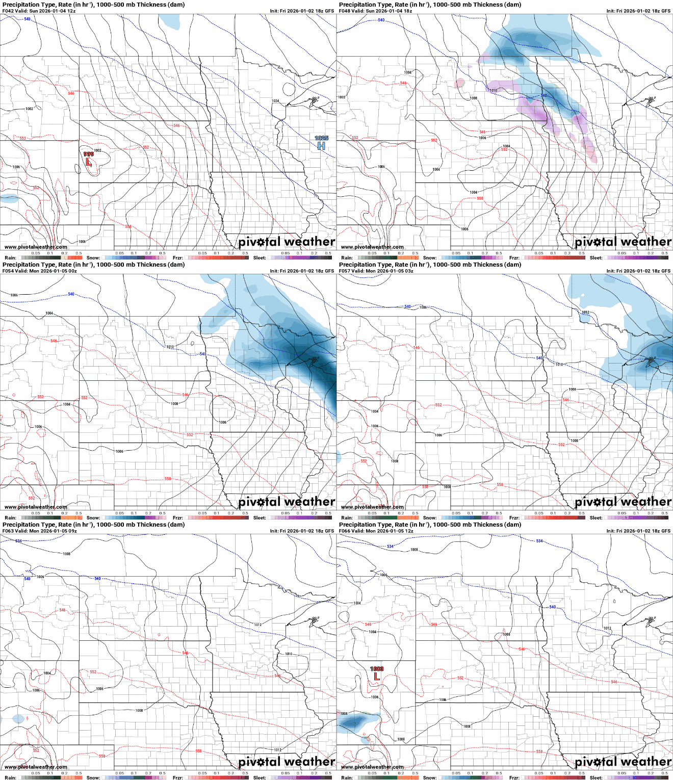
With warmer air in place, this system could produce a mix of precipitation types. Central and northern Minnesota and northwestern Wisconsin are likely to see mostly snow, while sleet or freezing rain becomes more likely farther south.

Snowfall is expected to range from 1 to 2 inches in east-central and northeastern Minnesota and western Wisconsin, with only a light dusting farther south, where mixed precipitation is more likely.

