
Winter weather advisories issued as freezing rain, sleet and snow move in
Temperatures above average for the first full week of the New Year

Go Deeper.
Create an account or log in to save stories.
Like this?
Thanks for liking this story! We have added it to a list of your favorite stories.


Winter weather advisories are in effect across parts of Minnesota and Wisconsin as a fast-moving system brings a brief period of freezing rain and sleet.
Messy wintry mix expected
Our next storm system is on the move and will approach the Upper Midwest on Sunday. The system is fast-moving but strong. While it will have limited moisture to work with initially, precipitation is expected to develop across central Minnesota by late Sunday morning before spreading east into Wisconsin through the afternoon and evening.
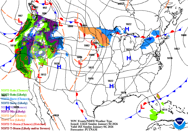
Winter weather advisories are in effect across much of northern, central and eastern Minnesota and Wisconsin through late Sunday night. Because the system is fast-moving, precipitation is expected to last only two to four hours.
Warmer temperatures in the lower and middle levels of the atmosphere could lead to a mix of freezing rain and sleet. Small temperature differences of just a degree or two may dramatically change the type of precipitation, causing sleet and freezing rain to alternate.
Turn Up Your Support
MPR News helps you turn down the noise and build shared understanding. Turn up your support for this public resource and keep trusted journalism accessible to all.

Despite the short duration, even light ice accumulation could make roads, sidewalks and untreated surfaces slick. Afternoon temperatures rising into the 30s across Minnesota may improve conditions later in the day.

For more information on the different types of wintry precipitation, see this article I wrote.
Above-freezing temperatures expected next week
A mild air mass will dominate the forecast next week, with temperatures 10 to 15 degrees above average. Highs are expected in the 30s and 40s, which will lead to melting of the current snowpack, currently about 6 inches in the Twin Cities.
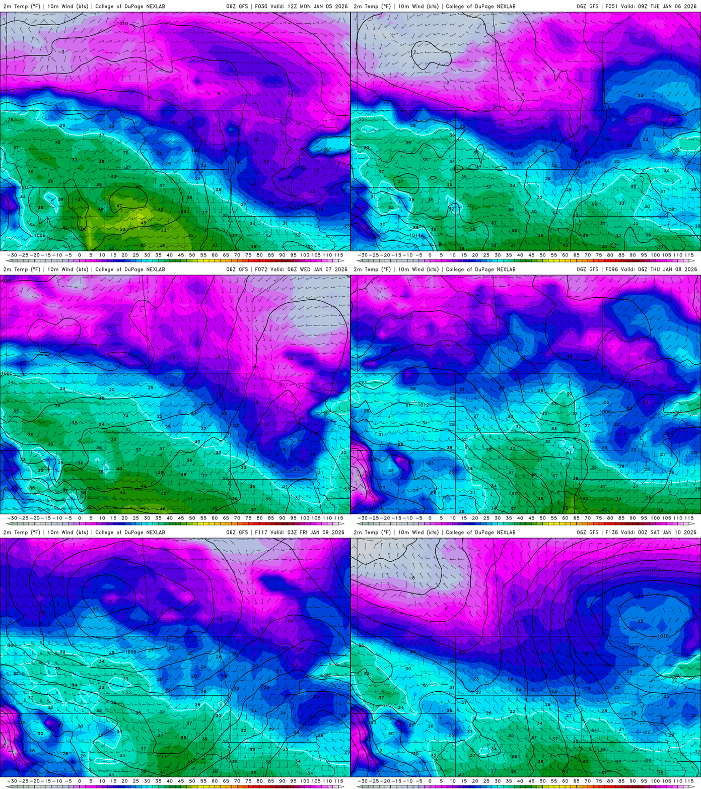
Our next system could bring another chance of a wintry mix late Monday into Tuesday as warmer temperatures and a shift in the weather pattern move in. More details will be available as the forecast develops.

