
Another foggy start to Thursday with rain showers by afternoon
January thaw continues with highs above freezing

Go Deeper.
Create an account or log in to save stories.
Like this?
Thanks for liking this story! We have added it to a list of your favorite stories.


Thursday begins with dense fog in many areas, followed by rain showers during the afternoon that will mix with snow as colder air moves in behind the system.
Repeat foggy start
Here we go again with widespread dense fog and areas of freezing fog to start the day. Another dense fog advisory is in effect for the metro area northward into central and northeastern Minnesota, with visibility occasionally reduced to one-half mile or less. With little wind or sunshine, fog will be slow to clear today.
The January thaw continues, with highs above freezing and approaching the mid to upper 30s in the Twin Cities metro area.
Turn Up Your Support
MPR News helps you turn down the noise and build shared understanding. Turn up your support for this public resource and keep trusted journalism accessible to all.

Gloomy, gray skies will continue ahead of the next system, which is moving from the Panhandle into the Great Lakes region by Thursday night.
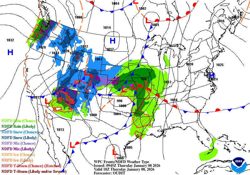
Rain develops, changing to snow
With warmer temperatures we’ll see precipitation beginning as rain Thursday afternoon across southern Minnesota and spreading northeast into the Twin Cities and western Wisconsin by Thursday evening.
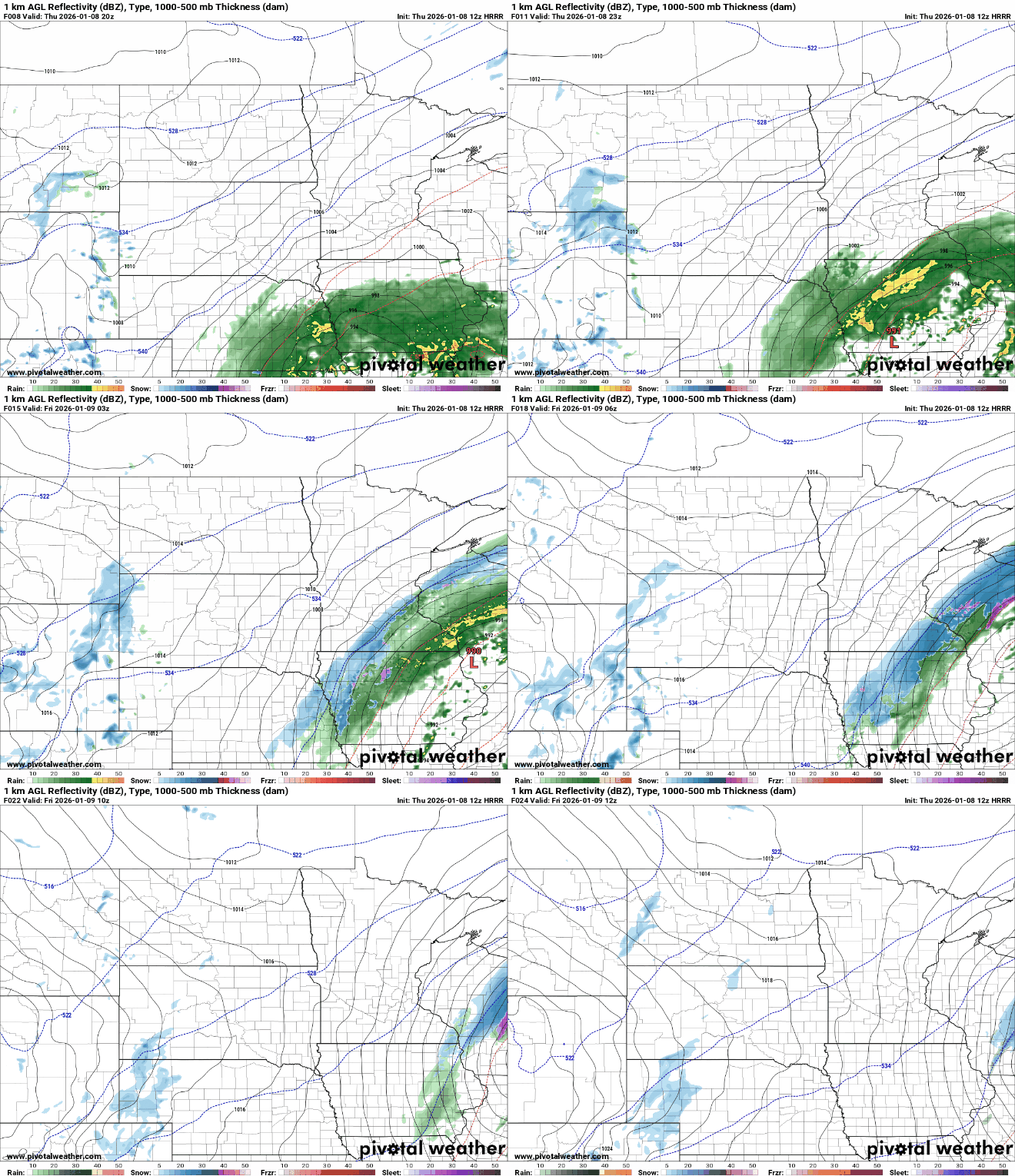
Rain will mix with snow before colder air changes the precipitation to light snow. Accumulations should be light, generally a trace to half an inch, with most precipitation falling as rain near the metro. Southeastern Minnesota at most could see a couple of slushy inches by Friday morning.

The heaviest total precipitation is expected across southeastern Minnesota into central Wisconsin, with totals reaching up to an inch. Much lighter amounts taper off northwest of this area.

Snow showers will linger across southeastern Minnesota and western Wisconsin early Friday before moving out of the region.
Colder air returns for the weekend
By Friday morning, the system’s cold front will bring a colder air mass that will settle over the region through the weekend. Highs on Friday will only reach the mid-20s to lower 30s, with temperatures continuing to fall on Saturday.
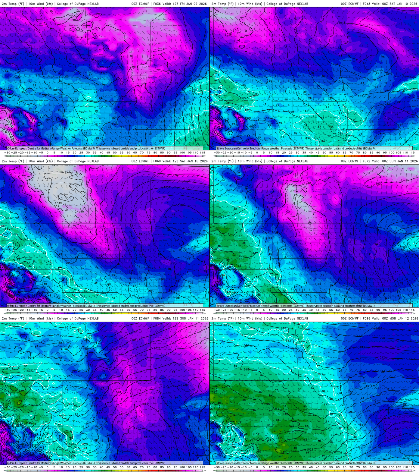
A clipper-type system will move through Friday night into Saturday. Snowfall accumulations are expected to be light east of Interstate 35 into western Wisconsin, generally ranging from 1 to 2 inches.

