
Clouds give way to another brief January thaw before winter pushes back
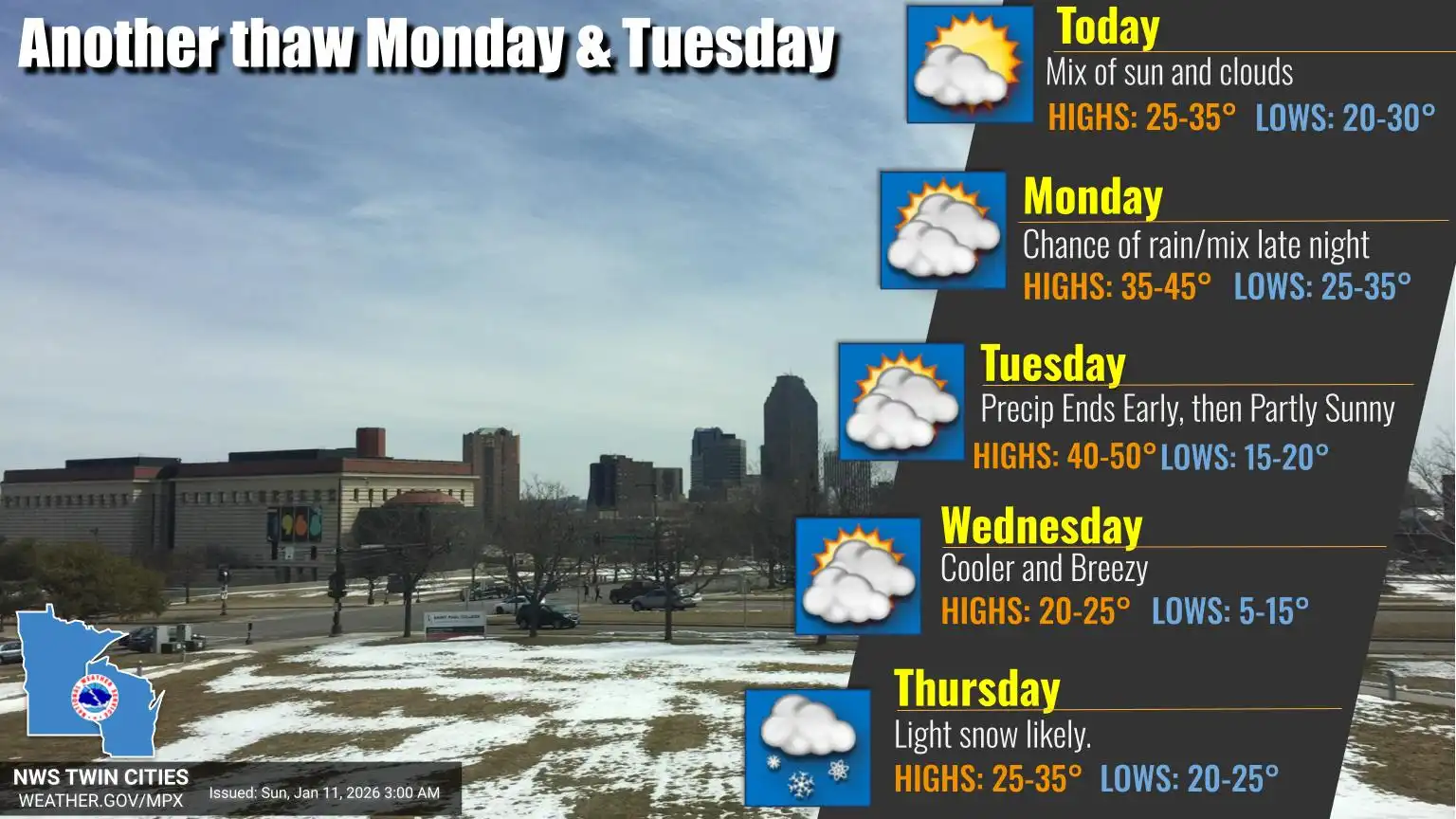
High temperatures 10-15 degrees above average for early this week
Go Deeper.
Create an account or log in to save stories.
Like this?
Thanks for liking this story! We have added it to a list of your favorite stories.


Clouds linger into Sunday, but clearing skies and warmer temperatures will lead to a mild start to the work week. A few light snow chances are possible as multiple clipper systems pass through.
Sunday sunshine ahead
Early cloud cover will clear as high pressure brings a calm, quiet Sunday. Some mid- to high-level clouds will linger, but overall conditions will be pleasant.
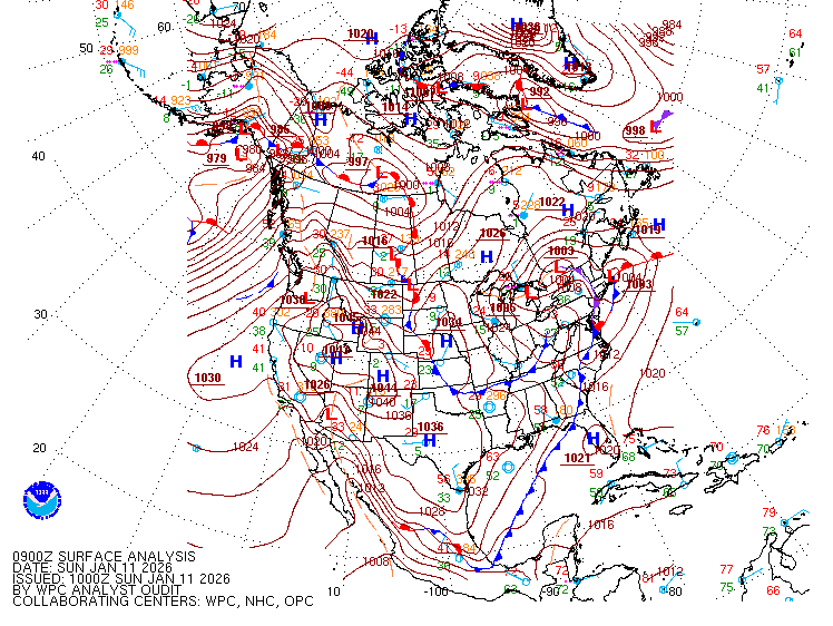
As the ridge moves east, warmer air will wrap in behind it, pushing temperatures into the upper 30s to near 40 degrees across the Buffalo Ridge area. Farther east, lingering cold air and snow cover will keep temperatures in the 20s.

Mild temperatures will continue Sunday night, leading into a warm Monday with highs ranging from 35 to 45 degrees under mostly sunny skies.
Turn Up Your Support
MPR News helps you turn down the noise and build shared understanding. Turn up your support for this public resource and keep trusted journalism accessible to all.

The warmup will be short-lived as a stronger cold front moves through Tuesday night, bringing very gusty northwest winds.
A couple clipper systems and the return of winter
A couple of weak clipper systems will move through early this week. The first arrives Sunday, bringing light snow chances near the international border and across the Arrowhead region, with amounts limited from a dusting to less than an inch.
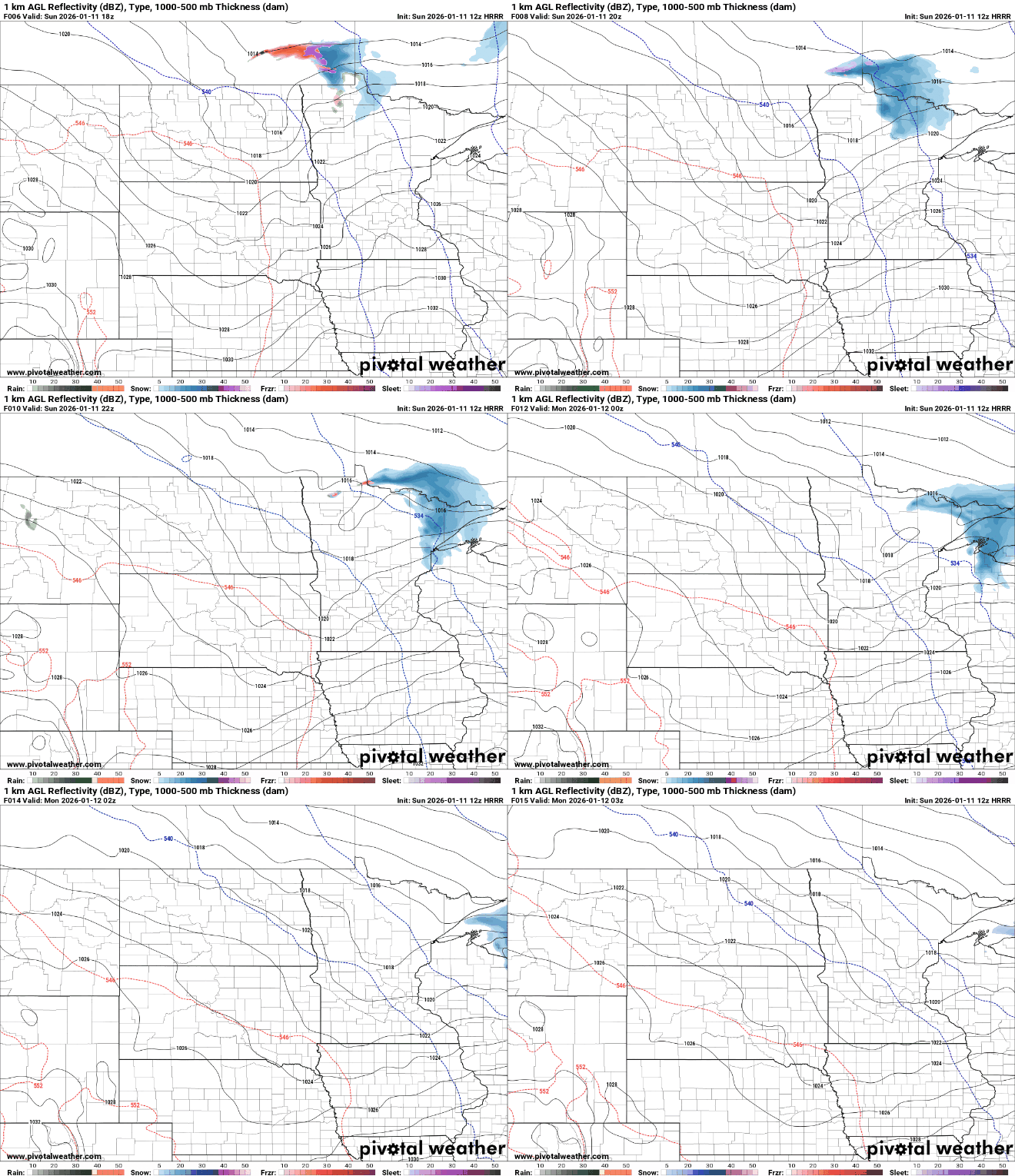
A second system late Monday night into Tuesday morning could dip farther south. With warmer temperatures in place, a wintry mix is possible, mainly northeast of Interstate 94.
Winter returns Thursday and Friday as several weak disturbances move through in a colder, northerly flow. Moisture will be limited, but periods of light snow are possible. Most locations will see minor accumulations, though totals could reach a few inches over the two-day period.
Saturday will be colder, with highs likely limited to the teens. The cold, however, may be brief, with temperatures rebounding toward seasonal normals by the end of next weekend.

