
Final mild day before sharp cooldown
Much cooler air arrives with snow chances late this week
Go Deeper.
Create an account or log in to save stories.
Like this?
Thanks for liking this story! We have added it to a list of your favorite stories.


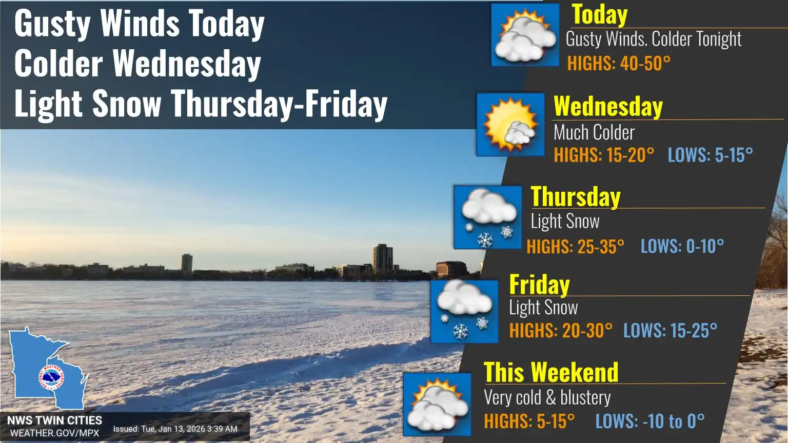
The region will see one more mild day today before much cooler air moves in late this week, bringing snow chances.
One more mild day before strong cold front late Tuesday
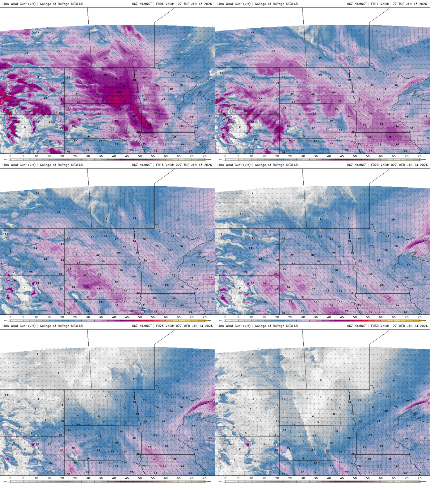
Another mild day is ahead before a strong cold front moves through the region late Tuesday afternoon and evening, bringing gusty northwest winds and sharply falling temperatures. Wind gusts of 30 to 40 mph are expected, along with increasing cloud cover ahead of the front.
Despite the approaching front, most of southern Minnesota should still warm into the 40s Tuesday afternoon before temperatures drop rapidly into the teens and single digits overnight. Temperatures are expected to reach above freezing as far north as the international border.

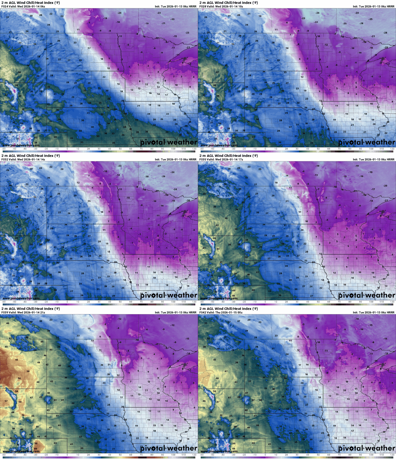
Cold air will remain in place Wednesday, with highs limited to the teens and single digits. Persistent northwest winds will make it feel colder, with wind chills near zero in the morning and in the teens during the afternoon.
Turn Up Your Support
MPR News helps you turn down the noise and build shared understanding. Turn up your support for this public resource and keep trusted journalism accessible to all.
More cold and snow chances late week
Several weak disturbances rotating through the region are expected to bring multiple rounds of light snow Thursday and Friday.
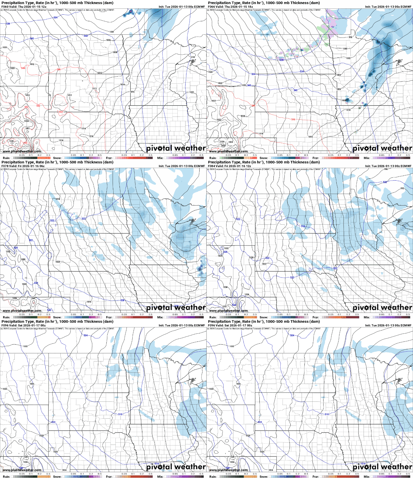
While none of the systems appear to carry much moisture, snowfall over time could total 2 to 4 inches across much of the state by late Friday night into early Saturday.

A surge of arctic air will bring very cold temperatures this weekend with highs struggling to rise above the single digits.
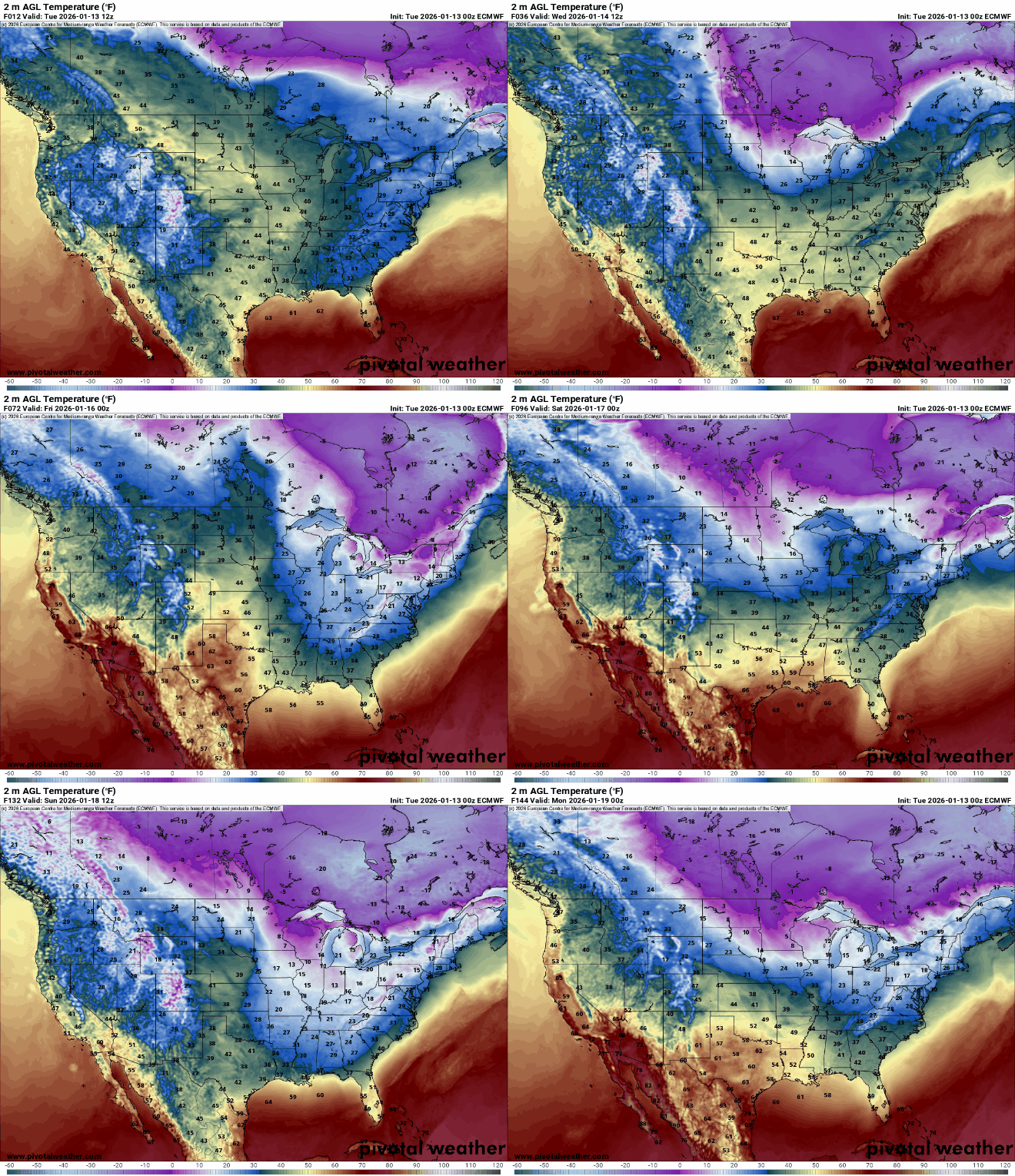
A peek into the crystal ball shows that very cold temperatures will stick around for the rest of the month. Our warm start to January may just balance itself out by the time the calendar flips to February.

