
Brisk, breezy start to Wednesday followed by sunshine
Light snow on track for Thursday and Friday

Go Deeper.
Create an account or log in to save stories.
Like this?
Thanks for liking this story! We have added it to a list of your favorite stories.


Cooler, brisk air for early Wednesday with sunshine as high pressure builds overhead. Snow chances return Thursday and Friday with several inches of accumulation possible.
Cooler Wednesday with sunshine
Brisk winds early Wednesday will bring a sharp chill with wind chill values dropping into the teens and even single digits below zero.
As high pressure builds in, winds will gradually diminish through the day, allowing highs to recover into the single digits and teens across northern areas and the low 20s farther south.
The next weather system is expected to reach Manitoba by Thursday night, bringing several waves of light to moderate snow.
Turn Up Your Support
MPR News helps you turn down the noise and build shared understanding. Turn up your support for this public resource and keep trusted journalism accessible to all.
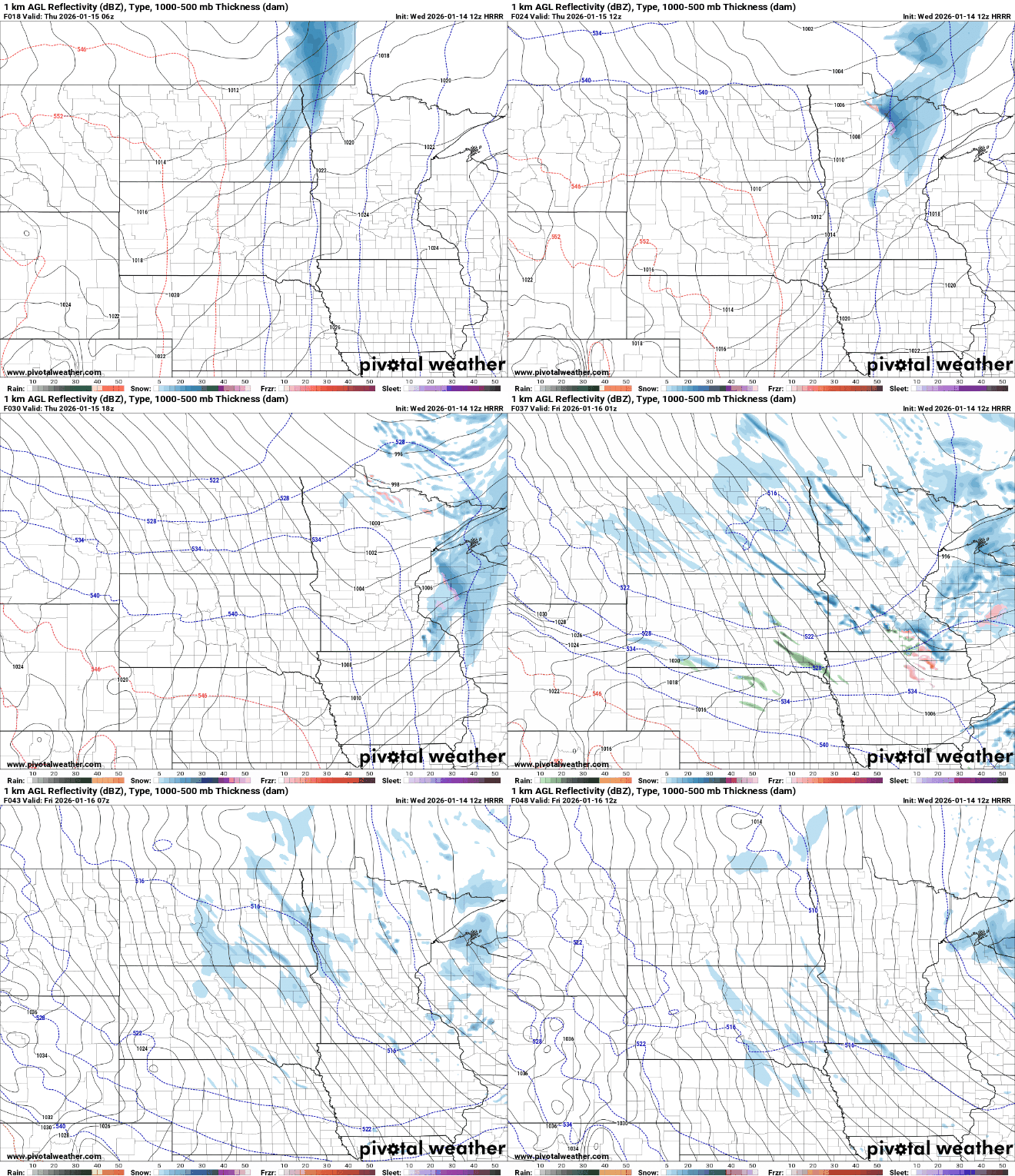
While none of the waves are expected to produce significant moisture, snowfall totals are forecast to gradually accumulate to 2 to 4 inches by the time snow tapers off late Friday night or early Saturday.
The highest totals, closer to 3 to 4 inches, are most likely across northeastern Minnesota into western Wisconsin.

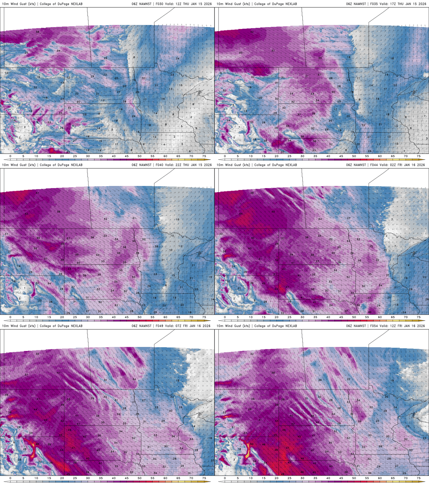
Snowfall rates should remain light, but strong northwest winds developing Thursday afternoon through Friday are expected to create blowing snow, particularly in open areas of west-central and southern Minnesota.
Surge of arctic air
Another surge of arctic air will move in late Friday, locking the region into bitter cold through the weekend. High temperatures are expected to remain in the single digits with overnight lows well below zero.
The coldest period is expected late Saturday night into early Sunday, when widespread lows of 5 to 10 below zero are likely.

Winds are expected to remain elevated through the weekend with wind chill values staying below zero for the foreseeable future.


