
Arctic front brings wind, snow showers and falling temperatures
Snow squalls possible as strong winds sweep through region

Go Deeper.
Create an account or log in to save stories.
Like this?
Thanks for liking this story! We have added it to a list of your favorite stories.


Snow squalls and strong winds are expected today as an arctic front moves through the region, bringing brief periods of reduced visibility and falling temperatures.
Snow arriving later than expected; winter weather advisories posted
Snow will arrive later than expected and totals will be lower across the region, but gusty winds and brief bursts of snow could reduce visibility, with snow squalls possible.
Snow squalls are short-lived but intense bursts of snow that can rapidly deteriorate driving conditions. Unlike steady snowfall, they can develop quickly and produce near-zero visibility with little warning.

An arctic front moving in from northwestern Minnesota will sweep through the area Friday, bringing falling temperatures, northwest wind gusts of 35 to 45 mph, with periods of snow showers.
Turn Up Your Support
MPR News helps you turn down the noise and build shared understanding. Turn up your support for this public resource and keep trusted journalism accessible to all.
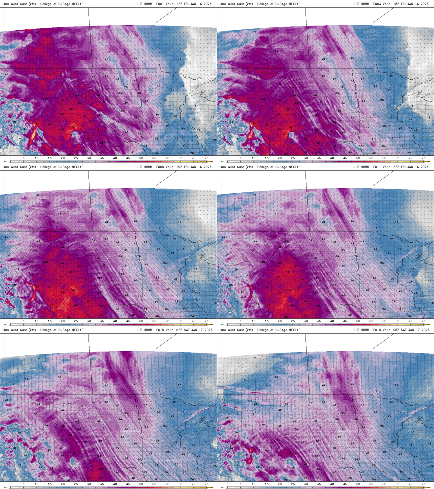
A winter weather advisory remains in effect until 6 p.m. Friday for western Minnesota and central, southern St. Louis, Carlton and southern Lake counties due to gusty winds and falling snow.
While snowfall amounts are expected to stay under an inch in many areas, most locations will likely see at least some snow.
Forecast totals range from less than a trace to an inch across the southern half of the state, with 1 to 3 inches possible in the Arrowhead region, including the North Shore, and up to a couple inches in western Wisconsin.


Snow showers will taper off Friday night as temperatures continue to fall.
By early Saturday morning, lows are expected to range from single digits below zero for northwestern Minnesota to near zero across central and western Minnesota and around 10 degrees in western Wisconsin.
Daytime highs Saturday will remain cold, struggling to climb out of the single digits.

Another fast-moving system could bring snow early Sunday. We will continue to monitor the chance for accumulating snowfall from that system.
Brace for a cold spell through the rest of January with only brief warmups in the forecast and several chances for light snow.

