
Next clipper system delivers more snow followed by the coldest air of winter
Brutal wind chills sweep in late Thursday into Friday and Saturday

Go Deeper.
Create an account or log in to save stories.
Like this?
Thanks for liking this story! We have added it to a list of your favorite stories.


It’s another cold start but Tuesday afternoon and Wednesday will be colder. More snow showers are on the way later Tuesday with our latest clipper. It’ll be followed by brutal arctic air.
More snow on the way followed by frigid air
A cold weather advisory is in effect for northern Minnesota through noon Tuesday. Afternoon temperatures won’t be quite as cold with southern Minnesota reaching the teens for highs. Clouds will steadily increase through the day.

Snow showers develop Tuesday afternoon to the west and spread east Tuesday night. We’ll get a bit of a break Wednesday morning followed by more afternoon and evening snow showers Wednesday. The second round is when the Twin Cities area will see the bulk of our snowfall.
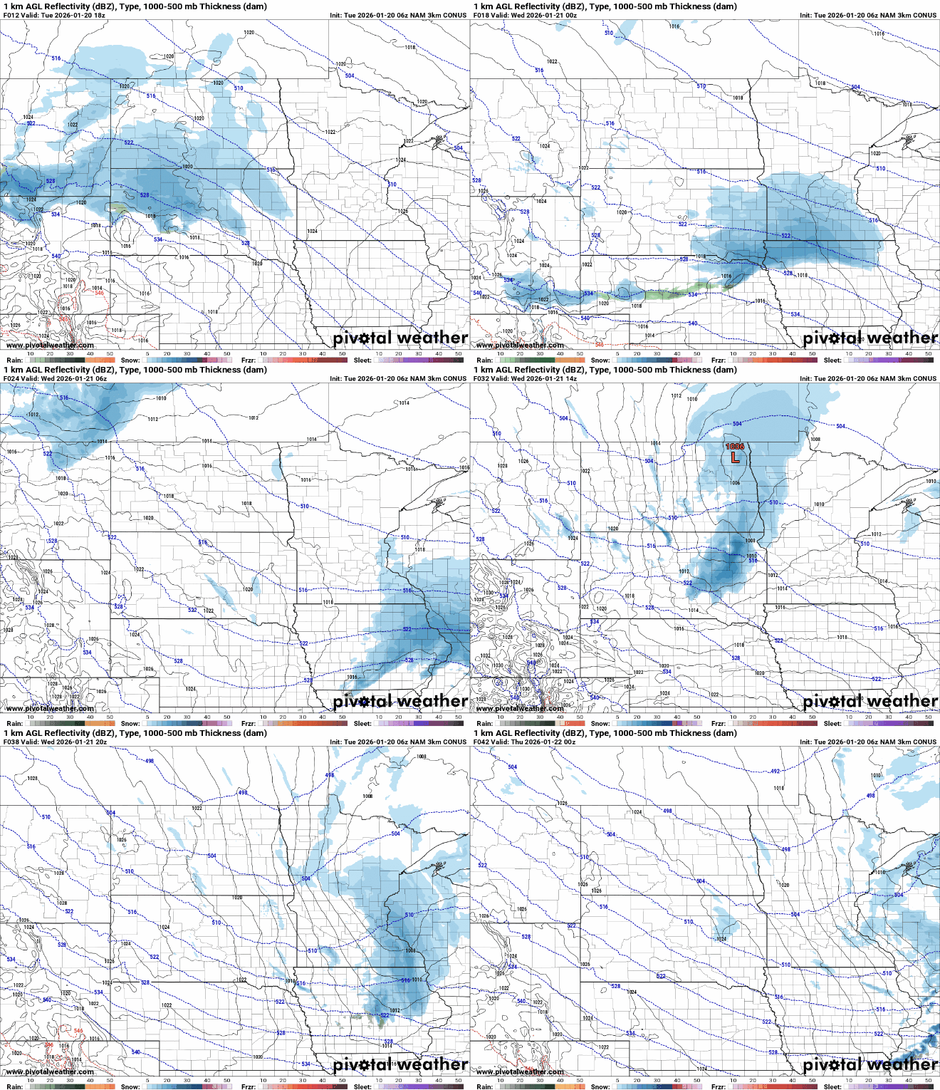
The higher — and still relatively light — snowfall totals will be across western and southern Minnesota where up to 2 inches could fall. There could be isolated 3 inch amounts along the Minnesota-Iowa border.
Turn Up Your Support
MPR News helps you turn down the noise and build shared understanding. Turn up your support for this public resource and keep trusted journalism accessible to all.
Wednesday will be briefly warmer with highs in the 20s for southern Minnesota. Those readings are close to normal for the date but it won’t last long.

The coldest air of the season moves in Thursday into Friday and Saturday. It’s the result of a brutal chunk of arctic air that will be diving straight south across Canada Thursday.
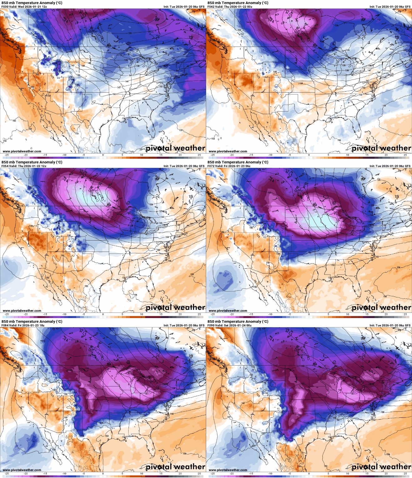
Overnight lows Thursday night into early Friday morning will be in the teens, close to 20 below zero in southern Minnesota with 30s below zero north.
Wind chill values will be near 50 below zero in northwestern Minnesota with 30s below zero south, including the Twin Cities. Exposed skin can freeze in just 5 to 10 minutes in those conditions.

Highs Friday will be subzero statewide with even just teens below zero for afternoon highs in northern Minnesota Friday.

It’ll be another frigid night Friday night with overnight lows in the teens, 20s and 30s below zero once again into early Saturday morning before temperatures slowly climb back upward into early next week.

