
Dangerous cold moving in making for the coldest temps of winter
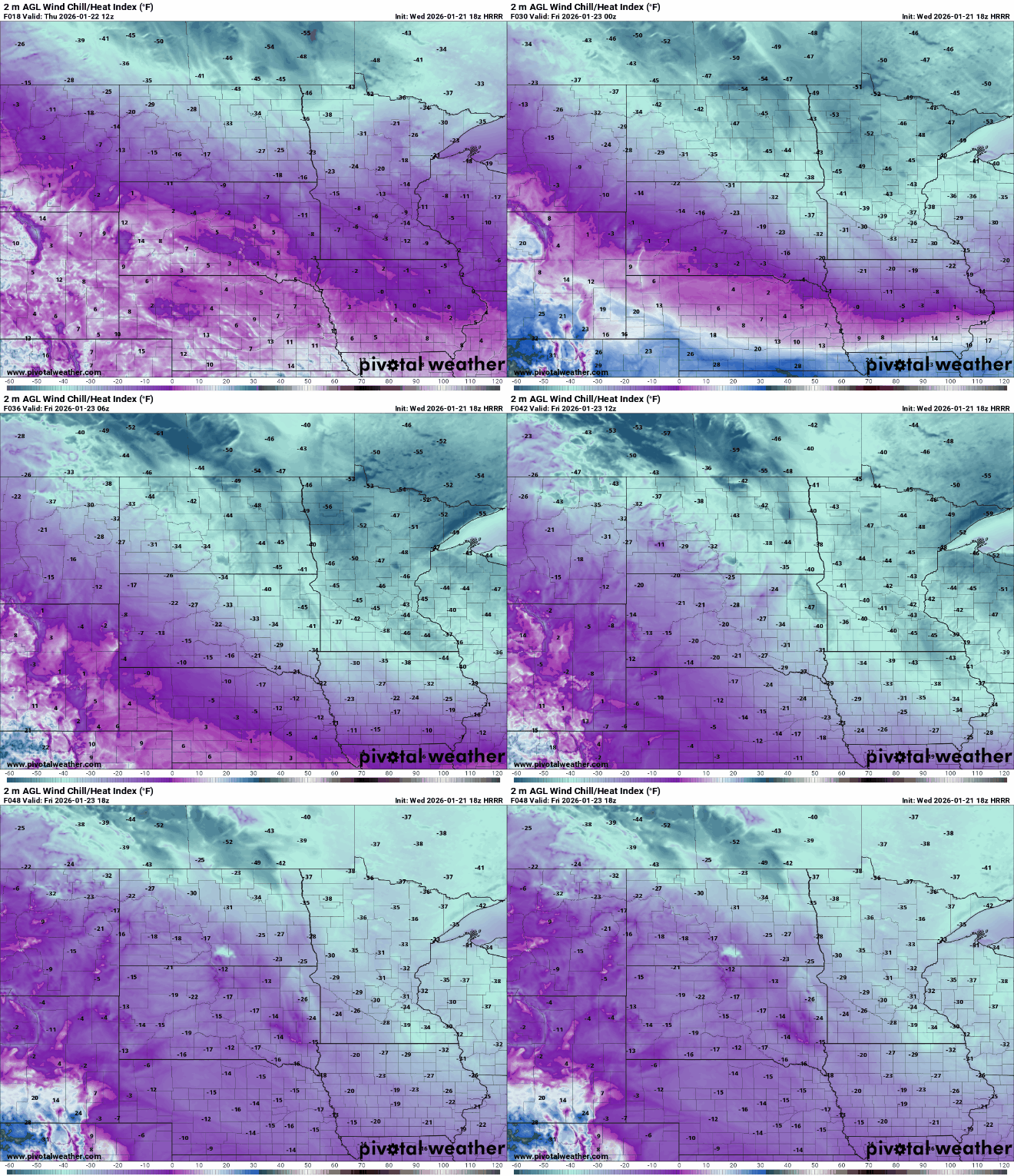
Wind chills will range from 35 to 55 below zero early Friday
Go Deeper.
Create an account or log in to save stories.
Like this?
Thanks for liking this story! We have added it to a list of your favorite stories.


After the snowfall comes the coldest air of winter. Extreme cold settles in tonight into the weekend with dangerous wind chills tonight into Friday.
Extreme cold settles in and sticks around into the weekend
Temperatures will not budge much today, that means temperatures in the teens to near 20 below zero in northern Minnesota with single digits above zero only in southern Minnesota. We should see clouds decrease some but a little sun won’t make any difference.

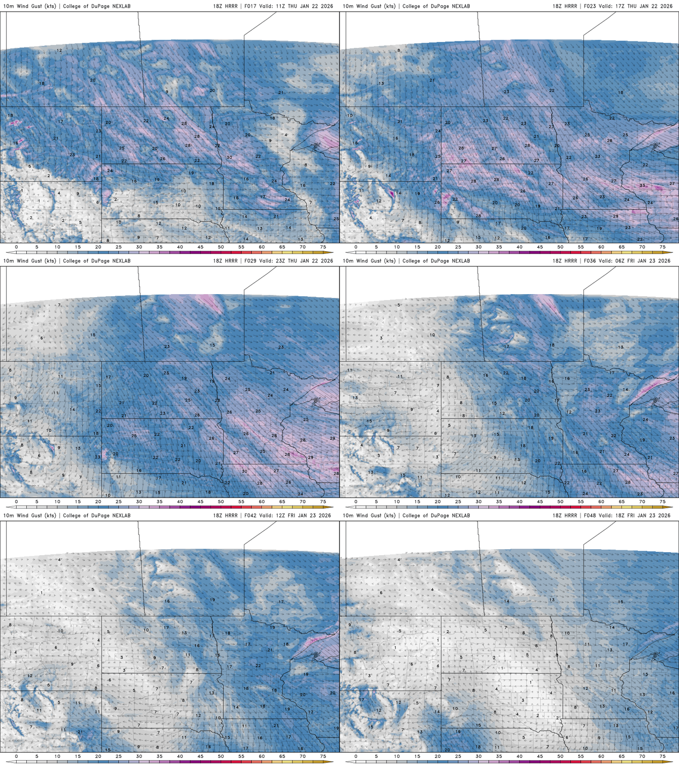
It’ll be blustery today too, making it feel much colder. Wind chills will be below zero across the state and slip into the 40s below zero in northwest Minnesota.
Extreme cold warnings blanket the state for Thursday night into Saturday morning and for northern Minnesota starting all day Thursday.
Turn Up Your Support
MPR News helps you turn down the noise and build shared understanding. Turn up your support for this public resource and keep trusted journalism accessible to all.

Overnight lows tonight will likely be the coldest of winter with lows near 30 below zero in northern Minnesota and teens below zero in the Twin Cities.

Wind chill values later tonight into Friday morning will be in dangerous territory in the 30s, 40s and even 50s below zero. Exposed skin freezes in just minutes in those conditions.

Afternoon highs Friday will remain below zero across the state with just teens below zero in northern Minnesota only.

Some of the coldest air in the Northern Hemisphere and the planet are just north of Minnesota and still settling in over the next 24 hours. The colder air mass is larger in Siberia but the temperatures and wind chills are colder in the chunk of air on our side of the globe.

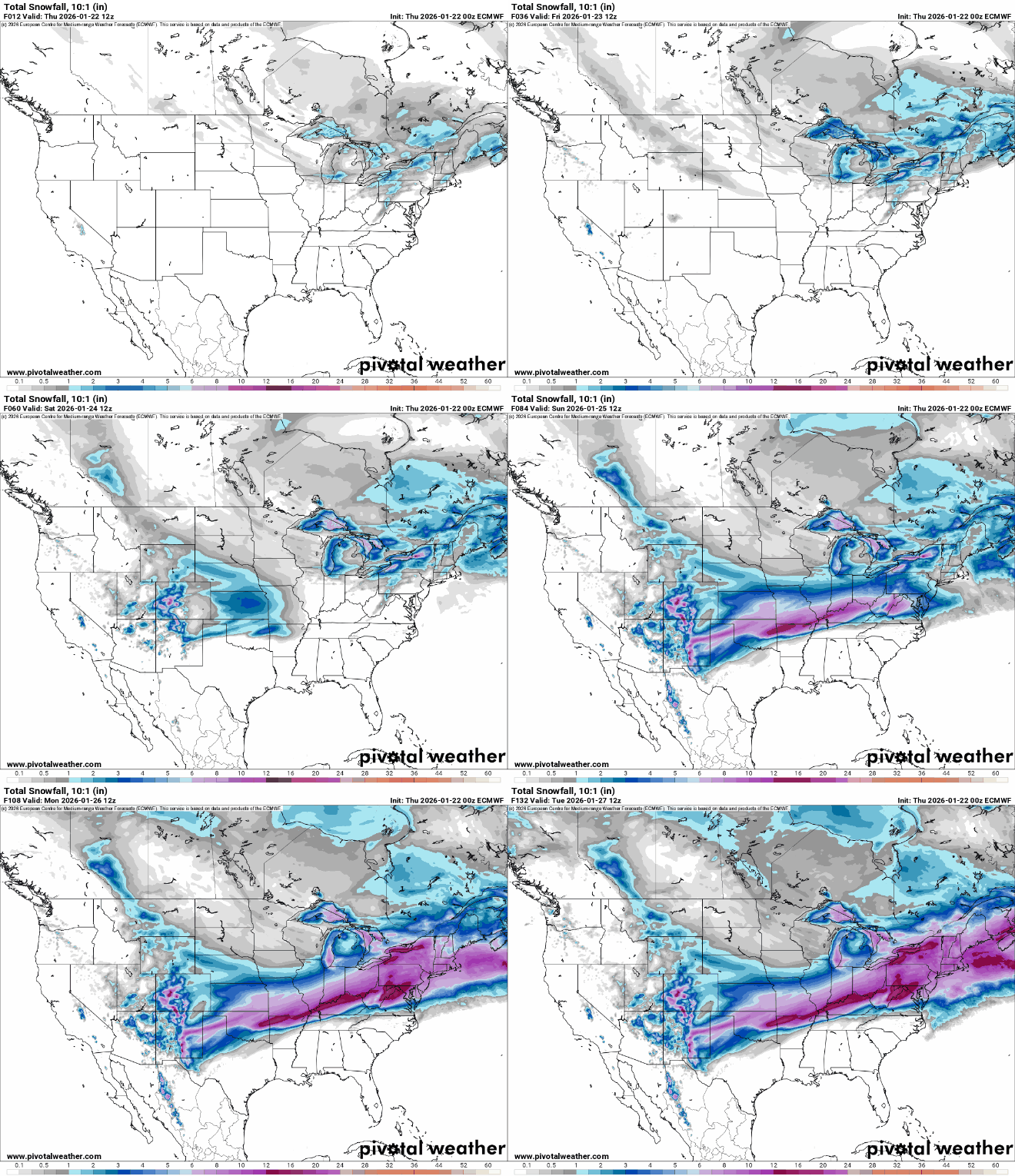
The cold is pushing the jet stream south and creating a major winter storm for the central and eastern U.S. into the weekend. Snowfall up to 6 to 10 plus inches, is possible from Northern Texas, Oklahoma, through Missouri, Arkansas into Kentucky and Washington D.C. through the weekend.
Don’t look for a lot of progress this weekend. We may not get above zero, even in the Twin Cities until Sunday afternoon. Next week won’t be as cold but temperatures will largely remain below normal.


