
Temperatures plunge Thursday afternoon ahead of arctic chill
Subzero temperatures spread south with dangerous wind chills

Go Deeper.
Create an account or log in to save stories.
Like this?
Thanks for liking this story! We have added it to a list of your favorite stories.


The region is entering its coldest period in several years as Arctic air pours south, driving temperatures well below zero and pushing wind chills into dangerous territory.
Buckle up, Minnesotans! Here we go…
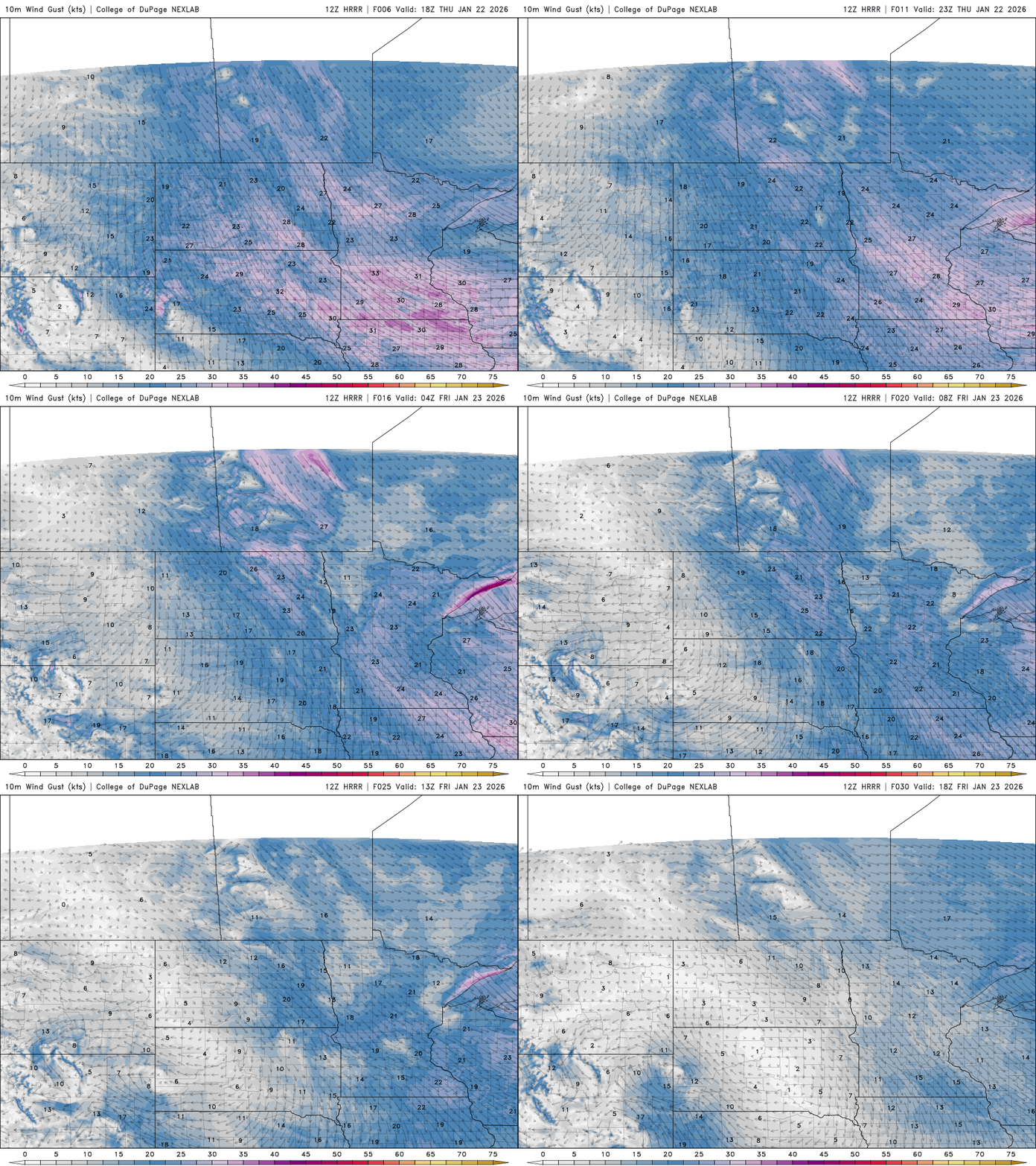
We’re heading into our coldest, harshest stretch yet. Not only will arctic temperatures be biting, but winds will be at their strongest over the next 24 hours or so, making it feel even colder and creating dangerously low wind chills.
Temperatures will keep falling through the day as arctic air pushes into the region. Instead of warming Thursday afternoon, readings are expected to hold steady or drop, with many locations slipping further below zero by late afternoon.
The 3 p.m. temperature map below shows the Twin Cities slipping into our long stretch of subzero temperatures, while areas in northern Minnesota approach 20 degrees below zero.
Turn Up Your Support
MPR News helps you turn down the noise and build shared understanding. Turn up your support for this public resource and keep trusted journalism accessible to all.

Blustery northwest winds will make it feel even colder with gusts 30 to 40 mph.
When you combine air temperature with wind speed, you get wind chill — and values are expected to reach dangerous levels.
Frostbite can occur within minutes on exposed skin. In the Twin Cities metro area, wind chills are forecast around 30 to 40 below zero, while northern Minnesota could see readings as low as 50 below zero.

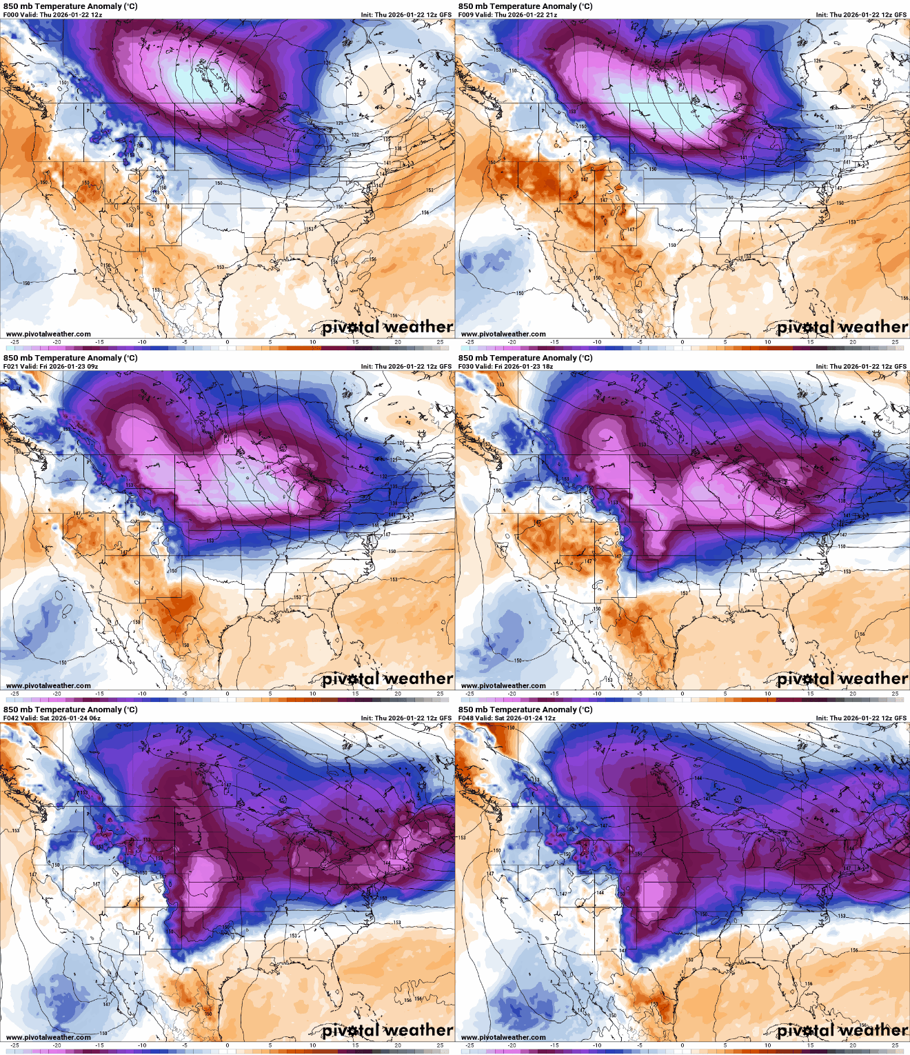
A strong northerly flow will keep this deep pool of arctic air around the region Thursday into Friday. Temperatures just above the surface, around 5,000 feet on the 850-millibar map, are dropping to levels not seen in several years.
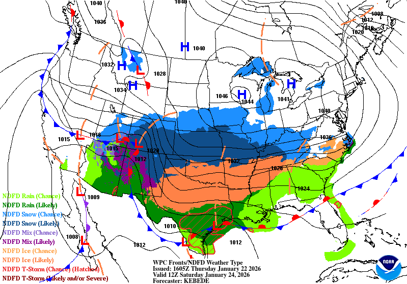
A strong area of high pressure will move into the region behind the arctic surge, helping to lock in the cold air for several days. While the cold will persist into Friday night and Saturday morning, winds are expected to weaken, resulting in comparatively warmer wind chills.
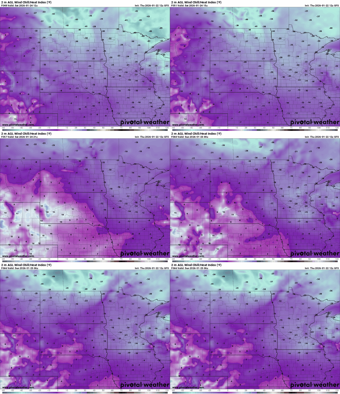
Wind chills Saturday morning are expected to fall between 20 and 40 below zero, with daytime values ranging from 10 to 20 below zero.
Extreme cold warnings continue across the Upper Midwest through Friday at noon.
May your hot chocolate stay warm until the next update!

