
Bitter cold loosens grip but subzero temperatures persist
More extreme cold warnings and cold weather advisories through Saturday

Go Deeper.
Create an account or log in to save stories.
Like this?
Thanks for liking this story! We have added it to a list of your favorite stories.


A bitterly cold air mass will remain in place across the region as a strong area of high pressure settles in for the northern Plains.
Worst behind us, but still frigid
High pressure will move overhead Friday night before weakening and shifting east toward the Great Lakes on Saturday. Winds are expected to become light and variable to calm overnight, leading to slightly improved wind chill values.

The coldest of the cold appears to be behind the metro area after temperatures bottomed out around 21 below zero Friday morning. The region has been well below average for nearly a week, with a normal high near 23 degrees in the Twin Cities.
Turn Up Your Support
MPR News helps you turn down the noise and build shared understanding. Turn up your support for this public resource and keep trusted journalism accessible to all.

However, dangerous wind chills as low as 60 below zero remain possible. As a result, an extreme cold warning and cold weather advisory will continue through early Saturday for the entire state.
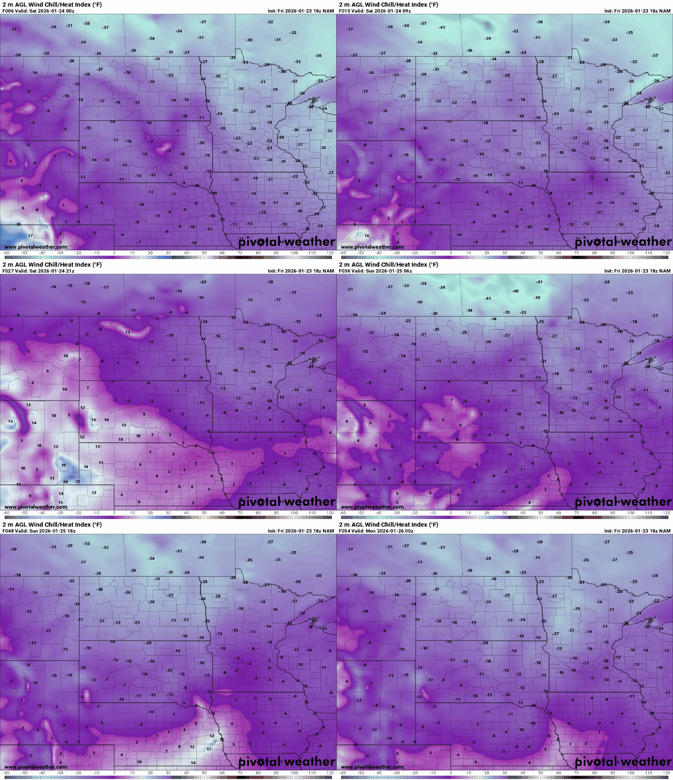
Wind chill values are expected to fall to between 45 and 60 below zero across northern Minnesota Friday night, with readings as low as 30 below zero in central and southern Minnesota. Wind chills will remain well below zero through the weekend as Arctic high pressure remains close by.
Low temperatures Friday night are expected to bottom out around 30 below zero in northern Minnesota, with teens and 20s below zero elsewhere.

Temperatures will moderate slightly over the weekend, with highs climbing to near zero on Saturday and Sunday. Overnight lows are still expected to fall into the teens and 20s below zero.

Looking ahead, northwest flow will continue into next week, bringing occasional bursts of colder air. A few flurries are possible at times, but dry conditions should prevent any significant snowfall. A warming trend is expected by next weekend as a milder Pacific air mass spreads across North America.

