
Overall cold pattern lingers this week
Northern Minnesota will see light snow Monday

Go Deeper.
Create an account or log in to save stories.
Like this?
Thanks for liking this story! We have added it to a list of your favorite stories.


It won’t be as cold Monday, but overall temperatures will remain well below normal all this week. A clipper brings some light snow to northern Minnesota later Monday.
Cold air lingers this week
Extreme cold warnings north and cold weather advisories south persist through midday Monday.
After a weekend in the deep freeze, temperatures won’t be quite as cold by Monday afternoon. We should see widespread highs in the teens across central and southern Minnesota.

Clouds will be on the increase, especially in northern Minnesota ahead of a fast-moving clipper system that will develop light snow showers Monday afternoon and evening for that region.
Turn Up Your Support
MPR News helps you turn down the noise and build shared understanding. Turn up your support for this public resource and keep trusted journalism accessible to all.
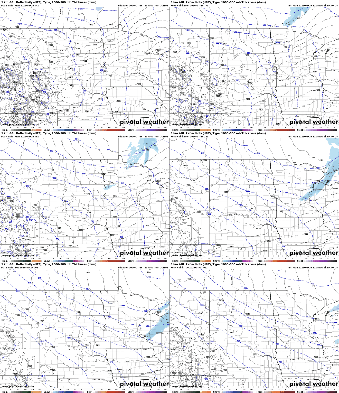
The clipper system doesn’t have a lot of moisture, so snowfall will be less than 1 inch across northeastern Minnesota.

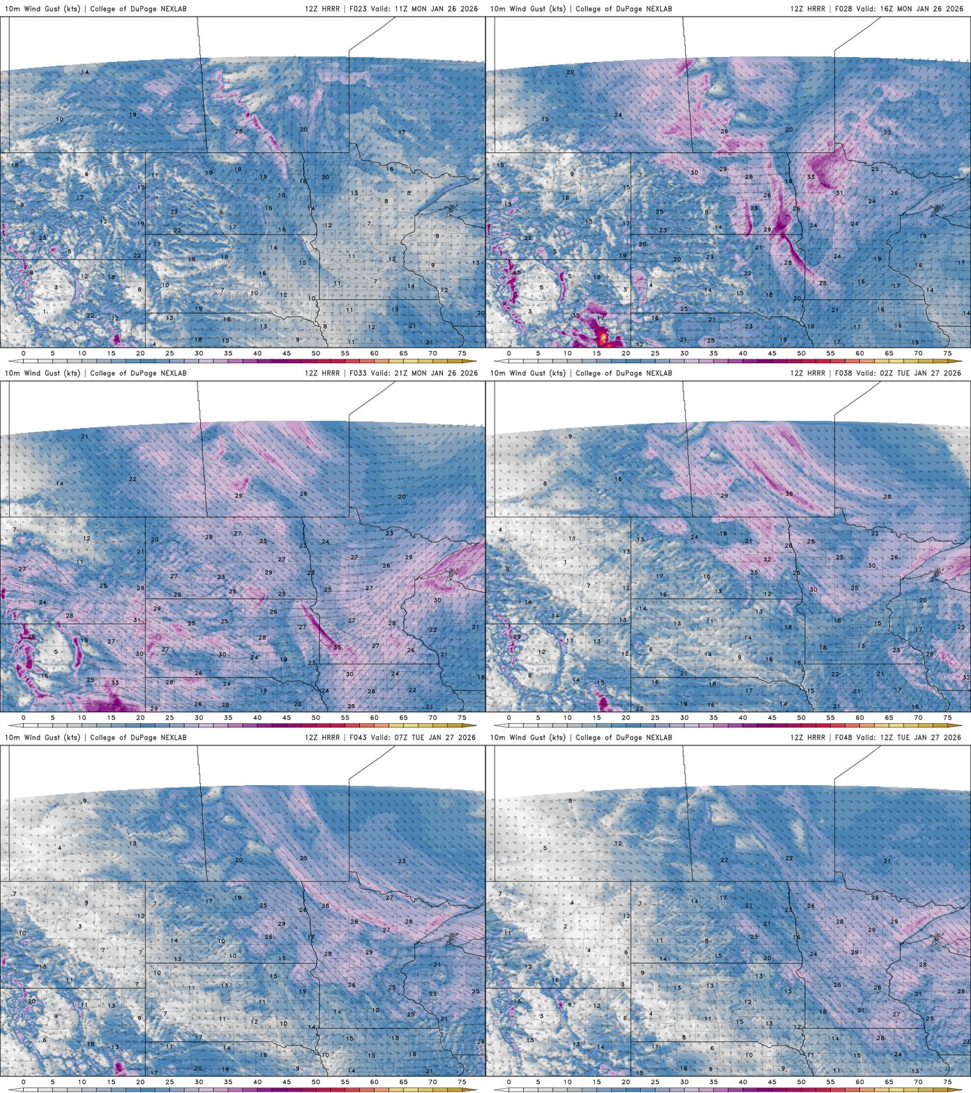
Winds will be blustery Monday and Tuesday. Winds will be southwesterly Monday ahead of the clipper system and switch back to the northwest Tuesday, allowing colder air to settles back in.
Highs Tuesday will be back to near 10 degrees in southern Minnesota with mostly single digits north.

The cold pattern will keep most significant systems well to our south. The next chance of measurable snowfall doesn’t move in until Sunday of next weekend.
Warmer air finally moves in over the weekend too with highs in the 20s by the weekend and even the potential for some 30s next week.


