Cold, windy Tuesday with below-normal temperatures lingering through Friday
Temps 10 to 20 degrees below normal through Friday
Go Deeper.
Create an account or log in to save stories.
Like this?
Thanks for liking this story! We have added it to a list of your favorite stories.


It’ll be another windy day Tuesday. Temperatures will remain cold, too, with highs mostly in the single digits and largely remaining there until things warm up this weekend.
Another blustery day Tuesday with cold air hanging on until the weekend
Cold air is reinforced behind Monday’s clipper system. We’ll see highs mostly in the single digits across the state Tuesday with a few spots remaining just below zero northwest and a few lucky spots hitting 10 degrees in the southwest. We’ll see a mix of clouds and sun Tuesday.

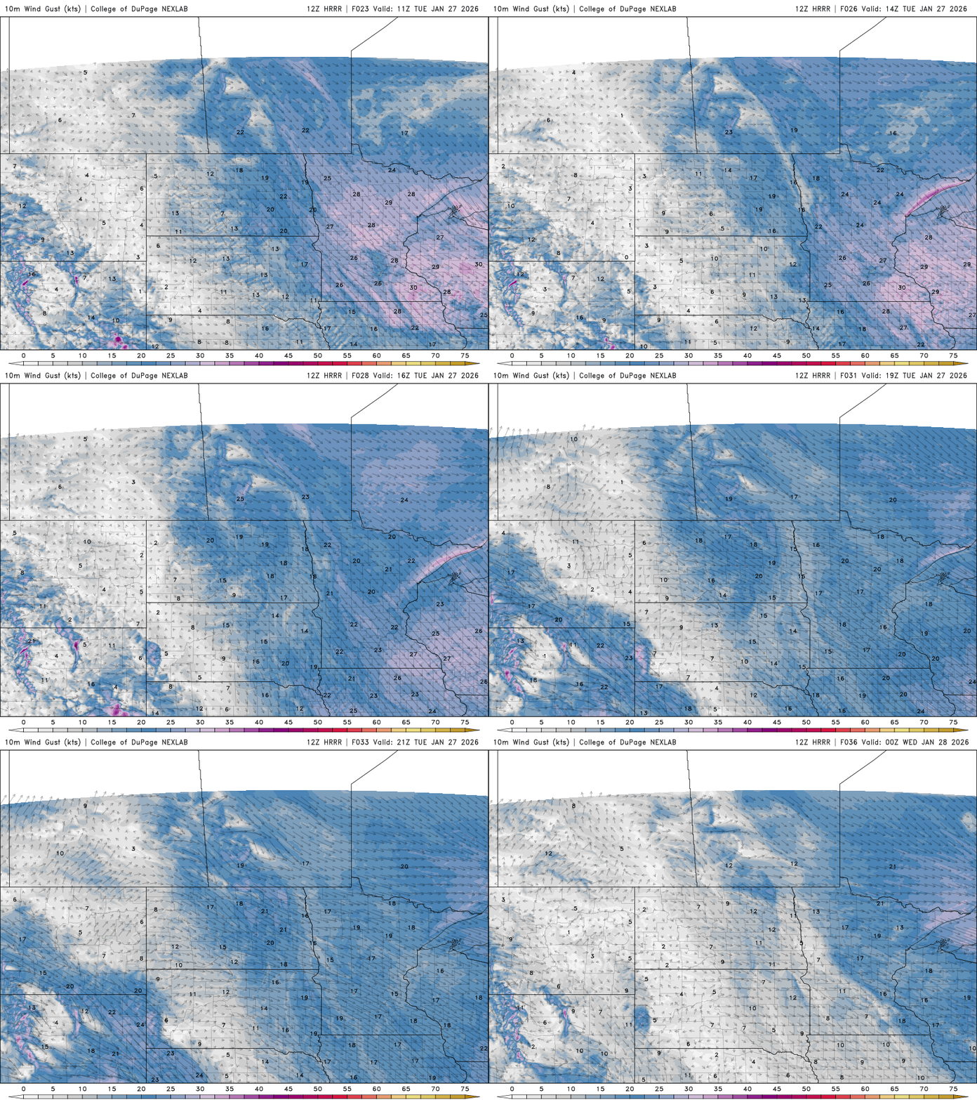
Winds will make it feel colder through the day Tuesday from the northwest at 10 to 20 mph. That will make those single digits temperatures feel more like they’re subzero all day long with even teens and 20s below zero in northern Minnesota Tuesday morning.
Those winds will keep wind chill values well below zero through the day Tuesday. Even this afternoon most wind chills will be in the teens to near 20 below zero:
Turn Up Your Support
MPR News helps you turn down the noise and build shared understanding. Turn up your support for this public resource and keep trusted journalism accessible to all.

Overnight lows will drop back below zero for all but southwestern Minnesota Tuesday night with partly cloudy skies.

Wednesday will again see highs mostly in the single digits with some teens in southwestern Minnesota and some spots in northwestern Minnesota remaining below zero. We should see a fair amount of sunshine with a few more lingering clouds in northeastern Minnesota.

We finally see warmer temperatures build in this weekend. Highs will be back in the 20s by Sunday if not Saturday for some in southern Minnesota.

This retreat of the coldest air will also allow for the chance of snow to return by Sunday across much of the state.
Weather usually occurs on the edges of warmer and colder air masses and while that periphery and corresponding jet stream remains west and south of us most of this week, it will move back in our region Sunday.

That will allow the next system, a clipper system, to move in Sunday producing a widespread chance of at least light snow Sunday.