
A couple more cold days before a weekend warmup
Snow showers are likely Sunday
Go Deeper.
Create an account or log in to save stories.
Like this?
Thanks for liking this story! We have added it to a list of your favorite stories.


We still have a couple cold days Thursday and Friday before temperatures warm this weekend. Snow showers are likely across much of Minnesota Sunday.
Temperatures trend upward this weekend along with chances of snow
Rinse and repeat. Bright cold days continue Thursday and Friday.
Once again we’ll have plenty of sun for most of central and southern Minnesota with temperatures starting out subzero and warming into mostly the single digits this afternoon.
A few pockets of northwestern Minnesota will remain below zero while a few spots in southwestern Minnesota will reach the teens again.
Turn Up Your Support
MPR News helps you turn down the noise and build shared understanding. Turn up your support for this public resource and keep trusted journalism accessible to all.

Northeastern Minnesota will see more clouds and some light snow showers with a dusting possible in many areas.

Thursday night will be another subzero night for most of the state with parts of far northern Minnesota reaching overnight lows near 20 below zero.

Friday will again be cold and bright with temperatures dropping back below zero Friday night. That might be our last subzero night for most of central and southern Minnesota for 10 days to potentially even two weeks.

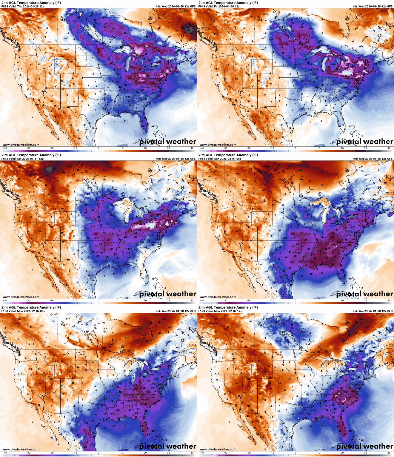
Highs in the 20s are expected by Sunday and should remain there most of next week. In fact, temperatures could even warm to above-freezing territory by late next week across southern Minnesota.

We’re still looking at a good chance of snow showers Sunday across much of Minnesota. As more seasonable air returns to Minnesota with the retreat of the arctic air, this allows the jet stream and storm track to lift back north into our region.
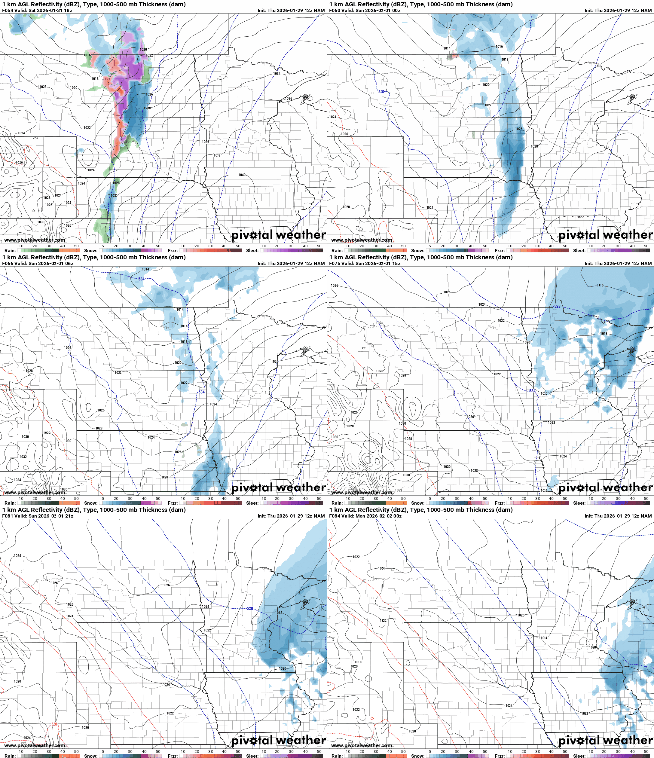
Snowfall totals look modest — likely in the range of 1 to 2, maybe 3, inches in some spots. There’s another chance of snowfall Tuesday for much of Minnesota.

The southeast is also dealing with some brutal cold, relative for those locations. Overnight lows Saturday night into early Sunday morning will be near-freezing all the way to Tampa, Fla. Even Miami may fall into the mid-30s with teens in Atlanta.

The lingering cold in the eastern United States is also going to generate yet another big storm for the mid-Atlantic states and northeast this weekend.
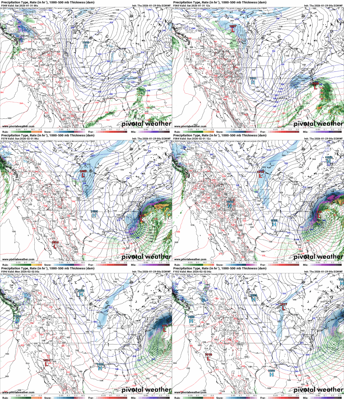
Several inches or more of snow will fall this weekend in much of the Carolinas into Virginia with snow extending northeast into parts of New England.


