
Warmer air moves in this weekend along with a more active pattern
Temperatures climb to normal and above next week
Go Deeper.
Create an account or log in to save stories.
Like this?
Thanks for liking this story! We have added it to a list of your favorite stories.


Friday brings one last cold day and one last subzero night. Temperatures warm this weekend and that’ll bring some snow Sunday and possibly Tuesday, too.
With warmer air comes a more active jet stream next week
It’s another cold start to the day Friday with most of Minnesota back below zero. A cold weather advisory is posted for northern Minnesota through 11 a.m.
We will finally get out of this repeated cold pattern starting this weekend. Friday, however, will bring highs back mostly in the single digits again with partly cloudy skies.

Overnight temperatures will be back below zero for most of Minnesota Friday night into early Saturday. This could be our last subzero night in central and southern Minnesota for at least a week and a half.
Turn Up Your Support
MPR News helps you turn down the noise and build shared understanding. Turn up your support for this public resource and keep trusted journalism accessible to all.

Saturday will start to see temperatures warm up, mostly in the teens. A few lucky spots could reach 20 degrees already Saturday afternoon.

Milder air yet moves in for Sunday. Highs will be in the 20s for most with 30s in southwestern Minnesota. Those readings are actually a few degrees above normal for the first time since Jan. 16, more than two weeks ago!

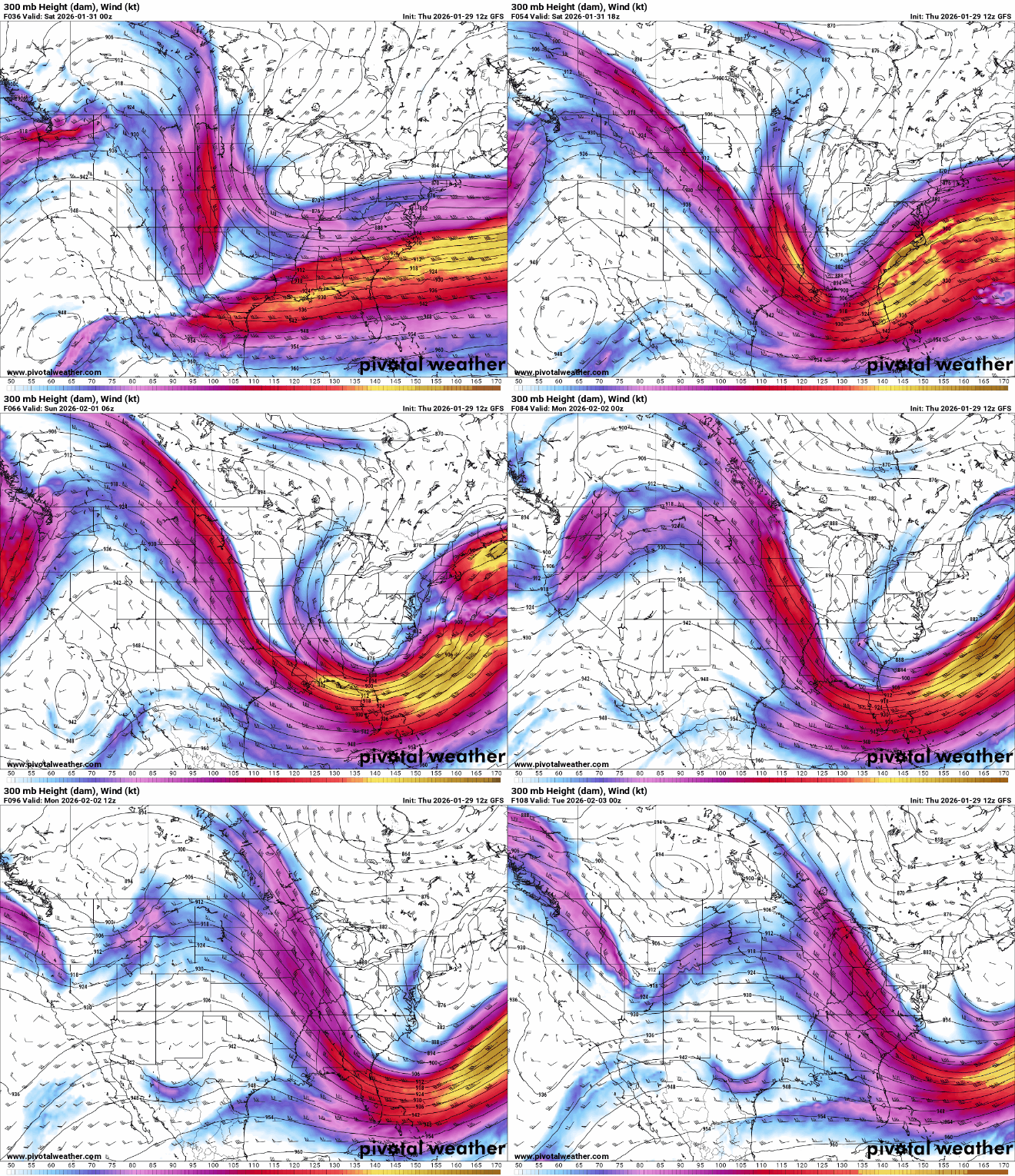
With the colder air retreating north, the jet stream is moving north as well and that’s the main track for weather disturbances.
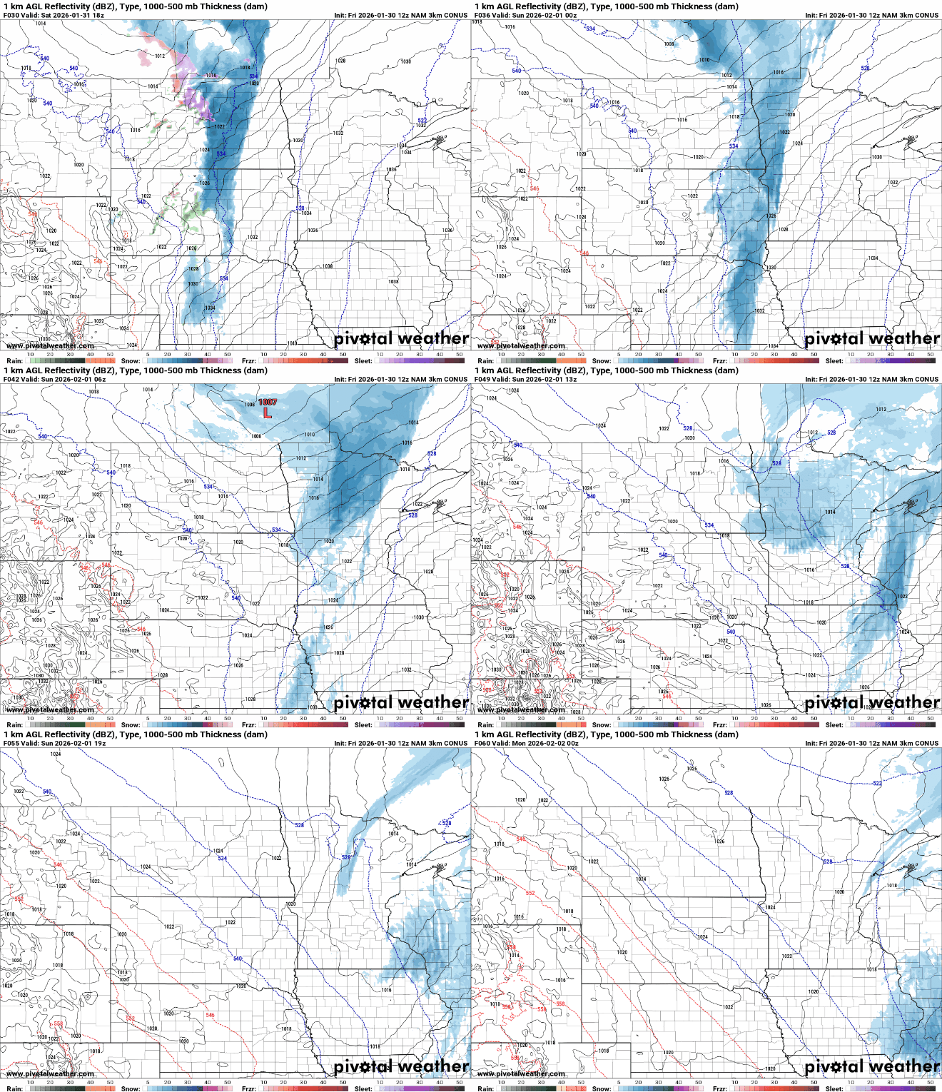
The first disturbance arrives late Saturday in western Minnesota with snow showers tracking east through the night Saturday night into Sunday for most of the state. Snow showers should wrap up for most by late Sunday afternoon.
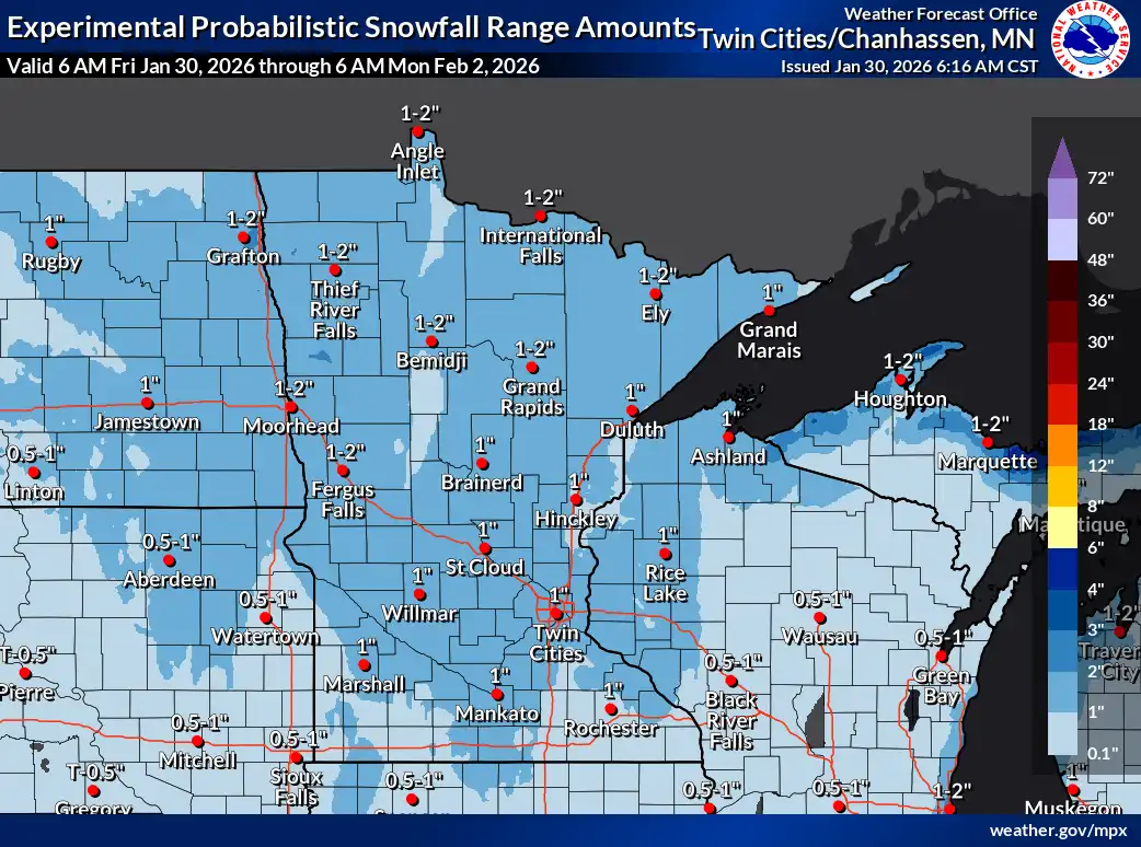
Snowfall won’t be anything terribly significant but much of the state will see a coating to up to 1 or 2 inches with isolated pockets of 3 inches possible.
Temperatures remain mild into next week, mostly in the 20s with even 30s by late in the week potentially. We’ll have another chance at snow showers for some on Tuesday.


