Minor snow accumulations expected from weekend clipper
Minnesota exits deep freeze with February warmup

Go Deeper.
Create an account or log in to save stories.
Like this?
Thanks for liking this story! We have added it to a list of your favorite stories.


After a stretch of bitter cold, Minnesota is in for a brief snow event Saturday as a fast-moving clipper moves across the state, followed by a gradual warming trend.
Warming trend into February
This will likely be the last brisk start to the day as a warming trend begins heading into February. Over the past 10 mornings, low temperatures have been at or below zero, but that stretch of cold is expected to end beginning Saturday morning.
High pressure will bring plenty of sunshine Saturday, allowing temperatures to warm into the upper teens and lower 20s. Southerly winds will increase ahead of an approaching warm front, which will bring the next chance for a refresh of snow.

A weakening clipper system is moving east-southeast along the U.S.-Canada border, bringing light snow to the region from Saturday afternoon through Sunday. Snow is expected to begin in western Minnesota Saturday afternoon, reaching central Minnesota by about 9 p.m. and the metro area closer to midnight.
Turn Up Your Support
MPR News helps you turn down the noise and build shared understanding. Turn up your support for this public resource and keep trusted journalism accessible to all.
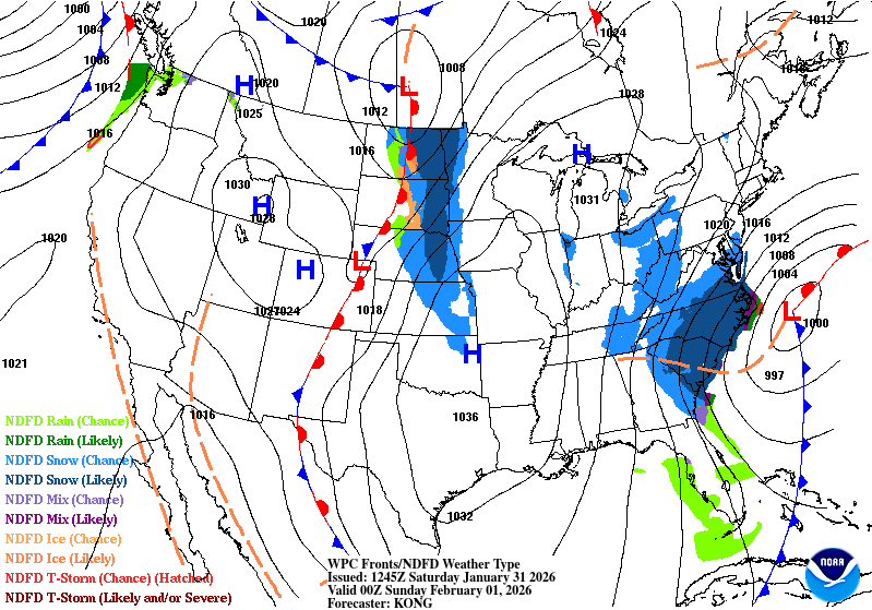
A winter weather advisory will be in effect from noon Saturday through noon Sunday for northwestern Minnesota. Blowing snow will be the primary concern, with wind gusts of 25 to 35 mph expected. Periods of minor mixed precipitation are also possible at times.

Snowfall rates are expected to remain light, though accumulations could add up over several hours before tapering off Sunday afternoon. The metro area is expected to receive between 1 and 2.5 inches of snow.
The highest snowfall totals are expected in northwestern Minnesota, with up to 3 inches of light, fluffy snow possible around Moorhead, Fergus Falls, and Thief River Falls.

Sunday will bring warmer temperatures, with highs rising into the 20s and 30s, returning close to seasonal averages.

Temperatures dip Monday before the warmest air in weeks arrives later this week
Behind the system, cooler air will move in Monday, bringing a brief drop in temperatures. Conditions will then gradually warm through the middle of the week as milder Pacific air spreads east across the Plains.

Another strong clipper system is expected to track toward the Great Lakes on Thursday, potentially bringing the warmest air of the week. High temperatures are forecast to reach the 30s, with some areas possibly climbing into the low 40s.

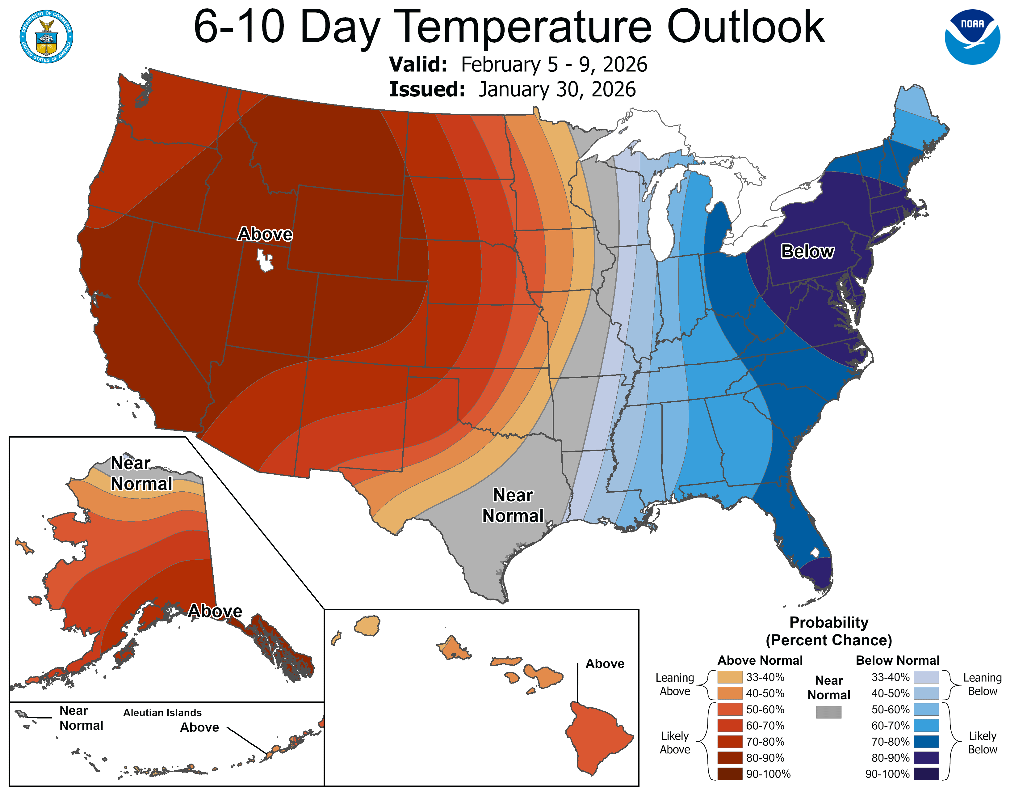
The first full week of February is shaping up to be much warmer than the recent stretch of bitter cold. The Climate Prediction Center’s 6- to 10-day outlook calls for above-average temperatures across the region.