
Falling temperatures Friday; milder air returns early next week
Next week looks quite mild overall
Go Deeper.
Create an account or log in to save stories.
Like this?
Thanks for liking this story! We have added it to a list of your favorite stories.


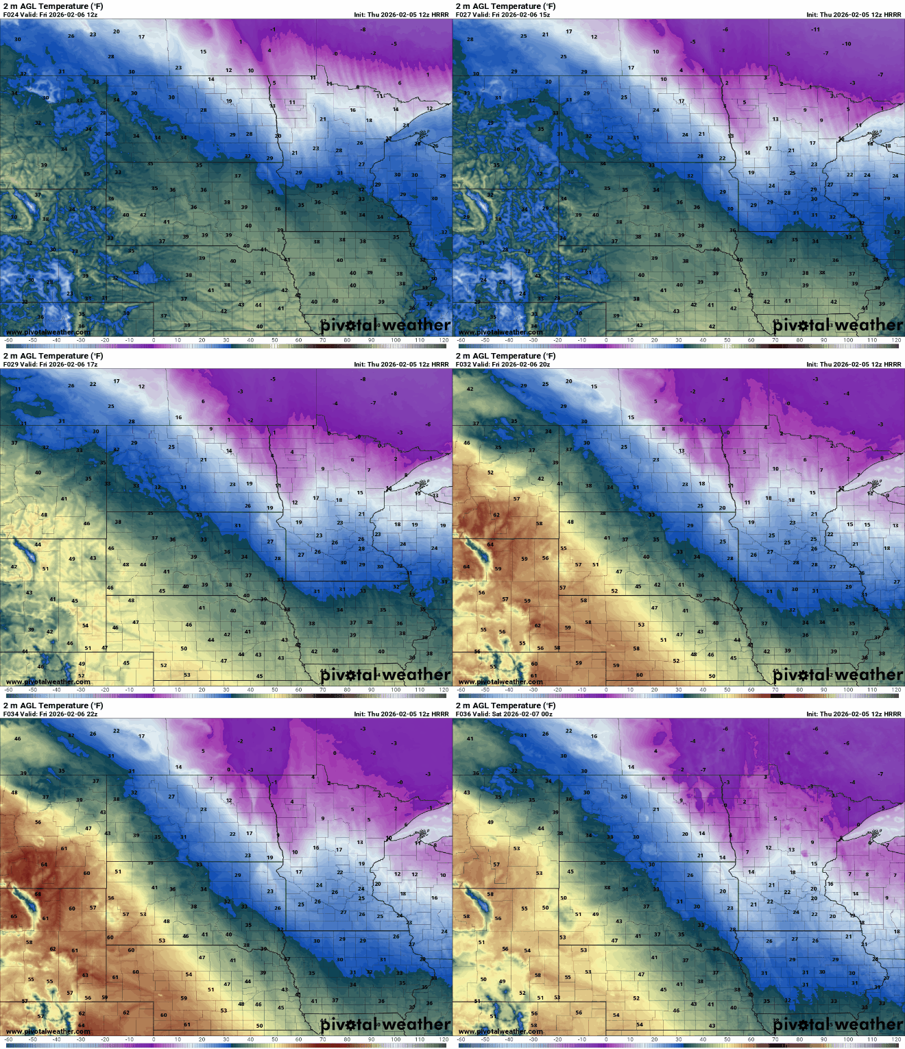
Temperatures on Friday are starting mild but will fall through the day as cooler air briefly returns. It will be windy with northwest winds 10 to 20 mph.
Mild air returns early next week.
Cooler air briefly moving in Friday, Saturday; more mild air ahead
Temperatures are starting out above freezing across southern Minnesota early Friday, but don’t be fooled — that will be our high of the day. Temperatures will fall through the day, into the 20s by evening.
Temperatures will drop from the teens into the single digits in far northern Minnesota.
Turn Up Your Support
MPR News helps you turn down the noise and build shared understanding. Turn up your support for this public resource and keep trusted journalism accessible to all.

Northern Minnesota will see a subzero night with mostly clear skies while southern Minnesota remains above zero but in the single digits.

Saturday will be cool but near-normal with highs mostly in the 20s. Northeastern Minnesota will see teens while southwestern Minnesota remains in the 30s.

Yet another clipper system will move through late Saturday into Saturday night for northeastern Minnesota with another fresh coating of some snowfall.
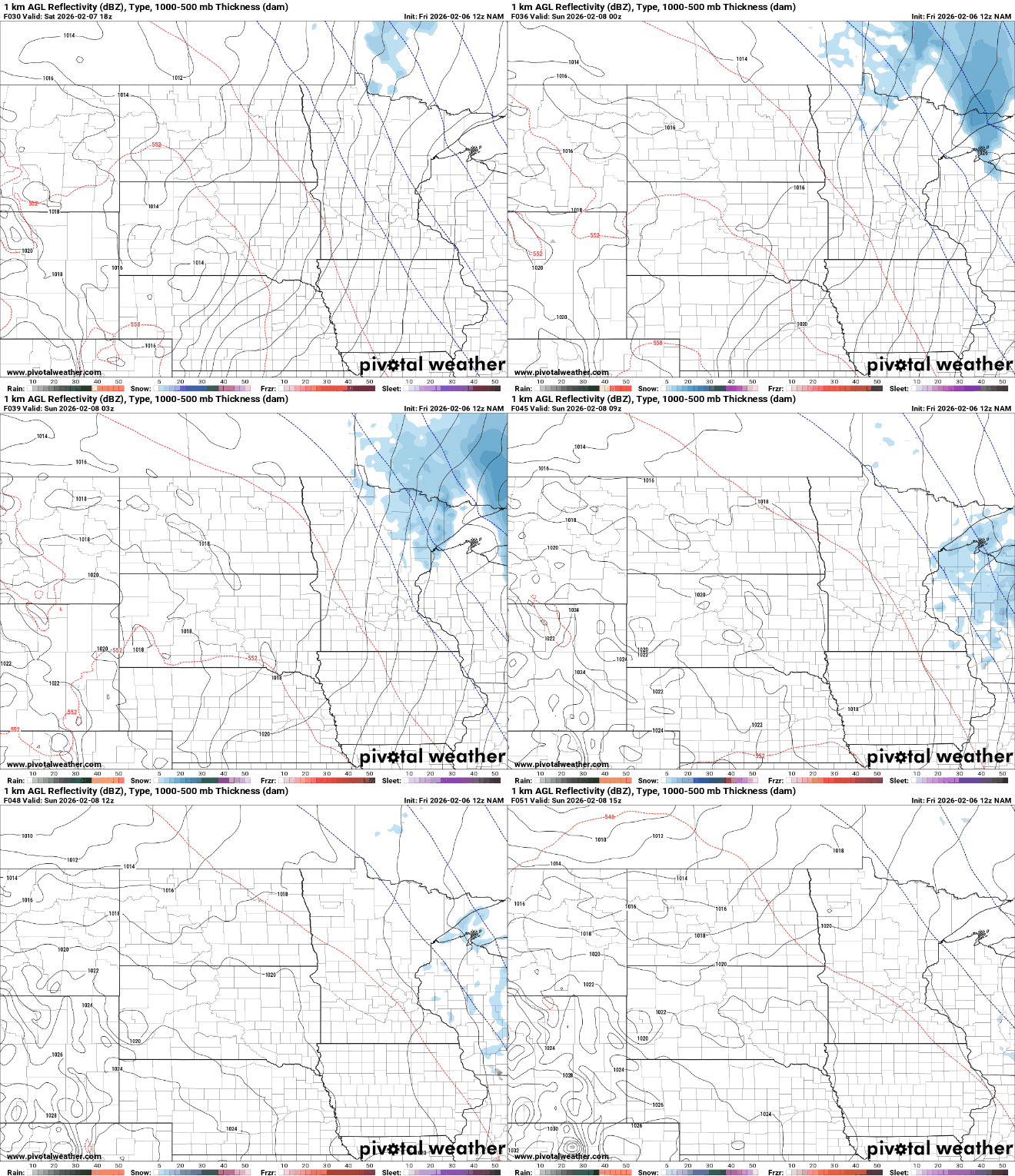
Portions of the Arrowhead could once again see up to an inch of snowfall accumulation through Saturday night.

The milder air flows back into the region Sunday, pushing temperatures above freezing across southern Minnesota. That warm air could create a wintry mix with the next incoming disturbance Sunday night for northeastern Minnesota once again.
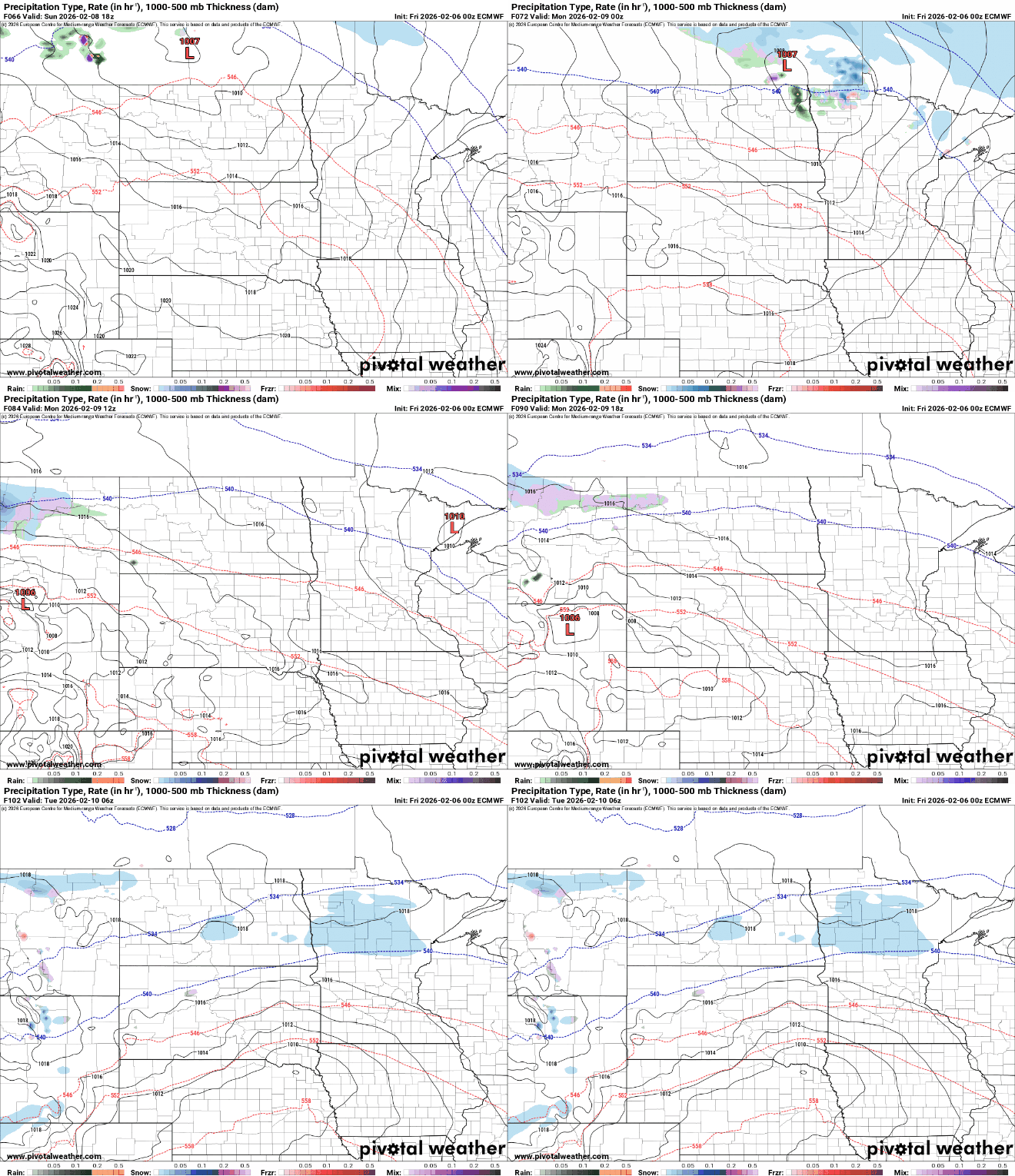
There’s a potential for some ice accumulation along the North Shore Sunday night into early Monday morning.

Our warmest temperatures of next week likely coming Monday afternoon. Southern Minnesota will see highs in the 40s with 50s in southwestern Minnesota and potentially even a 60 in the far southwest corner of the state!

We cool off some from those readings by mid to late next week, but we’ll remain mostly in the 30s and 20s — above normal for most.
We could also be eyeing a more active pattern later next week as some forecast models produce a storm system somewhere in the central United States.

