15 to 30 degrees above normal Monday
Cooler but still mild the rest of this week

Go Deeper.
Create an account or log in to save stories.
Like this?
Thanks for liking this story! We have added it to a list of your favorite stories.


Monday will be quite mild with highs in the 30s, 40s and even 50s in southwestern Minnesota. While we cool off some the rest of the week, it remains above normal.
Anomalous warmth persists all week
It’s already a mild start with temperatures starting in the 20s and 30s. Afternoon highs will be in the 30s north to 50s in southwestern Minnesota. In between, the Twin Cities and central Minnesota will see highs in the low 40s.
Those readings are 15 to 30 degrees above normal — as close as Omaha, Neb., could hit 70 degrees Monday, breaking their daily record high.

Something that’s below normal for central and southern Minnesota is snow cover. Only portions of northeastern Minnesota and the Arrowhead are seeing average snow cover for this time of winter (generally 12 to 18 inches).
Turn Up Your Support
MPR News helps you turn down the noise and build shared understanding. Turn up your support for this public resource and keep trusted journalism accessible to all.
The Twin Cities is down to just 1 or 2 inches when the average for the date is 5 to 6 inches.

The bare (brown) ground was clearly visible Sunday in satellite imagery. The snow cover versus bare ground boundary is just about 40 to 50 miles southwest of the Twin Cities.
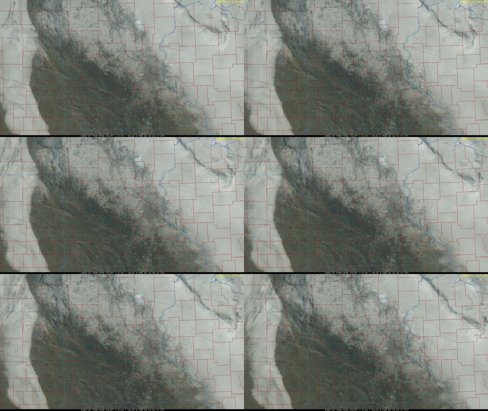
Much of southern Minnesota is likely to lose its dwindling snowpack this week as temperatures remain above normal and above freezing most of the week.
A cold front moves across northern and central Minnesota later today, touching off scattered rain and snow showers. The front will clear most of the state overnight tonight. Portions of central Minnesota could receive a coating of slushy snow.
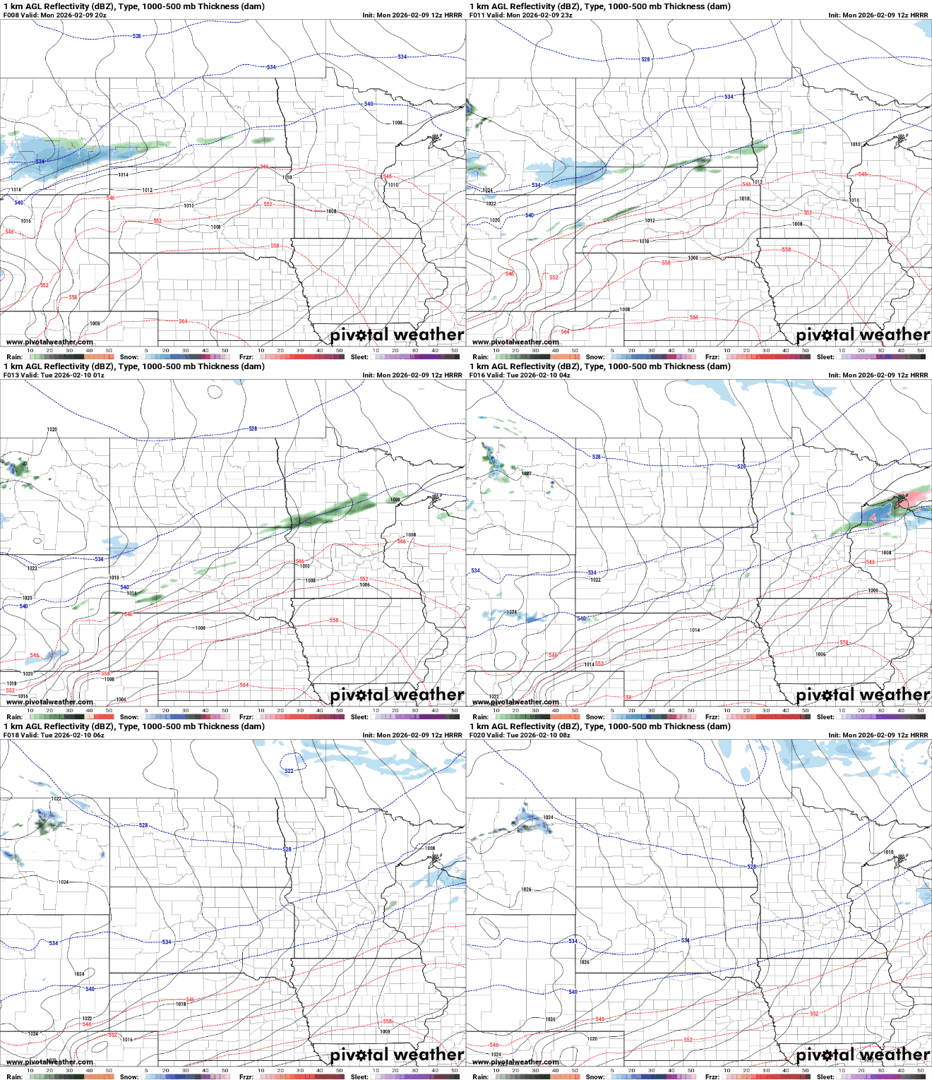
Overnight, puddles and slush will refreeze, so watch for slick areas early Tuesday morning. Temperatures will dip into the teens north to low 30s south Monday night.

Highs Tuesday will still be above normal, mostly in the 30s with 20s north and 40s still in southwestern Minnesota. Those temperatures are still 5 to 15 degrees above normal.

A round of rain and snow is also possible Wednesday night into Thursday across mainly southern Minnesota.
Not all forecast models are producing snowfall accumulation but an increasing number are so we’ll need to keep an eye on it. It may affect our Thursday morning commute.
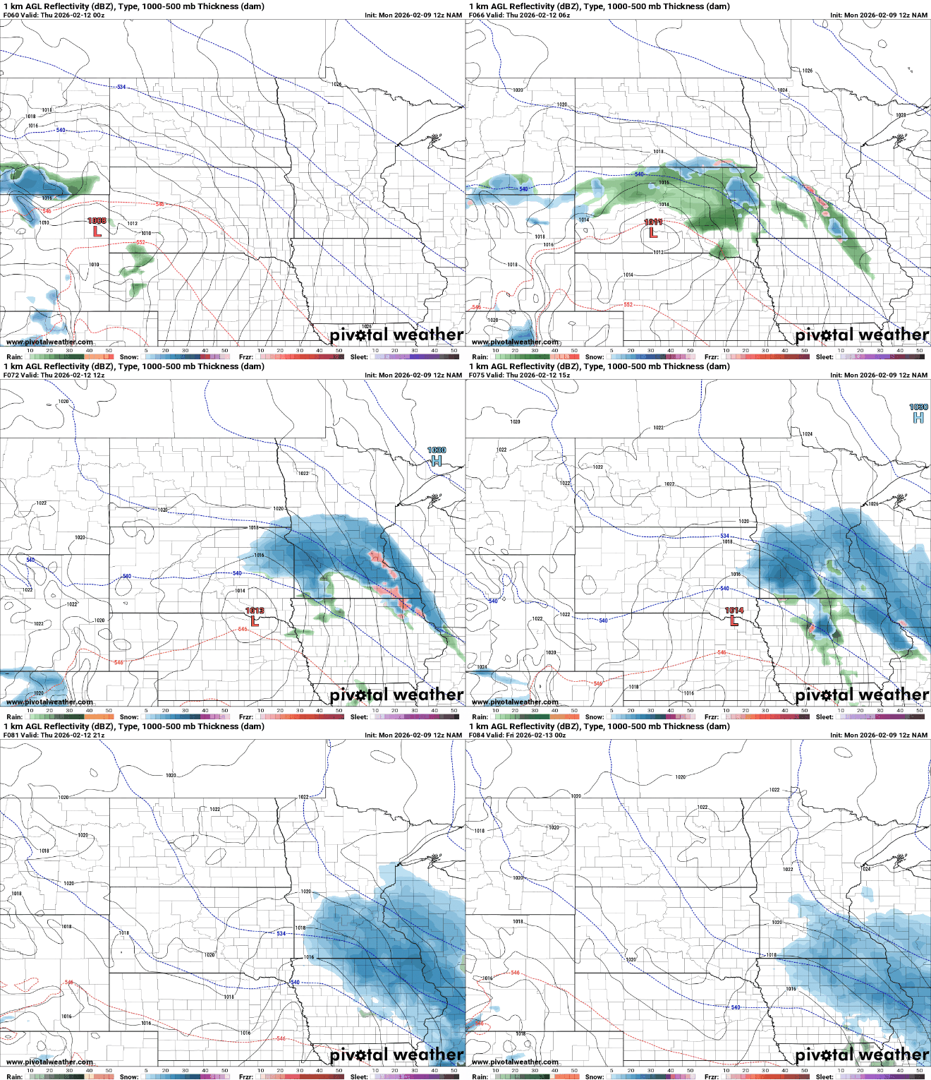
If snow does accumulate, most models favor central and southern Minnesota at this point. Complicating the forecast will be relatively mild temperatures. The timing of snow will depend on if it happens late at night and early morning versus midday when it’s warmer.

The remainder of the week will continue above-normal temperatures mostly in the 30s with 20s far north and 40s close to 50 occasionally in the southwest corner of the state. By Friday and the weekend we could see widespread highs in the 40s again.

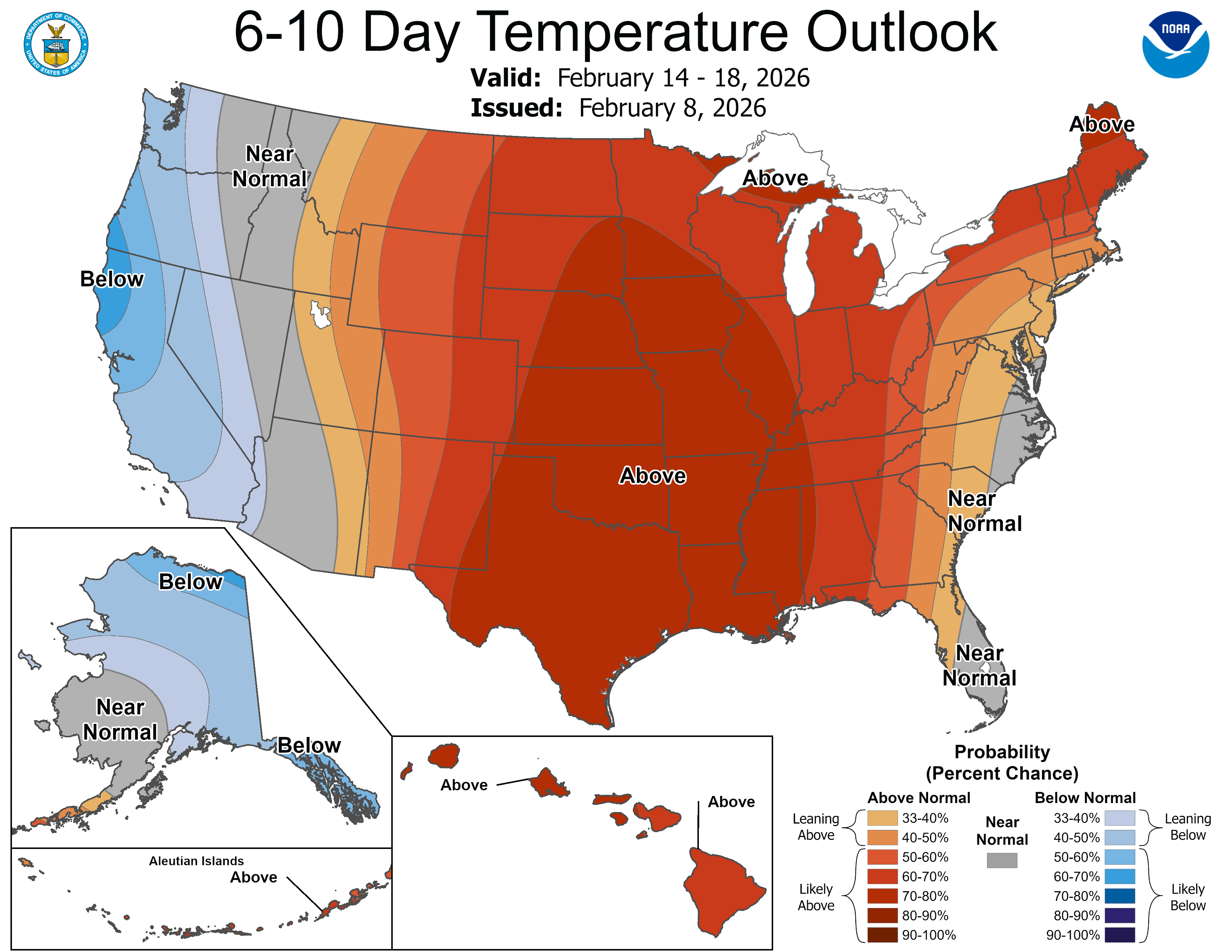
There’s really no end in sight to the mild pattern. The six to 10-day outlook calls for high odds of above-normal temperatures continuing.