
February thaw continues into the weekend
Warm Pacific pattern keeps winter on pause
Go Deeper.
Create an account or log in to save stories.
Like this?
Thanks for liking this story! We have added it to a list of your favorite stories.


A string of warmer February days ahead may possibly bring record setting temperatures on Saturday.
February thaw ahead
Wednesday marks the fourth consecutive day of above-freezing temperatures, as a February thaw continues across the region. The milder pattern is expected to persist through the weekend and into next week.
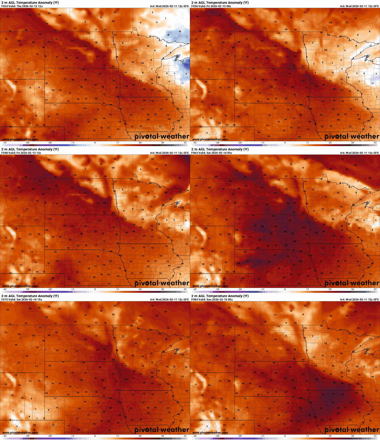
High temperatures Thursday will range from the mid- to upper 30s north of Interstate 94 to the low 40s across the Twin Cities metro area. Southwestern portions of the state will see the warmest readings, with highs climbing into the low 50s.
Turn Up Your Support
MPR News helps you turn down the noise and build shared understanding. Turn up your support for this public resource and keep trusted journalism accessible to all.

Friday will bring much of the same, with highs in the 40s and 50s across southern Minnesota and above-freezing temperatures extending north to the Canadian border.

The biggest surprise in the forecast arrives Saturday, when record-breaking temperatures are possible. The record high for the Twin Cities on Feb. 14 is 50 degrees, set in 1882. St. Cloud’s record for the date is 52 degrees, set in 1921. Eau Claire could also challenge its record high, set in 1934.

Highs are running well above typical mid-February levels, with the forecast calling for temperatures 10 to 20 degrees above average.
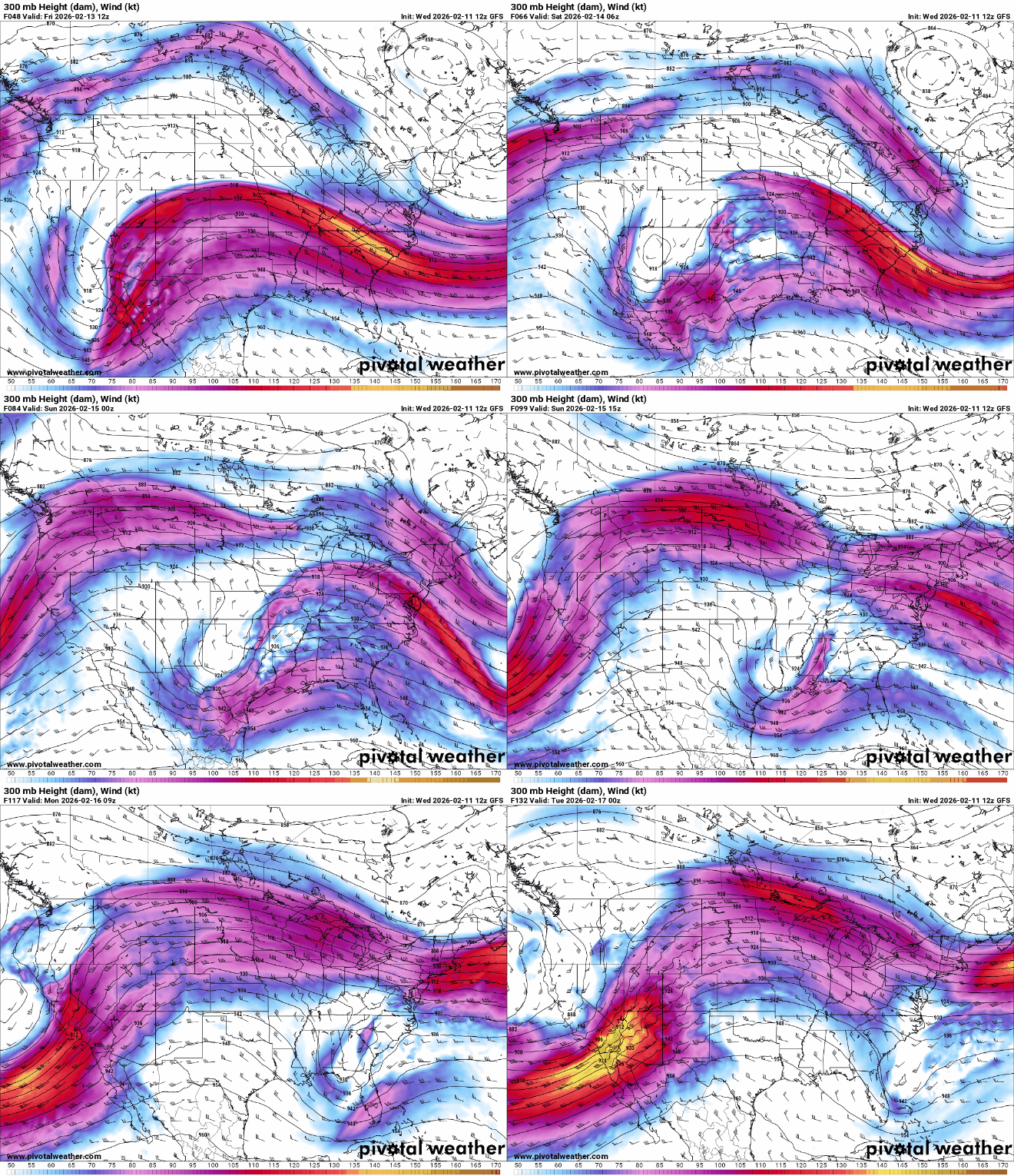
The warmer Pacific pattern will persist through early next week, as a largely zonal jet stream keeps mild air flowing west to east across the region.
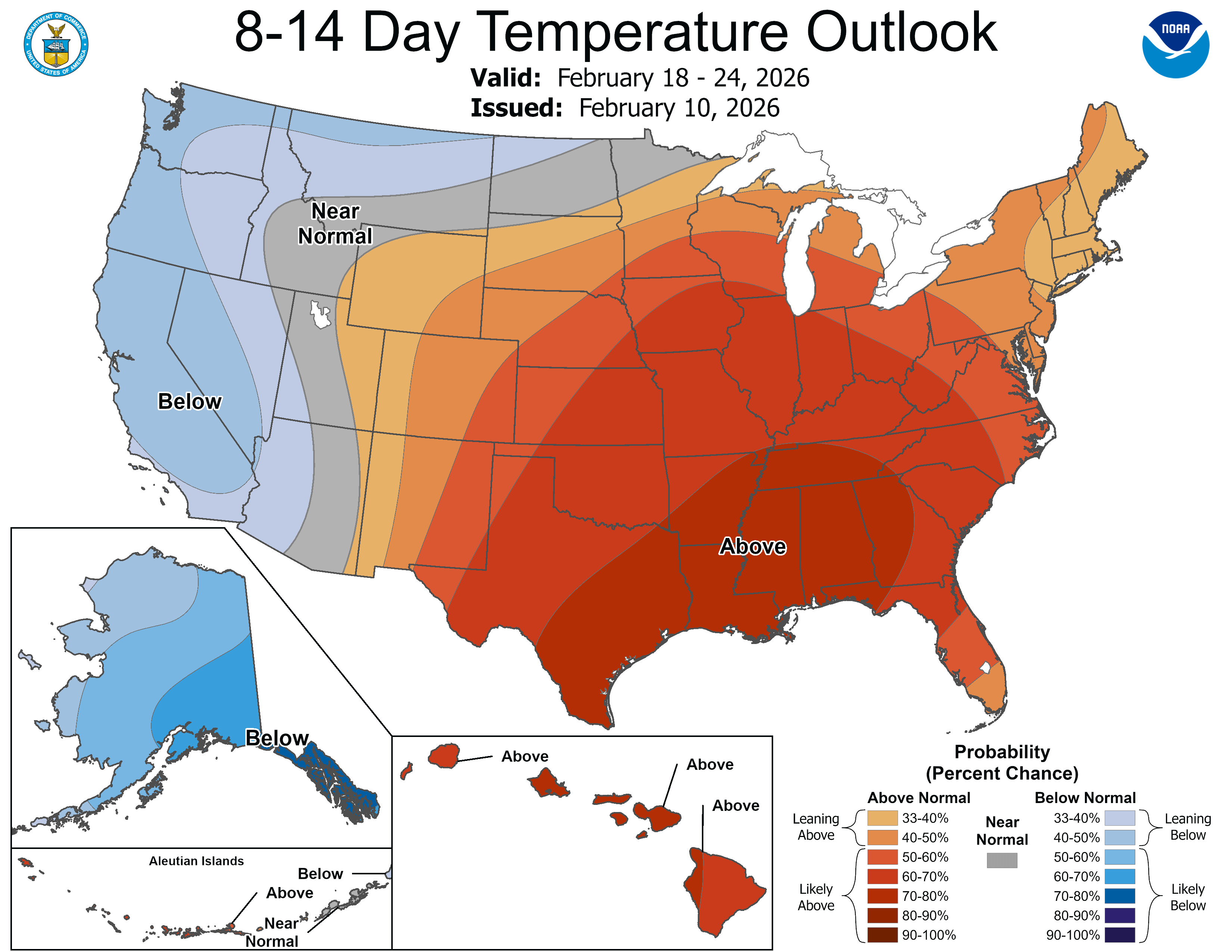
As we head toward the end of February, the mild streak shows little sign of breaking, with no major cooldowns expected.

