
Warmest weekend in nearly 3 months on the way
Pattern shifts cooler later next week

Go Deeper.
Create an account or log in to save stories.
Like this?
Thanks for liking this story! We have added it to a list of your favorite stories.


Enjoy a very mild weekend with temperatures that will average about 20 degrees above normal. The mild weather persists into midweek before a pattern shift.
Warmest weekend in nearly 3 months followed by a pattern change
If you liked Thursday, you’ll like Friday, too. We’ll see similar temperatures — mostly in the 40s in southern Minnesota with 50s again southwest and 30s north. Look for more sunshine, too. Northwestern Minnesota has some dense fog to burn off first Friday morning.

The weekend will be the warmest since just before Thanksgiving. Highs will be in the upper 40s to near 50 degrees and with more sunshine than clouds both days.
The last weekend that was warmer was Nov. 22-23 when it was 54 and 56 degrees for highs that Saturday and Sunday, respectively.
Turn Up Your Support
MPR News helps you turn down the noise and build shared understanding. Turn up your support for this public resource and keep trusted journalism accessible to all.
The mild weather persists into the start of next week. Monday could be even warmer with low 50s in the Twin Cities and a chance at 60 degrees in southwestern Minnesota.

The pattern inevitably shifts mid to late next week. We’re looking at cooler temperatures, mostly in the 30s for highs (which is still above normal) and also a potentially more active pattern with a pair of storm systems to watch.
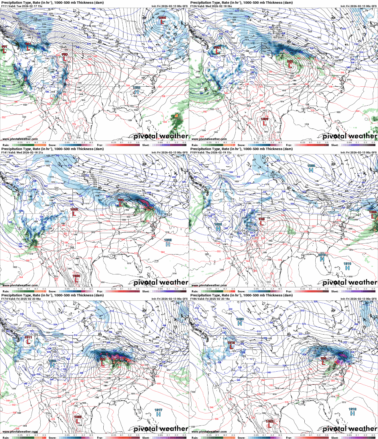
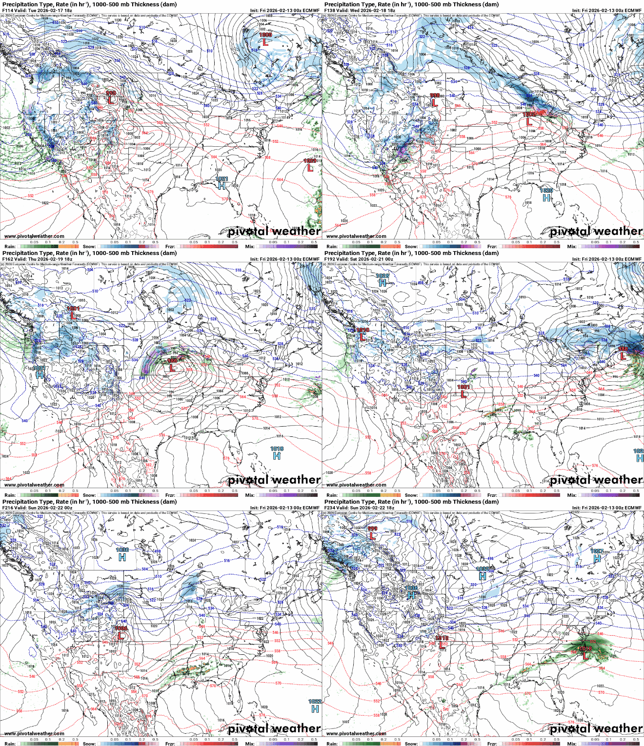
The forecast models have quite a large range of possibilities between storm tracks and rain or snow. The first system will be Tuesday and Wednesday, another system will arrive as early as Friday or later into next weekend (Feb. 21-22).
The National Oceanic and Atmospheric Administration’s Global Forecast System model puts the storm track farther north, giving southern Minnesota more rain than snow Tuesday into Wednesday:
The European Centre for Medium-Range Weather Forecasts model tracks farther south and colder, giving us more snow Tuesday and Wednesday with two more systems by Feb. 23.
We still have a lot of monitoring of forecast models to do before any degree of forecast certainty can be established. Either way, much of Minnesota looks to get at least a fresh coating of snow in the second half of next week. It’s still February after all!

