
No broken hearts, just broken records for Valentine's Day
Winter makes a comeback on Tuesday
Go Deeper.
Create an account or log in to save stories.
Like this?
Thanks for liking this story! We have added it to a list of your favorite stories.


A rare February flirtation with spring is ahead for Valentine’s Day as warm air pushes temperatures toward record highs across Minnesota.
Warm hearts, warm records possible
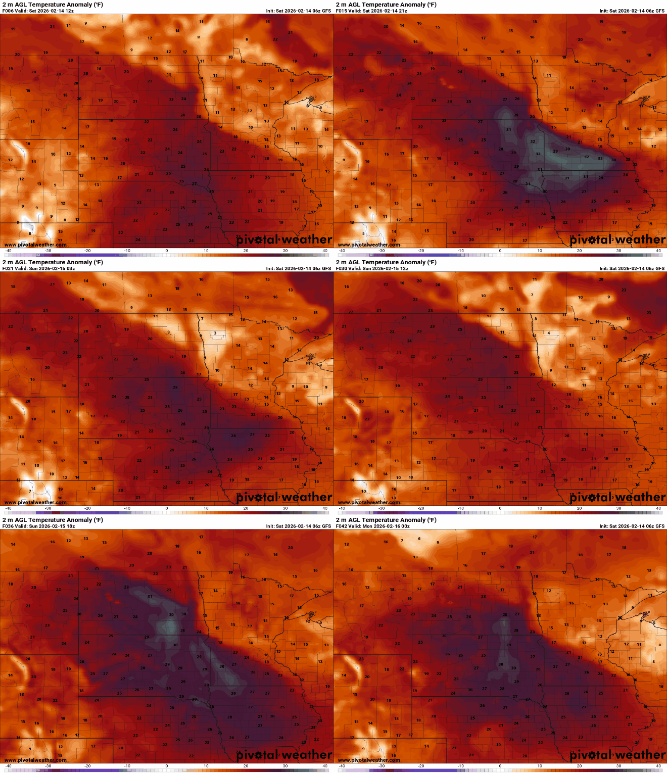
Mother Nature has sent Minnesota a Valentine in the form of unseasonably warm weather, with temperatures expected to run 20 to 30 degrees above normal for mid-February.
Temperatures will climb into the 30s and 40s across northern and central Minnesota, with 50s and even 60s possible again in the south. The record high for the Twin Cities is 50 degrees, set in 1882.

Vitamin D will be plentiful this weekend with abundant sunshine. Southern Minnesota may see only a thin veil of high clouds from a system moving through the central Plains on Saturday.
Sunday’s temperatures will be similar to Saturday’s, with the warm air mass still in place.

Winter is not ready to break up with us just yet. The next system will move across the Northern Plains on Tuesday and into the Upper Mississippi Valley on Wednesday. Forecast models show a surface low tracking from South Dakota into southern Minnesota.
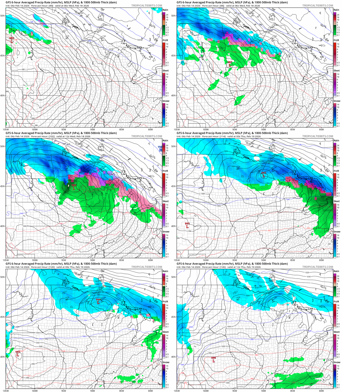
There will be ample moisture with this system, and a band of heavy, wet snow is likely somewhere in Minnesota. It is too early to determine exactly where the heaviest snow will fall or how much will accumulate. Warmer temperatures could complicate the forecast, particularly when it comes to precipitation type.
Turn Up Your Support
MPR News helps you turn down the noise and build shared understanding. Turn up your support for this public resource and keep trusted journalism accessible to all.

