
Patchy fog possible overnight, mild Monday ahead before our next winter storm
Anomalous warmth continues through the work week

Go Deeper.
Create an account or log in to save stories.
Like this?
Thanks for liking this story! We have added it to a list of your favorite stories.


Areas of freezing fog and patchy fog are expected to develop overnight Sunday into Monday morning across the state. A mild Monday is ahead, with temperatures remaining well above normal. However, a strong storm system is set to take shape midweek, bringing accumulating snow to the Northland.
Mild temperatures continue into work week
Anomalous warmth for mid-February will continue into the work week, with highs expected to remain 20 to 30 degrees above seasonal averages. This unseasonably mild stretch will persist until cooler air begins to filter in late week, bringing temperatures back to more seasonal levels.
Low temperatures Sunday night will dip into the teens and 20s in the north, with milder 30s expected across the southern portion of the state. Areas of patchy fog and freezing fog are possible in low-lying areas into Monday morning.
Turn Up Your Support
MPR News helps you turn down the noise and build shared understanding. Turn up your support for this public resource and keep trusted journalism accessible to all.

A mild Monday is in store, with high temperatures reaching the upper 30s to low 40s across northern and central Minnesota, and 50s expected in the southern part of the state.

Midweek storm system
It’s been a while since a snowstorm has been in the forecast, but one is on the horizon for late Tuesday, lasting into Thursday. A winter storm watch has been issued for the northern third of the state, beginning Tuesday evening.
The latest forecast models indicate a more northerly track for the low-pressure system, moving through the Dakotas into central and southern Minnesota. The exact track of the system will determine the location and intensity of the heaviest snow bands.
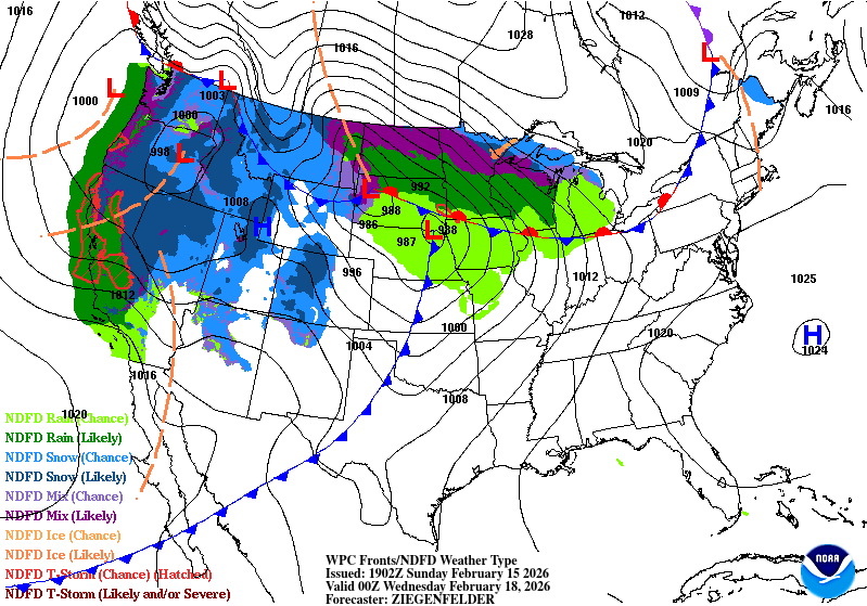
Temperatures in southern Minnesota will remain mild, ranging from the 40s to 50s, allowing mostly rain to fall. Meanwhile, northern Minnesota faces a high risk of a heavy, wet snow band late Tuesday into early Wednesday, with a strong likelihood of at least 4 inches of snow. This system will move slowly, keeping precipitation chances in the forecast through Thursday.

Winds will intensify with the strong low-pressure system, creating the potential for blizzard-like conditions in areas with falling snow. Gusts are expected to reach 30 to 40 mph.
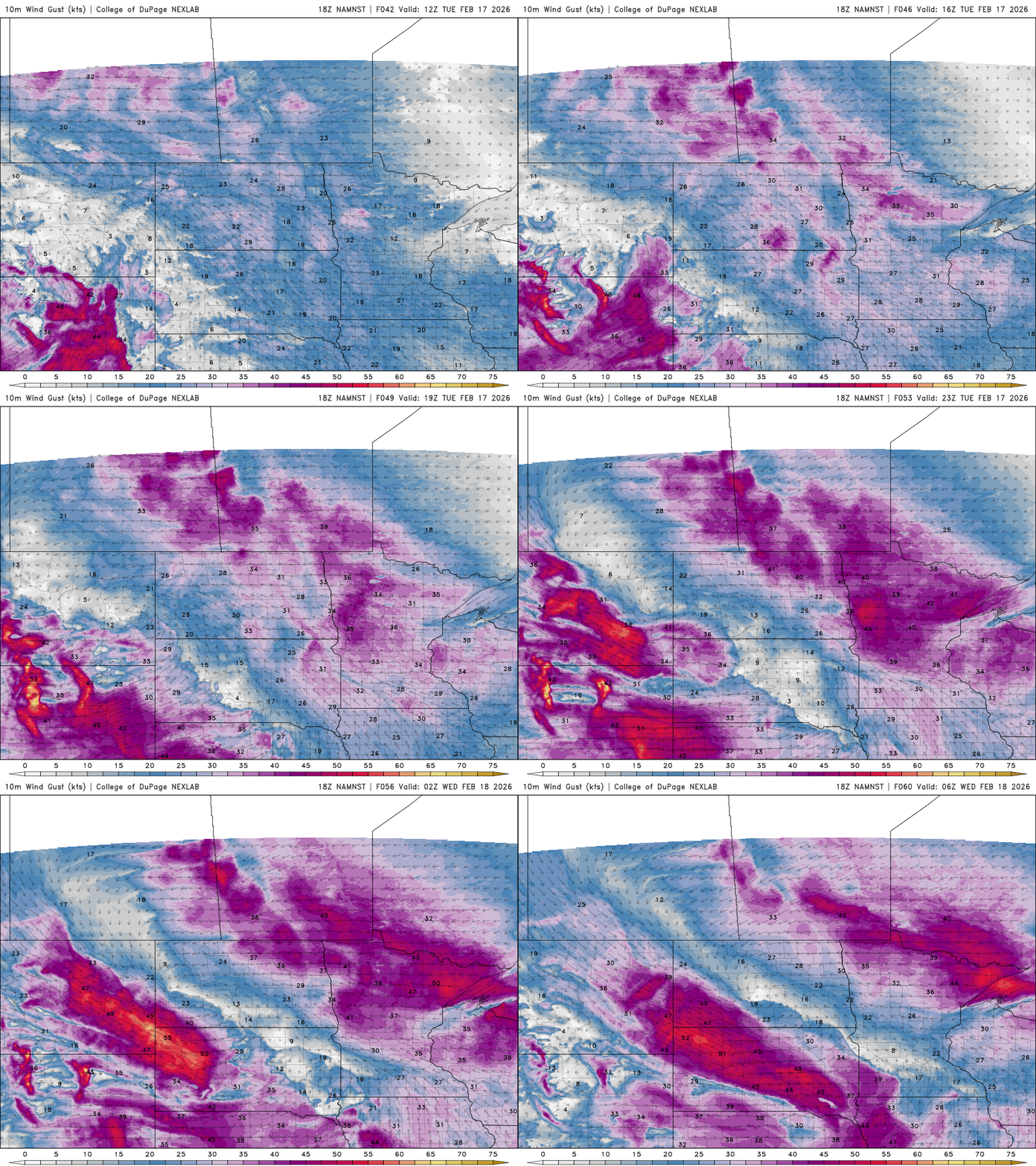
Cooler air will follow the system, with lingering light snow showers possible into Friday. Despite the cooler temperatures, highs will return to seasonal levels in the 20s and 30s by Friday.
Another system may bring winter conditions to southern Minnesota, with a very active weather pattern expected from Friday into the weekend.

