
First of two winter storms moves in later Tuesday
Temperatures will also cool to seasonable levels

Go Deeper.
Create an account or log in to save stories.
Like this?
Thanks for liking this story! We have added it to a list of your favorite stories.


Two winter storms are taking aim at Minnesota. The first storm affects mostly northern Minnesota Tuesday night with southern Minnesota hit Thursday night.
Two winter storms move in as mild air moves out
We’ll have one last pretty mild day Tuesday with highs back in the 50s and even 60s in southwestern Minnesota. Most of southern and central Minnesota will see highs in the 40s with 30s north. Clouds will be on the increase ahead of our developing winter storm system.

A blizzard warning is posted for Tuesday night through Thursday on the North Shore. A winter storm warning is posted for the northern counties of Minnesota, which will see a wintry mix develop later Tuesday with all snow by Tuesday night into Wednesday and early Thursday.
A winter weather advisory extends just south of the warned regions in north central Minnesota.
Turn Up Your Support
MPR News helps you turn down the noise and build shared understanding. Turn up your support for this public resource and keep trusted journalism accessible to all.
Rain showers will develop initially in central and northern Minnesota later in the afternoon Tuesday. There could even be some thunder for central and southern Minnesota!
The rain will turn to a wintry mix of freezing rain and sleet before transitioning to all snow overnight Tuesday. Snow will continue Wednesday into Wednesday night. Southern Minnesota will see some scattered rain showers with just a few snow showers early Wednesday.
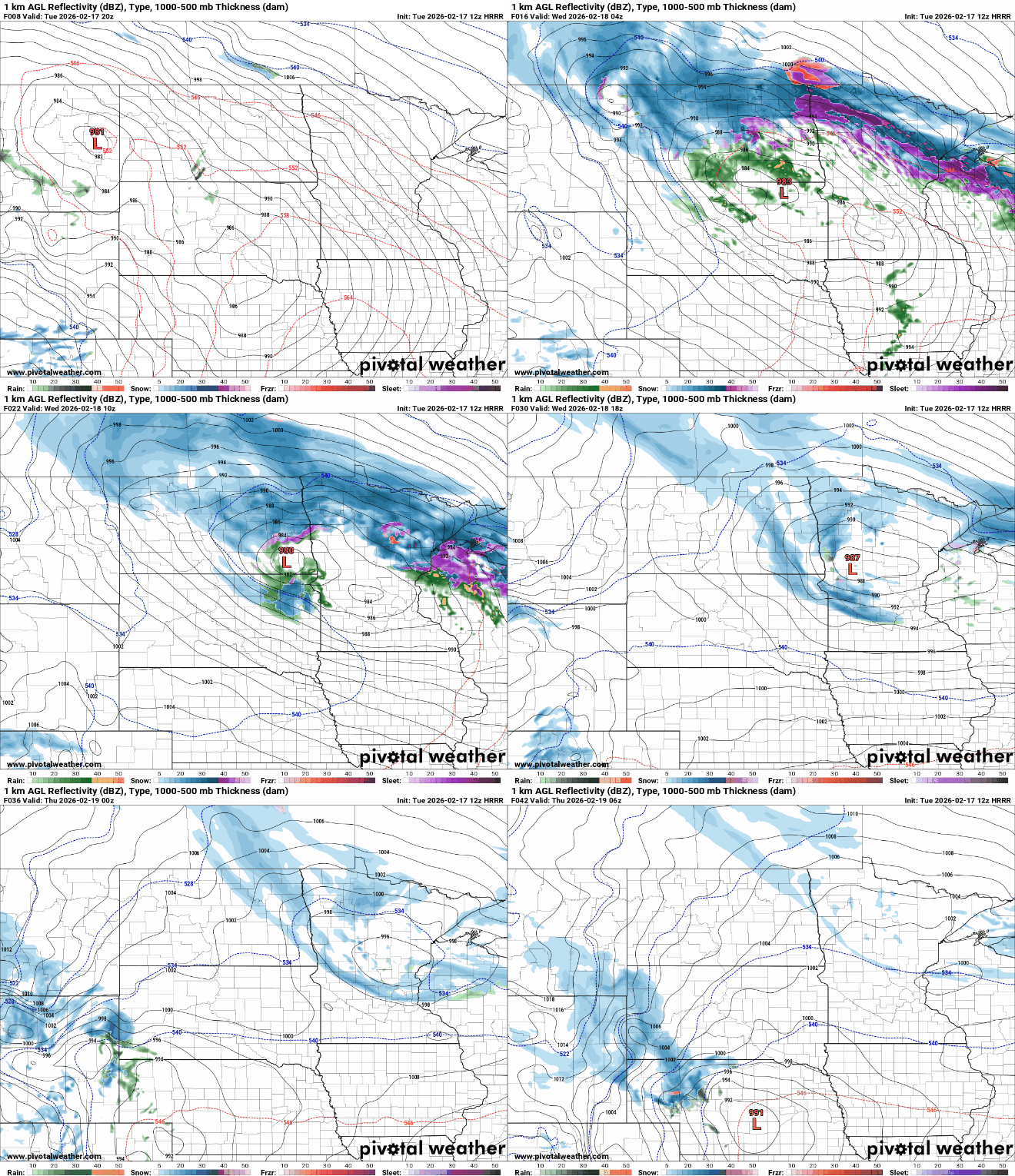
The icy accumulation could build up underneath the snow that falls Tuesday night into early Wednesday. The best chances for ice will be on the Iron Range and Duluth.

Snowfall will be heaviest along the North Shore, where more than a foot will fall. A broad area of a half foot or more of snow will fall across much of the rest of the northern third or so of the state into early Thursday.

The wind will be a big story with this system, especially for the North Shore. Wind gusts could exceed 50 mph along the North Shore. Not only will this create the blizzard conditions but it will give an enhanced boost to snowfall totals from Lake Superior.

Some forecast models Tuesday are hinting at some wrap around bursts of snow late Wednesday into Wednesday night.
These may affect the Twin Cities and central Minnesota but at this point these two forecast models are outliers but something we must monitor:

Another storm system will be lined up behind the first one, this time affecting mostly southern Minnesota late Thursday into early Friday, potentially.
Temperatures will be cold enough for southern Minnesota to receive snowfall this time but there’s a big spread in possible tracks for the second system and it appears it will be a narrow swath of heavier snowfall:

Temperatures will overall be cooler the second half of this week into the weekend but actually pretty close to normal or even still a little bit above with highs mostly in the 30s south and 20s north.

