
As 1 storm system departs, another grazes southeastern Minnesota
Cooler weekend on the way
Go Deeper.
Create an account or log in to save stories.
Like this?
Thanks for liking this story! We have added it to a list of your favorite stories.


Snow showers will wind down on the North Shore Thursday. Another system will graze southeastern Minnesota and Wisconsin Thursday night.
One system exits and another grazes Minnesota Thursday night
Snow is still falling along portions of the North Shore but should wind down through the day Thursday. There will still be a few spotty snow showers across the state with lingering clouds.
The town of Hovland received a whopping 38.6 inches of snowfall. The Twin Cities received 7.6 inches in total at Minneapolis-St. Paul International Airport:

Winter weather advisories persist for portions of northeastern Minnesota through noon Thursday. Another winter weather advisory goes into effect Thursday night for Iowa into southwestern Wisconsin.
Turn Up Your Support
MPR News helps you turn down the noise and build shared understanding. Turn up your support for this public resource and keep trusted journalism accessible to all.

The Twin Cities was the beneficiary of a narrow but potent band of snow that developed Wednesday in what we call a “deformation” zone or band aloft. Think of it as essentially a stalled frontal boundary at about 5,000 to 10,000 feet above the ground.
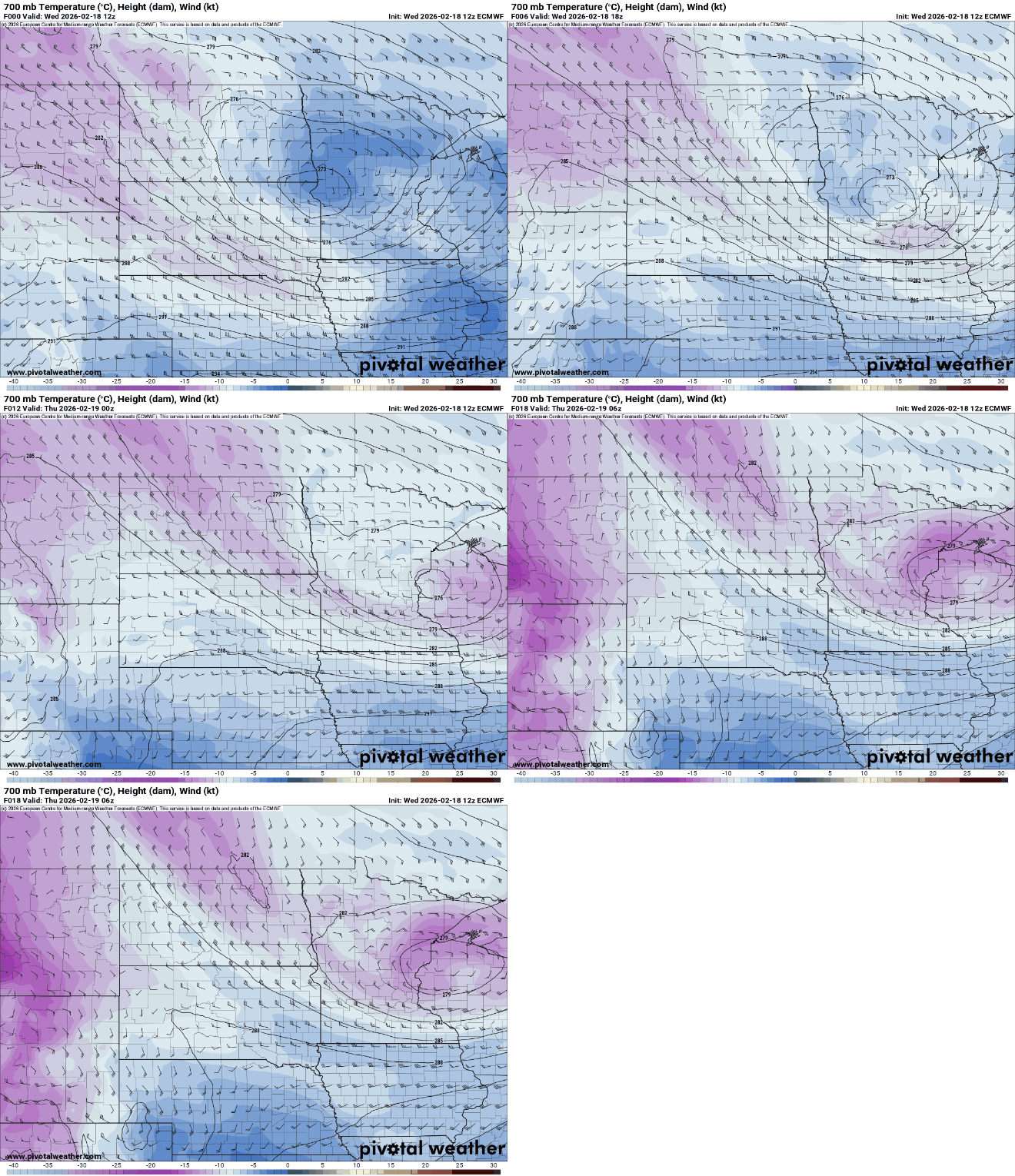
You can see in the animation below how a narrow finger of colder (purple) air aloft is sucked into the system. This pushes warmer, more moist air up and over it, producing clouds and snow.
Some forecast models started hinting at this already on Tuesday and honed in on it more Wednesday morning. Here are a couple of those forecast models from early Wednesday morning:

These bands are notoriously difficult to forecast with a lot of lead time. Once we were able to see where this band was setting up on radar, the National Weather Service issued its winter weather advisory for central Minnesota and the Twin Cities Wednesday morning.
The band was so narrow and stationary that some northern suburbs saw very little snow while southern suburbs saw 6 to 8 inches!
Afternoon highs Thursday will range from near 40 in far southeastern Minnesota to the 20s north. Those readings are still above normal for the date. With above freezing temps across central and southern Minnesota, roadways should improve Thursday.

Lingering snow showers taper off for the North Shore Thursday but they and far southeastern Minnesota will be grazed by the second system of the week. Most of Minnesota will be missed, however.
This second system looks to create a fairly narrow swath of snowfall accumulation but several inches could fall within that band, mainly just southeast of most of Minnesota.
The North Shore could receive some of that snow in addition to lingering snowfall Thursday morning. This forecast map shows snowfall from early Thursday through Friday night:

After that, the weekend looks mostly quiet and cool. We’ll have lingering clouds Saturday with brighter skies by Sunday. While it will be cool, it won’t be that far below normal with highs mostly in the teens north and 20s south both Saturday and Sunday.
We may see 40s again next week in southern Minnesota.

