
Overnight chill followed by a cold Monday, snow chances Tuesday
Quick-hitting system targets northern Minnesota

Go Deeper.
Create an account or log in to save stories.
Like this?
Thanks for liking this story! We have added it to a list of your favorite stories.


The coldest air of the week settles in Sunday night before a fast-moving clipper system brings light snow chances and another round of temperature swings across the region.
Cold continues Monday; clipper system on Tuesday
A fast-moving Alberta clipper will move out of Canada and into the Great Lakes region on Tuesday. Forecast models continue to track the surface low north of the Twin Cities, placing the heaviest snowfall across northern Minnesota and northern Wisconsin.
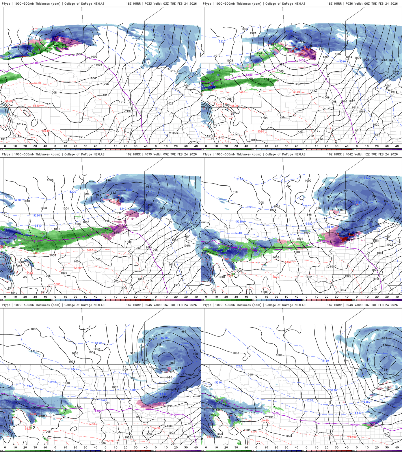
Snowfall totals are expected to remain light, generally between a half inch and 1 inch. Higher amounts are possible along the North Shore, where a winter storm watch is in effect from midnight Tuesday until 3 p.m. Tuesday for southern Cook County.
Turn Up Your Support
MPR News helps you turn down the noise and build shared understanding. Turn up your support for this public resource and keep trusted journalism accessible to all.
Snowfall totals in the Arrowhead could be plowable, with accumulations ranging from a couple of inches to more than 6 inches in some areas.

Winds will be breezy with the system, raising the potential for blowing snow, especially across northeastern Minnesota.

Our chilly Canadian air will remain in place Sunday night as low temperatures fall into the single digits above and below zero. Parts of northern Minnesota could dip into the teens below zero.

Wind chills will drop into the single digits and teens below zero by Monday morning, with northwestern Minnesota potentially seeing readings in the 20s below zero across northwestern Minnesota.
Monday will be our last day of cooler temperatures as a return to southerly flow begins to usher in warmer air by Tuesday. Highs Monday will reach the teens and 20s statewide.

Temperatures warm into the 30s, 40s, and even some low 50s Tuesday, mainly south of the departing low-pressure system. Behind the clipper, highs will dip slightly below average before a gradual warming trend brings the warmest day of the week Friday.
Another clipper system could impact southwestern Minnesota later this week, but current models continue to track it farther south. More details will be available early this week.

