
Clipper brings ice, snow showers and warmer temperatures
Temperatures drop again Wednesday

Go Deeper.
Create an account or log in to save stories.
Like this?
Thanks for liking this story! We have added it to a list of your favorite stories.


A clipper system is pulling in warmer air Tuesday and creating snow showers for northern Minnesota. It’ll be colder behind it again Wednesday.
Clipper system blows through Minnesota Tuesday
Our latest disturbance, a fast-moving clipper system, brought a fresh round of snow showers to mostly northern Minnesota Tuesday morning.
The fresh snowfall and blowing snow are the issues in northeastern Minnesota while central and southeastern Minnesota have seen an icy mix of freezing rain mixing with snow during the morning hours Tuesday.
Watch for some potential slick spots. There are numerous crashes in the metro area as of 11 a.m. Tuesday.
Turn Up Your Support
MPR News helps you turn down the noise and build shared understanding. Turn up your support for this public resource and keep trusted journalism accessible to all.
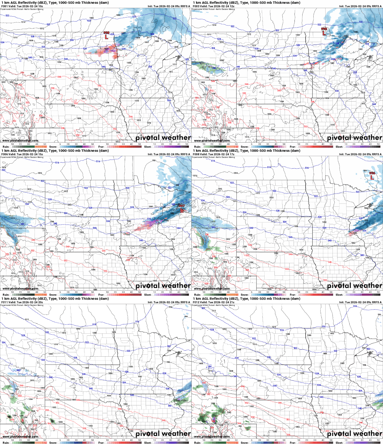
With icy conditions in the south and snow in the north, winter weather advisories are posted for the Twin Cities, southeastern and south-central Minnesota through early Tuesday afternoon and for parts of the North Shore through midafternoon Tuesday.
It’ll also be milder Tuesday afternoon with highs in the 30s and 40s for southern Minnesota. Those readings are several degrees above normal and should melt some of that fresh ice. Temperatures should climb above freezing by 1 to 2 p.m. in the Twin Cities region.

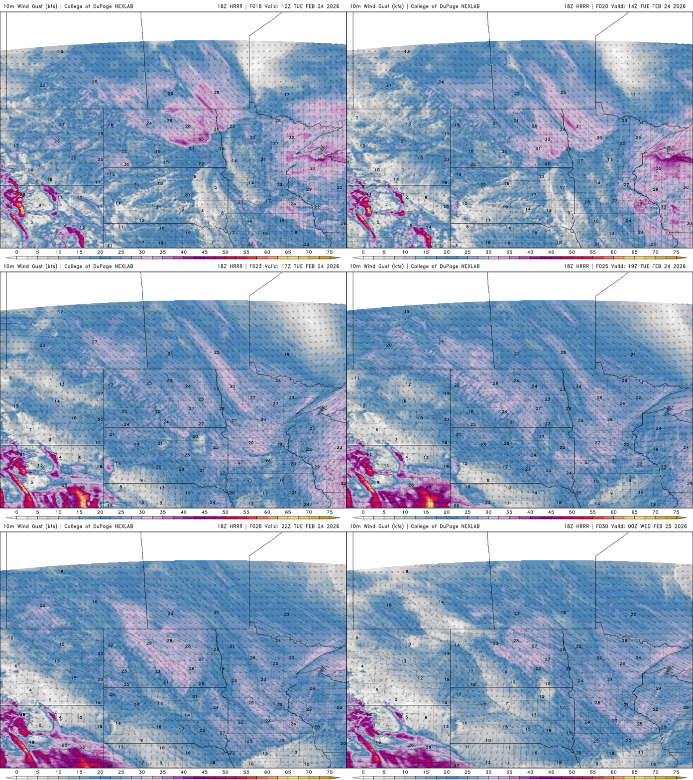
Winds will be blustery from the south, turning northwest as the system passes through Minnesota. There will be gusts as high as 50 mph in northwestern Minnesota.
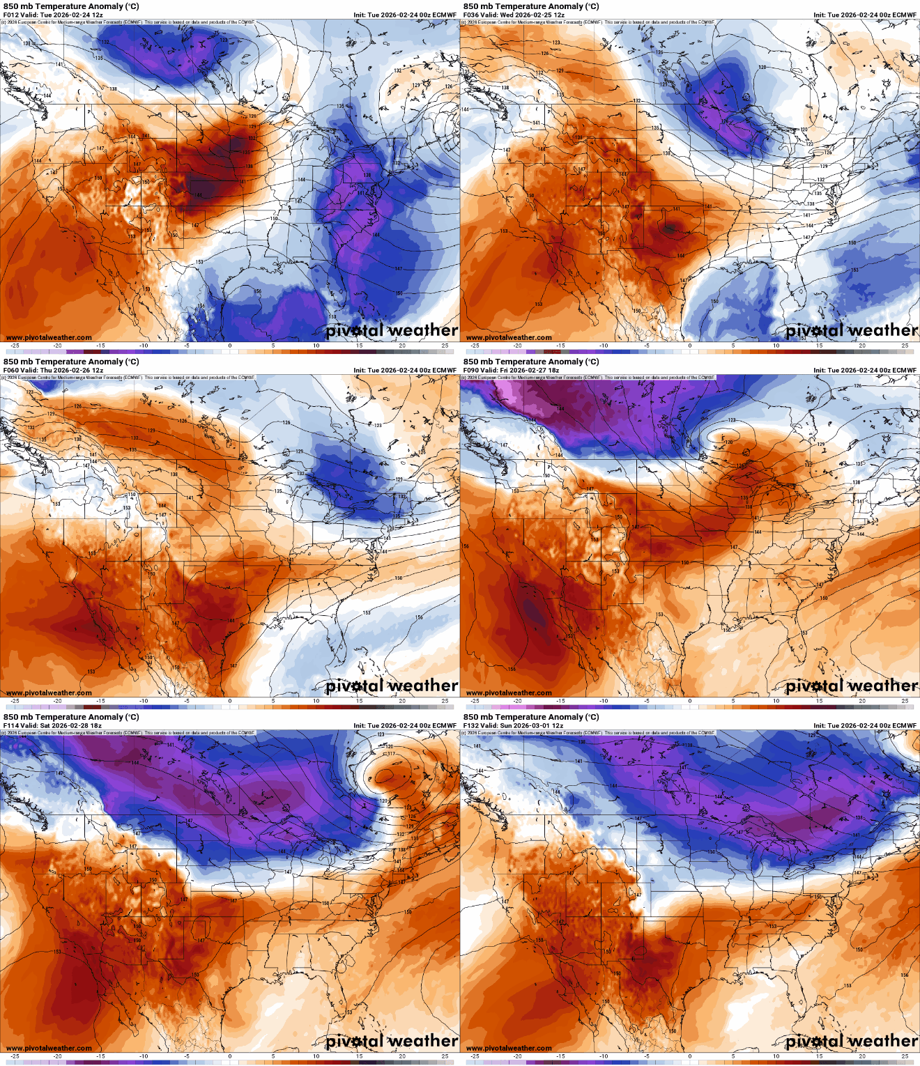
Cooler air moves back in Wednesday with highs mostly in the 20s and teens again but with some sunshine also returning to Minnesota.

Warmer air will move in Thursday and Friday followed by a cold front Friday night that will drop temperatures yet again for the weekend.
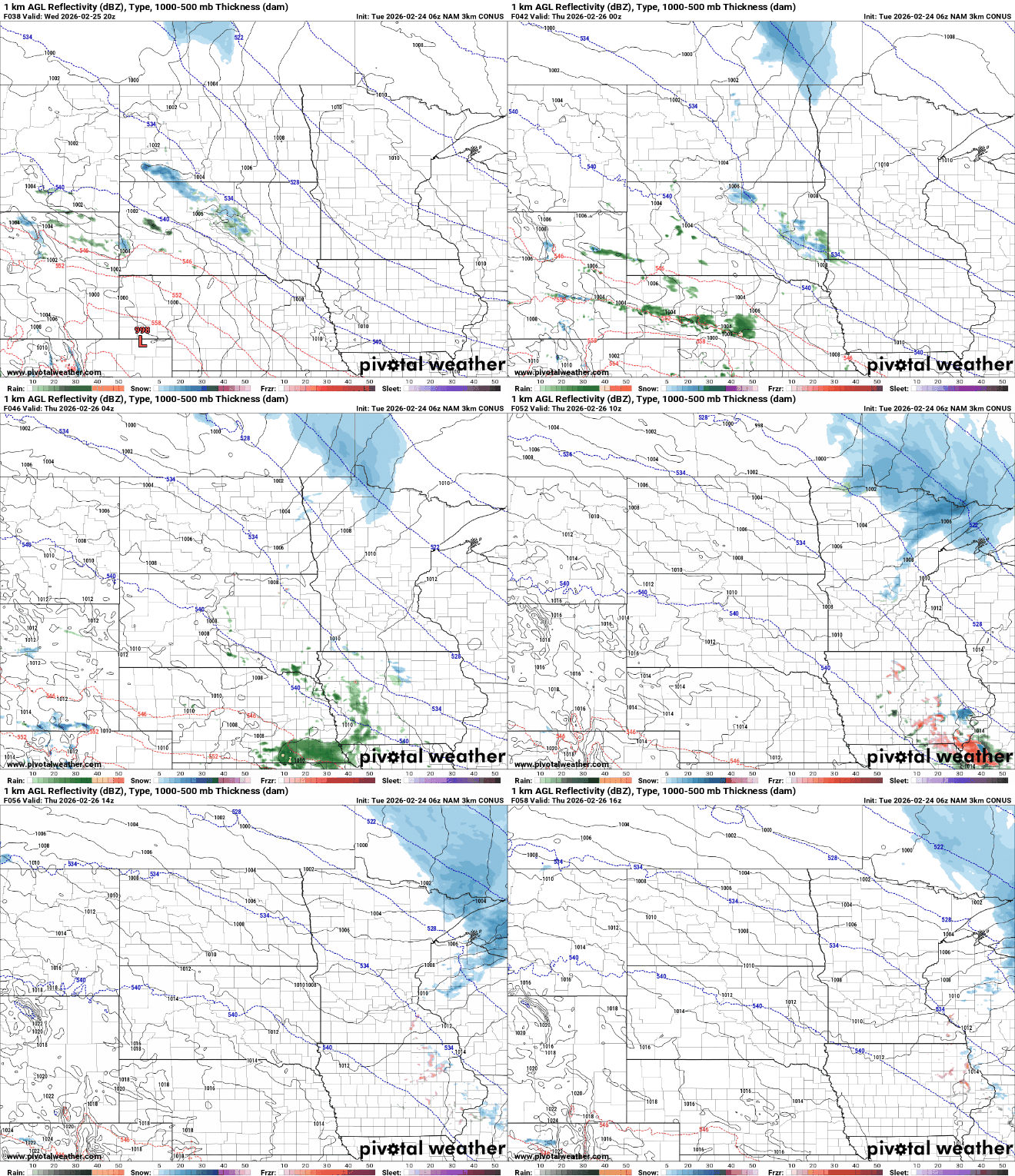
Another disturbance will create more rain and snow showers for far southern Minnesota mostly late Wednesday into Thursday morning. There will be some snow showers in northeastern Minnesota as well Wednesday night into Thursday.
That Friday night cold front will bring temperatures back below normal for the weekend. Highs Saturday will be in the 20s south but just barely near zero in the northwest corner of the state. The northern half of Minnesota will also drop below zero Friday and Saturday nights.


