
Mild air returns Thursday and Friday before a cool weekend
Snow possible Saturday

Go Deeper.
Create an account or log in to save stories.
Like this?
Thanks for liking this story! We have added it to a list of your favorite stories.


Warmer air is back Thursday and Friday. It will also be pretty windy Friday ahead of yet another cold front Friday night. That front could produce snow showers, too.
Mild air returns for a couple days before a cooler weekend and Saturday snow showers
Here we go again. Temperatures will warm to above-normal readings Thursday afternoon across the state.
Northeastern Minnesota will see morning snow showers move out. Morning clouds will decrease, giving way to midday and afternoon sun for most. Highs will range from the low 50s in southwestern Minnesota to near-freezing in the northwest and northeast corners of the state.

Highs Friday will be even warmer, with mid-50s in southwestern Minnesota and mid-40s in the Twin Cities. Northern Minnesota will see 30s as cooler air already starts to move in.
Turn Up Your Support
MPR News helps you turn down the noise and build shared understanding. Turn up your support for this public resource and keep trusted journalism accessible to all.

The approaching cold front Friday night will crank up the winds out ahead of and behind it. Winds Friday will be 15 to 30 mph.
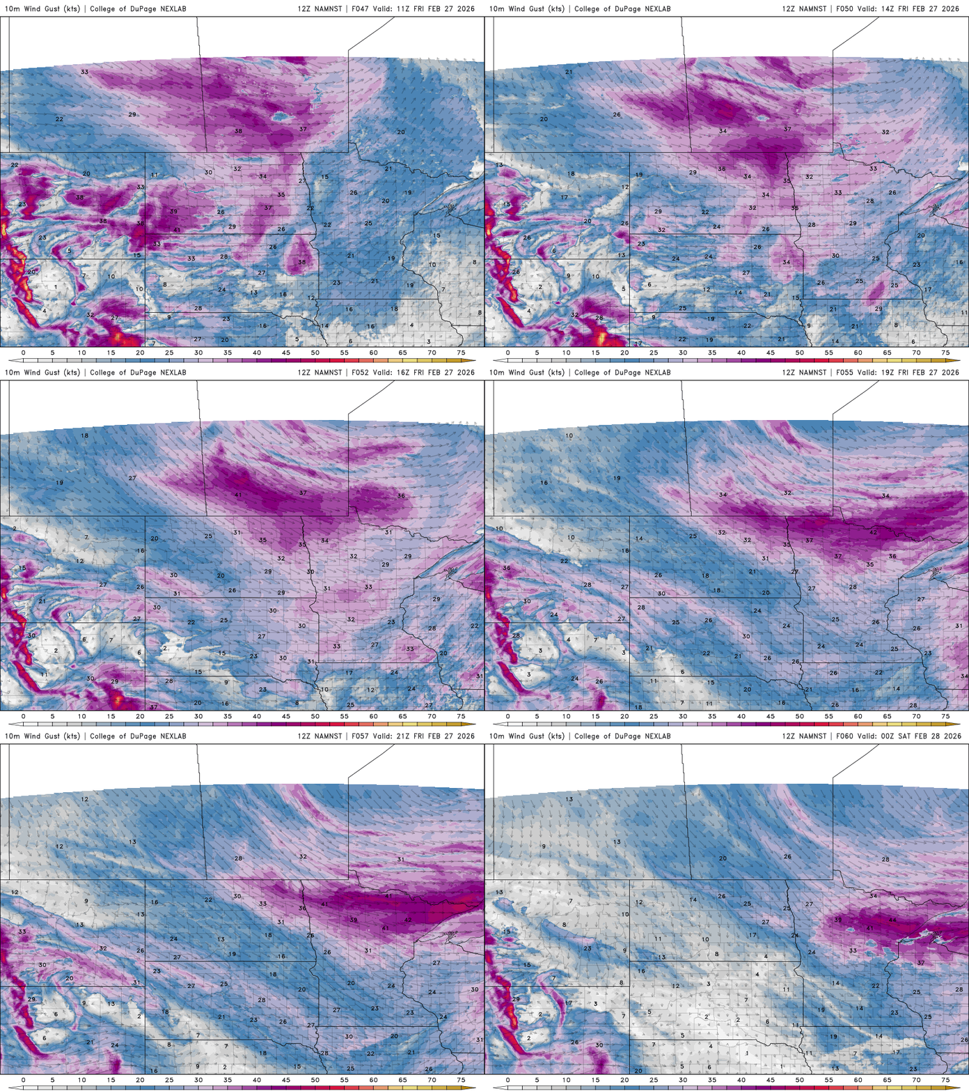
Some wind gusts could exceed 50 mph across much of northern Minnesota and especially the North Shore Friday afternoon into Friday night as colder air moves. A high wind watch is posted for late Friday for the North Shore.

We’ll also see the possibility of snow showers for southern Minnesota late Friday night into Saturday near and just behind the cold front. Most forecast models favor southern Minnesota for this round of snowfall.
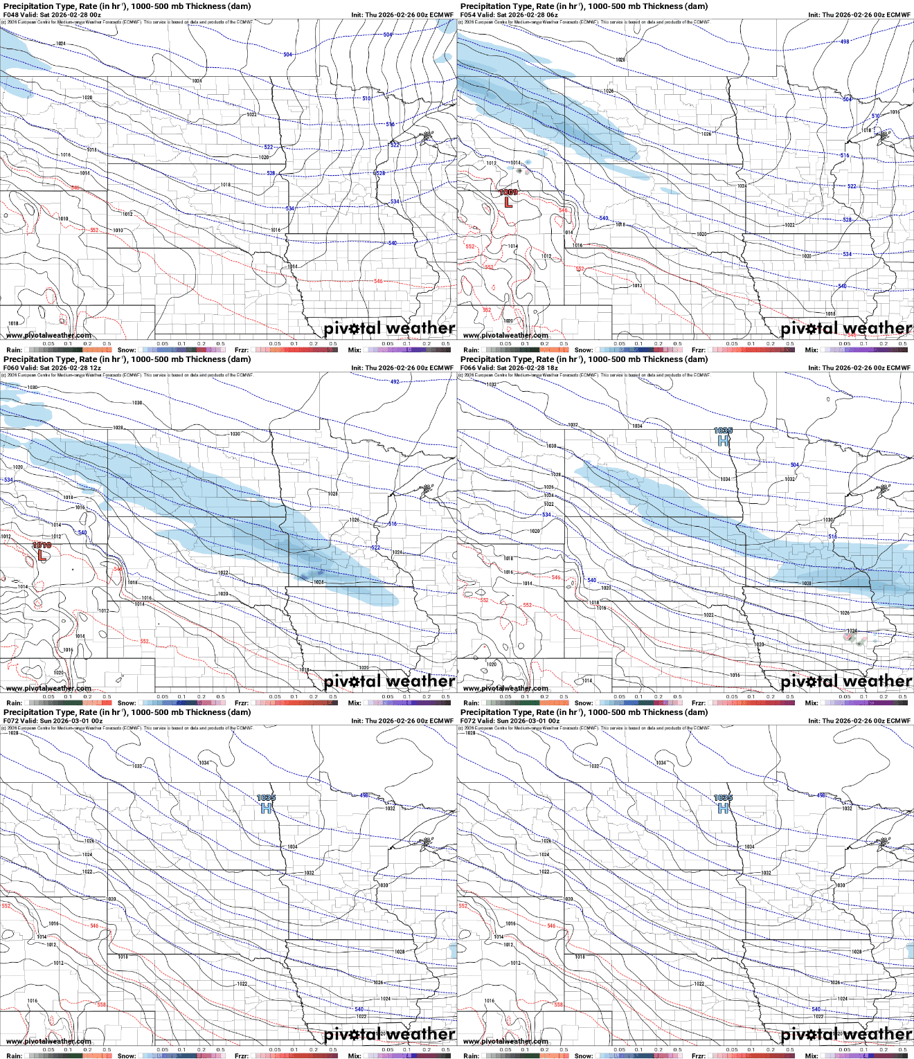
A couple of inches or more will be possible for some spots. There is some spread in the forecast models, however, with some models bringing the snow a bit more north, including most of the Twin Cities. We’ll need to monitor this over the next 24 hours.

Saturday and Sunday will bring a return of below-normal temperatures in the 20s and teens.

Saturday night will be cold with single digits in southern Minnesota and subzero temperatures across northern Minnesota.

We’ll likely be back above freezing by Tuesday. In fact, this weekend may be the last batch of cool air for a while. Most forecast models have us remaining above normal for temperatures after Monday.


