
Mild, windy Friday followed by snow and cold for the weekend
Milder temperatures return next week
Go Deeper.
Create an account or log in to save stories.
Like this?
Thanks for liking this story! We have added it to a list of your favorite stories.


It’ll be another mild day Friday but also windy. Colder air moves back in for the weekend. Southern Minnesota will see snow Saturday.
Mild, windy Friday followed by snow and cooler temperatures for the weekend
We have another mild day on the way Friday along with sunshine through some high clouds. Highs will be in the 50s across southwestern Minnesota with 40s in the central part of the state and 30s north. Those readings are 10 to 25 degrees above normal for most.

Temperatures could top out warmer in many southern Minnesota locations than the official forecast numbers.
The National Oceanic and Atmospheric Administration’s High-Resolution Rapid Refresh model might be a bit high, but I do think the Twin Cities could hit 50 degrees Friday as temperatures warm quickly Friday morning:
Turn Up Your Support
MPR News helps you turn down the noise and build shared understanding. Turn up your support for this public resource and keep trusted journalism accessible to all.

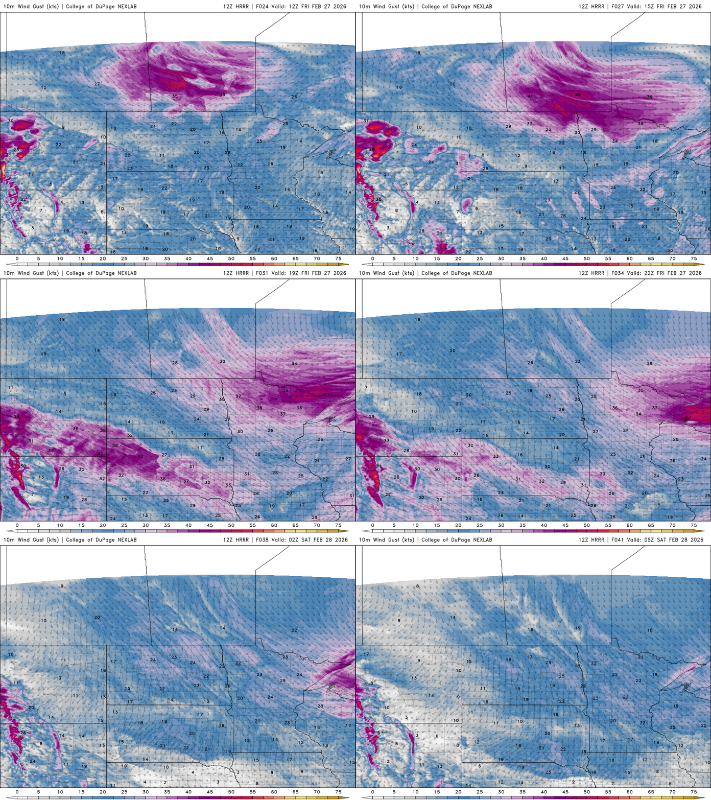
The winds will become the other story Friday with afternoon and evening wind speeds at 15 to 30 mph with higher gusts, especially in northern Minnesota and the North Shore.
Peak wind gusts could be as high as 60 mph along portions of the North Shore late Friday into Friday night as the cold front blows through.
Maximum wind gusts could be in the 50 to 60 mph range for portions of the North Shore Friday afternoon into Friday night.

There’s a wind advisory for much of northern Minnesota and a high wind warning for the Cook County portion of the North Shore Friday.
Winter weather advisories are posted northwest for blowing snow potential. There’s also a winter weather advisory for Saturday in southern Minnesota for the potential of 1 to 3 inches of snow.

Temperatures will drop below zero Friday night in northern Minnesota and highs Saturday will be only near zero in the northwestern corner of the state with 20s south.

We’ll also see snow showers for southern Minnesota late Friday night into Saturday near and behind the cold frontal boundary. There’s a potential for up to 2 even 3 inches of fresh snow.
Here is the official National Weather Service forecast:

Many recent forecast model runs are trending north, however. Watch for the possibility that the Twin Cities metro get some of the higher 2 or 3 inch amounts.
Here’s an example of one such forecast model shift from last night (red) to this morning (blue):

Saturday night will be quite frigid, especially north where temperatures will drop into the teens below zero into early Sunday morning.

The cool air lasts through Sunday but already milder air is back next week and this might just be our last batch of colder air for a while.

It also looks potentially active next week with a couple of storm systems that could bring both rain and snow to the region.

