Mild air returns Monday and sticks around this week
We’ll have some chances of rain, snow this week also
Go Deeper.
Create an account or log in to save stories.
Like this?
Thanks for liking this story! We have added it to a list of your favorite stories.


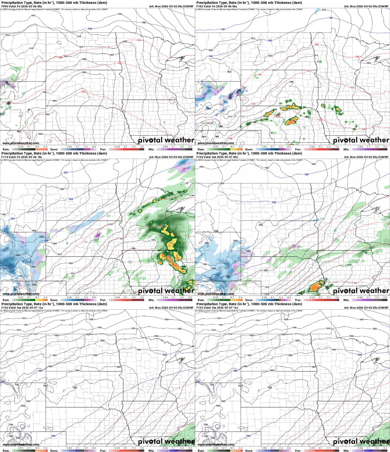
Warmer air is back Monday and it’ll stick around through the week and next weekend. Some showers are possible south Monday night and we’re watching a bigger system for Friday.
After a cool weekend, mild air returns to Minnesota
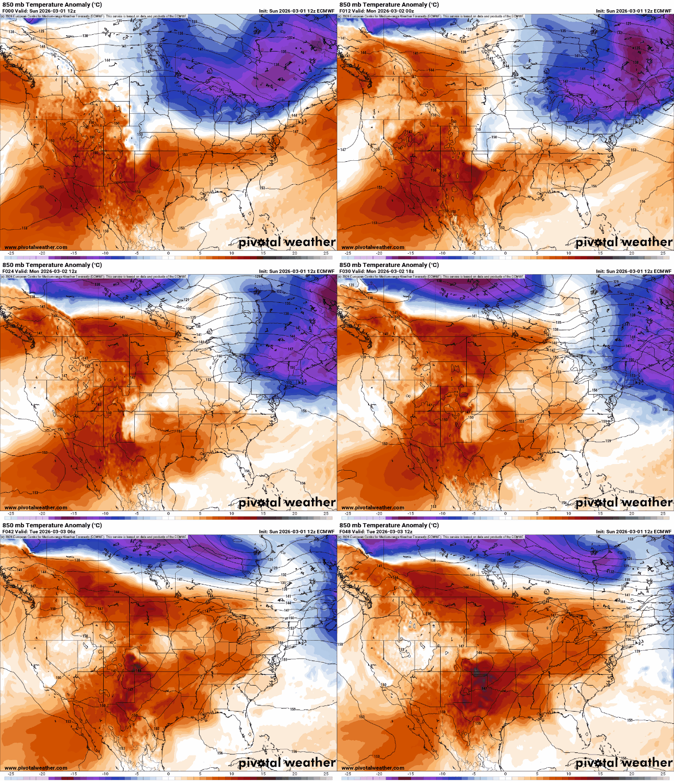
Warmer air returns to Minnesota quickly on Monday. We’ll see sun to start, but clouds will increase some Monday afternoon. Afternoon highs will be in the 40s south to 30s north, back above normal.

The northern edge of a system to our south will bring some rain showers to southern Minnesota Monday night into early Tuesday.
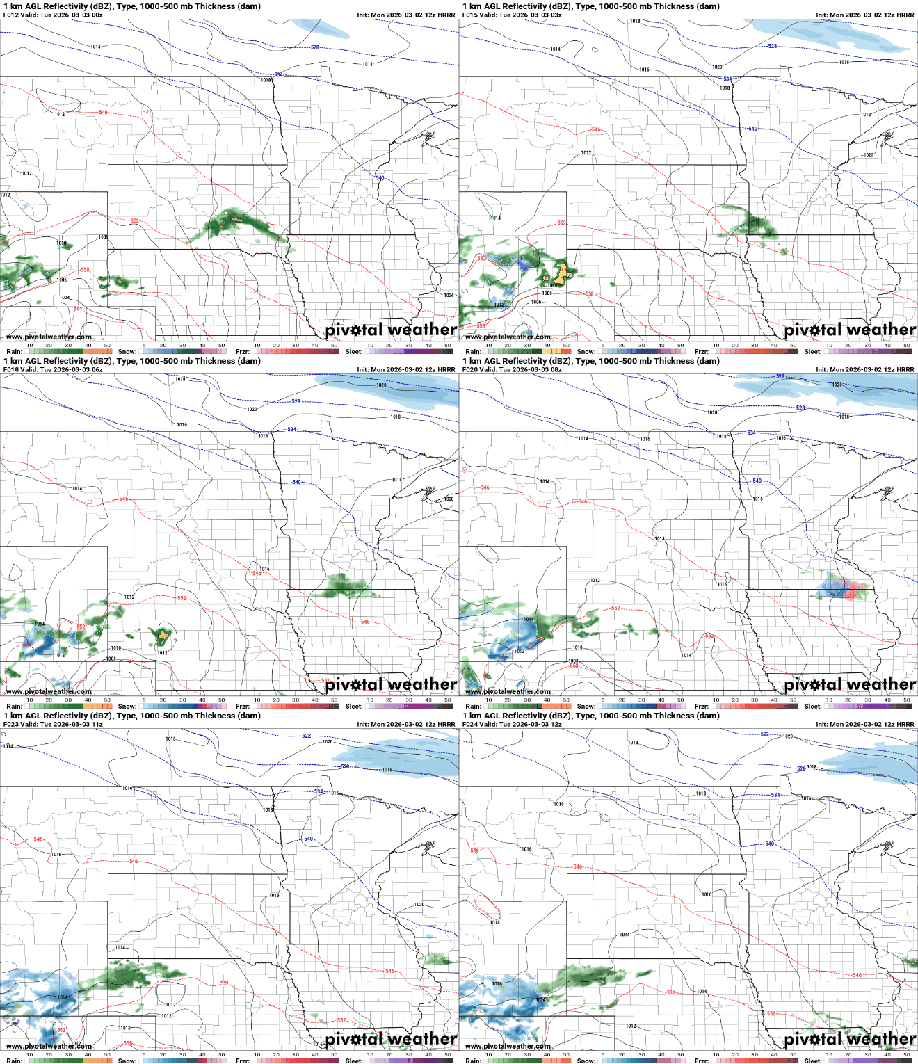
The precipitation should be mostly liquid but there could be some patch areas of freezing rain or snow mixing in.
Turn Up Your Support
MPR News helps you turn down the noise and build shared understanding. Turn up your support for this public resource and keep trusted journalism accessible to all.

There’s a lunar eclipse early Tuesday morning that will affect much of the United States, but sadly it looks like there’ll be a lot of cloud cover in Minnesota. Earth’s shadow will cover an otherwise full moon with the maximum coverage at 5:33 a.m. locally.

The best viewing will be about 4 a.m. through 6:30 a.m. as earth’s shadow moves across the moon but clouds will obscure this mostly for eastern and southern Minnesota. The best chances of breaks in the clouds will be in western and northern Minnesota.

Highs Tuesday will be back in the 40s for many. Clouds will decrease as the system to our south moves away, to the east.

The mild air largely sticks around this week with highs in the 50s by midweek into the weekend for most of southern Minnesota. There will even be some 60-degree readings possible with our best chances Thursday and Sunday. Those would be the first for many locations except southwest Minnesota.

We’re also monitoring a larger storm system for the end of the week that will bring rain and possibly snow, especially to northern or western Minnesota on Friday. Who gets what will depend on the precise track of the system.