
Decreasing clouds, mild Tuesday and through the week
An end of week storm system will deliver rain and possibly snow

Go Deeper.
Create an account or log in to save stories.
Like this?
Thanks for liking this story! We have added it to a list of your favorite stories.


Morning clouds will move out and it’ll be another mild day Tuesday. Wednesday will see even warmer readings — in the 50s for many. A storm system will likely bring rain Friday.
Decreasing clouds with more mild weather ahead
The mild weather continues Tuesday. Lingering morning clouds will decrease, making way for plenty of midday and afternoon sunshine. Afternoon highs will be in the upper 40s to near 50 degrees in southern Minnesota.

Wednesday will be even warmer with abundant sunshine most of the day. Highs will be into the 50s for much of central and southern Minnesota, nearly 20 degrees above normal.

We’ll see similarly above-normal temperatures, mostly in the 40s and 50s, much of the rest of the week into the weekend with some cooler readings north — especially the northwest corner of Minnesota. Sunday and Monday could be our warmest days with a chance at 60-degrees in the Twin Cities.
Turn Up Your Support
MPR News helps you turn down the noise and build shared understanding. Turn up your support for this public resource and keep trusted journalism accessible to all.

We’re also keeping our eye on an end-of-week storm system still that will likely bring mostly rain Friday, but it could also turn to a narrow area of snow Friday night into early Saturday with colder overnight temperatures.
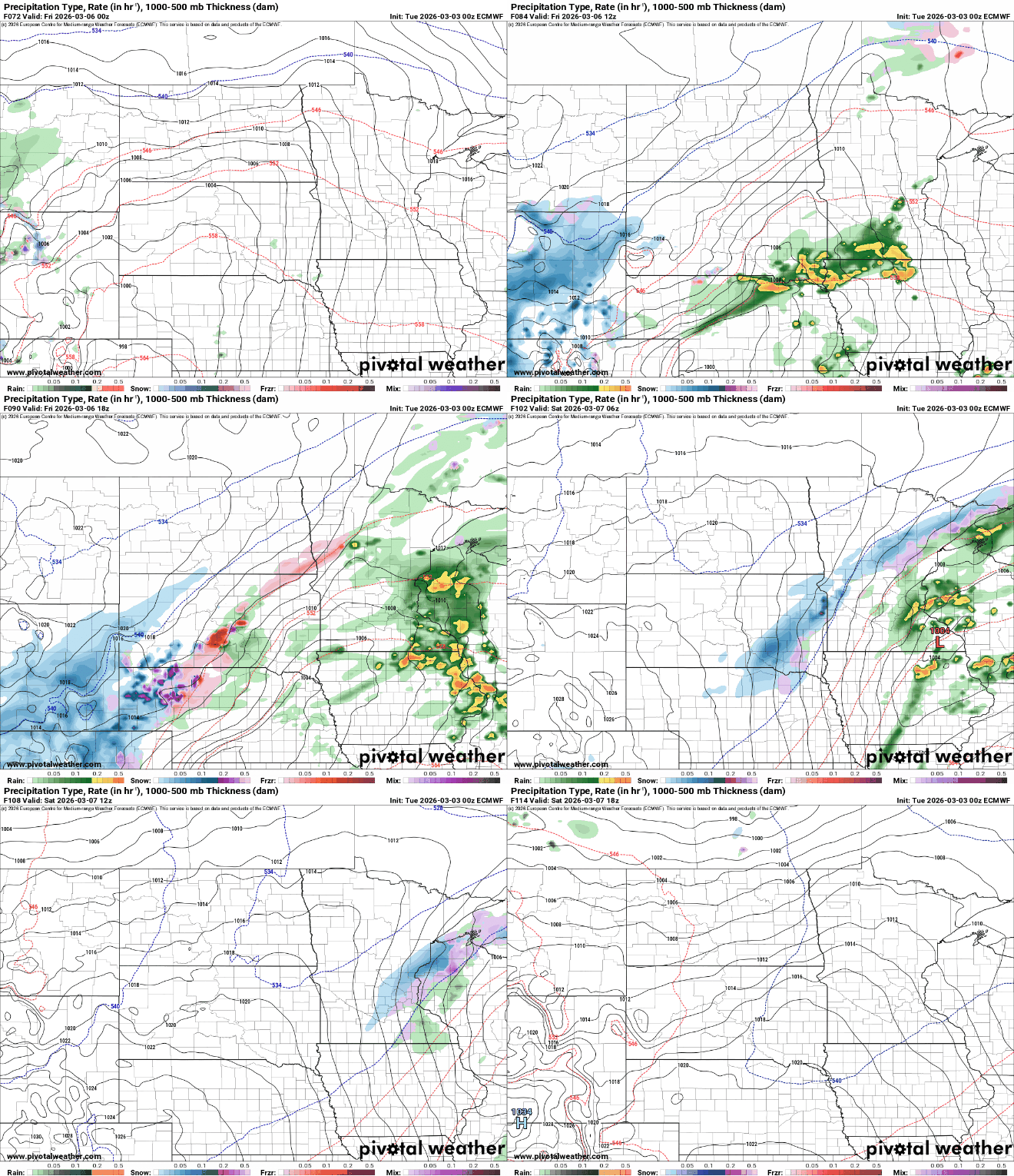
This system could yield quite a bit of liquid equivalent precipitation. Most forecast models dump up to one-half inch to as much as 1 or 2 inches of liquid Friday into Saturday.

We’ll also need to monitor a narrow area of snow that could develop Friday night into early Saturday as colder air wraps into the northwest side of the system. Most forecast models favor northern and western Minnesota at this point but that could easily shift.

Next week will likely bring a shift to cooler weather with a continued active pattern by midweek next week.

