
Even warmer days ahead with an eye on a Friday storm system
Next week will be cooler and active

Go Deeper.
Create an account or log in to save stories.
Like this?
Thanks for liking this story! We have added it to a list of your favorite stories.


Temperatures Wednesday will average 20 degrees above normal. The anomalous warmth persists through Monday. We’re still watching a Friday storm system that will deliver rain and snow.
Very mild Wednesday and into early next week, but some changes ahead
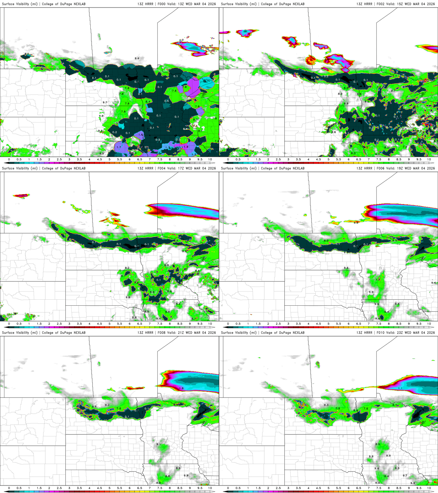
If you liked Tuesday, you’ll love Wednesday. We do have some fog to burn off through the early and midmorning hours Wednesday due to all the melting, light winds and clear skies overnight.
There are dense fog advisories posted through midmorning Wednesday:

Most fog should burn off by late morning across the region. Central Minnesota will be the last to see fog burn off.
Turn Up Your Support
MPR News helps you turn down the noise and build shared understanding. Turn up your support for this public resource and keep trusted journalism accessible to all.
We’ll see partly cloudy skies most of the midday and afternoon with more clouds in far northern and southwestern Minnesota.
Temperatures will again be mild, in the 40s and 50s for most of central and southern Minnesota, about 10 to 25 degrees above normal for the date. The morning fog will likely cost many of us a few degrees in high temperatures.
Thursday will be just as mild but clouds will be on the increase ahead of Friday’s storm system. There could also be patchy fog in the morning hours again. Southwestern Minnesota will take a run at highs in the low 60s again. This is the fourth such reading for some of those places!

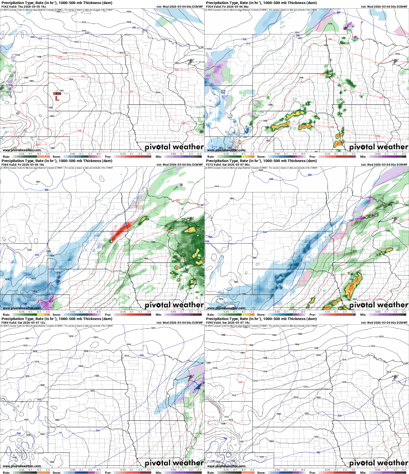
The next storm system will deliver rain to the region starting Friday morning in southwestern Minnesota, expanding east and northeast through the day into Friday night.
Colder air will wrap in on the western and northern edges, turning rain over to a period of snow later Friday night into early Saturday.
There will be the risk of even a couple strong storms in southeast Minnesota Friday. The National Oceanic and Atmospheric Administration’s Storm Prediction Center forecasts a marginal risk (level 1 of 5) of severe weather, with hail being the main potential threat:

Most forecast models favor northern and western Minnesota for a narrow snowfall Friday night into very early Saturday. Some models bring a bit of snow into the Twin Cities too, so we’ll need to monitor that.

Temperatures will dip briefly behind the system for Saturday, mostly into the 40s and 30s. They’ll warm again by Sunday and Monday. We could see 60-degree temperatures expand to much of southern Minnesota by Sunday or Monday.
Those readings would come about two weeks earlier than normal, which is nearly 10 days earlier than just 50 years ago.

Temperatures drop by midweek next week and stay chilly. Next week looks to continue to be active but with cooler air. That means snowfall could be on the table for many.


