
Wet Friday with a transition to snow overnight, then mild again
Next week will be cooler but still relatively mild
Go Deeper.
Create an account or log in to save stories.
Like this?
Thanks for liking this story! We have added it to a list of your favorite stories.


Our latest storm system is bringing a variety of precipitation types Friday into Saturday. Saturday will be cooler with very mild air back by Sunday. Next week looks cooler and active.
Rain, ice, snow; mild temps again by Sunday
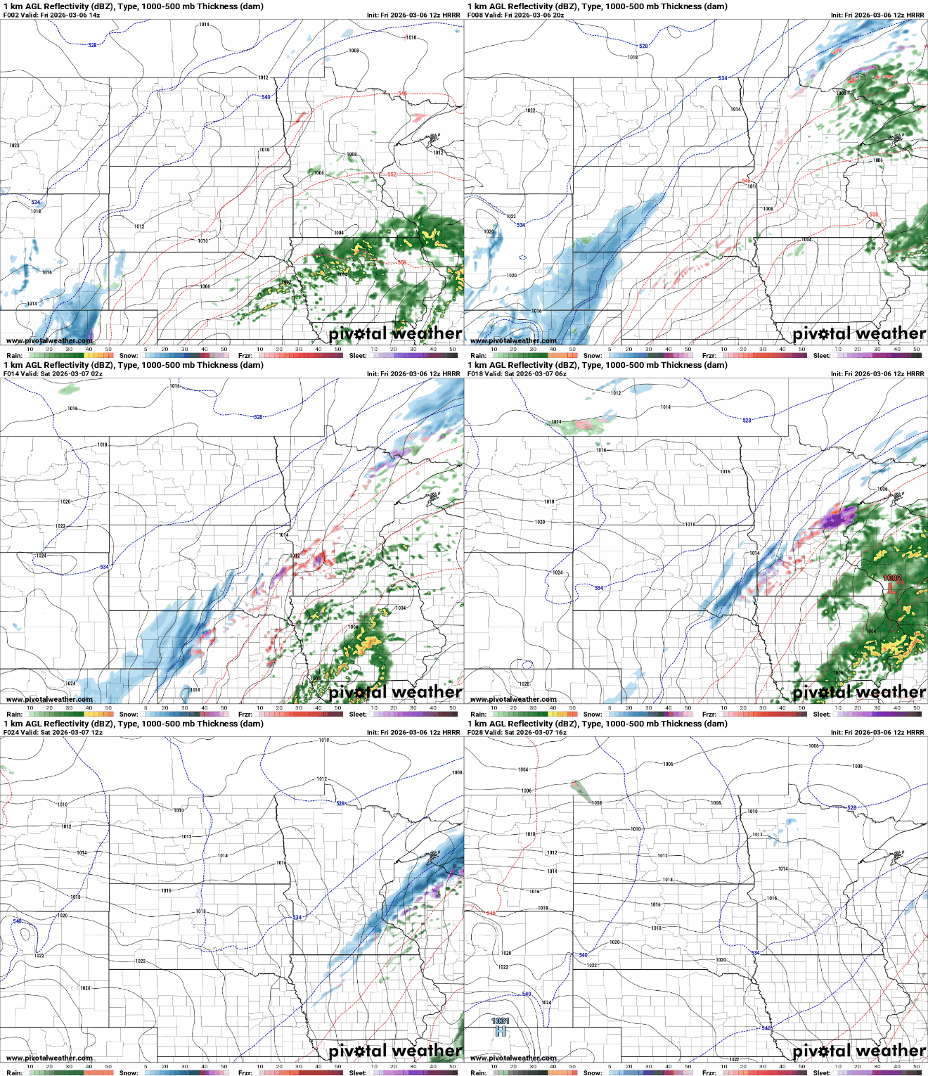
Our latest storm system is a classic spring storm setup. We have severe weather potential just south of Minnesota Friday with rain in southern Minnesota and a wintry mix developing west and north with eventually snow showers for all overnight into Saturday.
There are winter weather advisories posted for much of western Minnesota where an icy and wintry mix develops Friday along with some snowfall accumulations late Friday into Friday night.

There’s even a marginal (level 1 of 5) severe risk for far southeastern Minnesota where a couple thunderstorms could produce some hail.
Turn Up Your Support
MPR News helps you turn down the noise and build shared understanding. Turn up your support for this public resource and keep trusted journalism accessible to all.
Overall, the greatest risk of severe storms remains south of the state. While most of Minnesota will miss the severe threat, those storms that develop will provide a second round of moisture Friday evening and overnight as it lifts north.

Northwestern Minnesota will see the potential for ice accumulation where temperatures are colder Friday and precipitation falls as a wintry mix. Other parts of the state could see an icy glaze overnight as we transition from rain to snow.

Many areas will see at least some slushy snowfall accumulation overnight Friday and into the early morning hours of Saturday as colder air wraps into the backside of the system. A narrow area of up to 1 to 2 inches of snow will be possible.

Some forecast models bring the narrow snow band closer to the Twin Cities late Friday night into early Saturday morning. Don’t be shocked to wake up to a slushy coating on your lawn Saturday morning, potentially.

It’ll be cooler Saturday behind the system with decreasing clouds. We should see afternoon sun, with highs mostly in the 40s, which is still about 5 to 15 degrees above normal.

Temperatures jump upward for Sunday and Monday again already with our first 60-degree reading possible in the Twin Cities.

Next week will be cooler overall, but not as cold as previous forecasts. Highs will be mostly in the 40s and 30s mid to late week. We’ll be watching three possible storm systems for midweek into next weekend.

