
Cooler air starts to move in tonight; multiple rain, snow chances ahead
Overall a cooler and active pattern this week
Go Deeper.
Create an account or log in to save stories.
Like this?
Thanks for liking this story! We have added it to a list of your favorite stories.


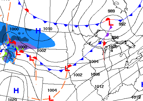
A cold front is moving across northern Minnesota tonight. It will touch off some rain showers north. More rain and snow develops Monday night into Tuesday night.
Cool front starts to drop temps into Monday followed by multiple rain, snow chances this week
After a very mild Sunday, changes will start to move into the region tonight into Monday. Many spots saw their first 60-degree reading of the season, including Saint Paul and Bloomington but we fell just shy at the Minneapolis-St. Paul international airport at 59-degrees. The first 70s were observed in southwest Minnesota. Luverne and Worthington both topped out at 70 or warmer. The first of two cool fronts is already pushing into northern Minnesota Sunday evening into the overnight, sweeping south overnight. The front is touching off some light rain showers in northern Minnesota and will continue to do so overnight, possibly mixing with snow in some spots.
Overnight lows will still be rather mild ahead of the front in southern Minnesota, mostly in the 40s, but temps will dip into the 20s in northwest Minnesota overnight.

Monday will see quite the temperature contrast with highs in the low 60s in far southeast Minnesota still but just 20s in northwest Minnesota. We’ll see a mix of clouds and sunshine and breezy northwest winds.

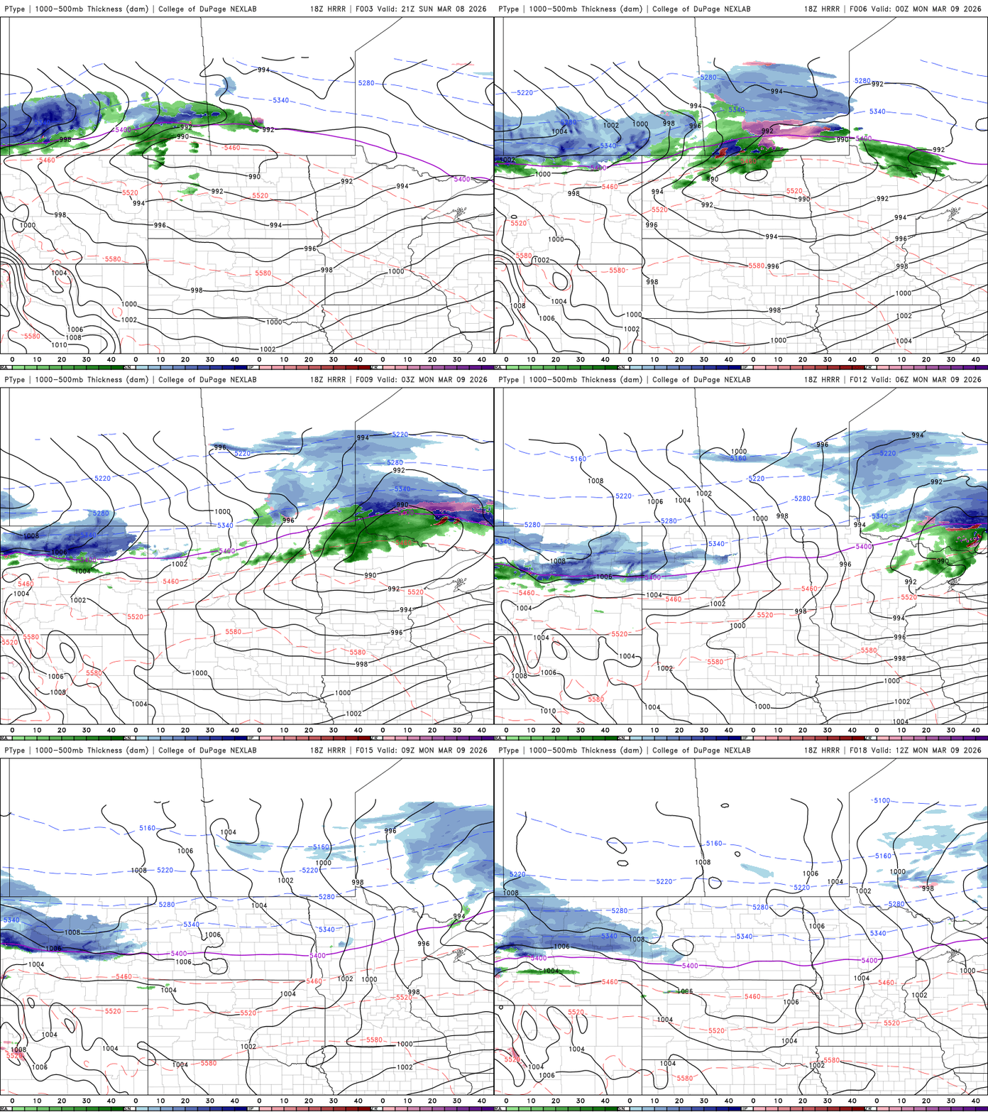
The week will be cooler and active with multiple chances of rain and snow. The first of potentially three widespread chances develops late Monday into Monday night with snow showers in northern Minnesota. Rain showers will develop south Tuesday, transitions to snow Tuesday night.
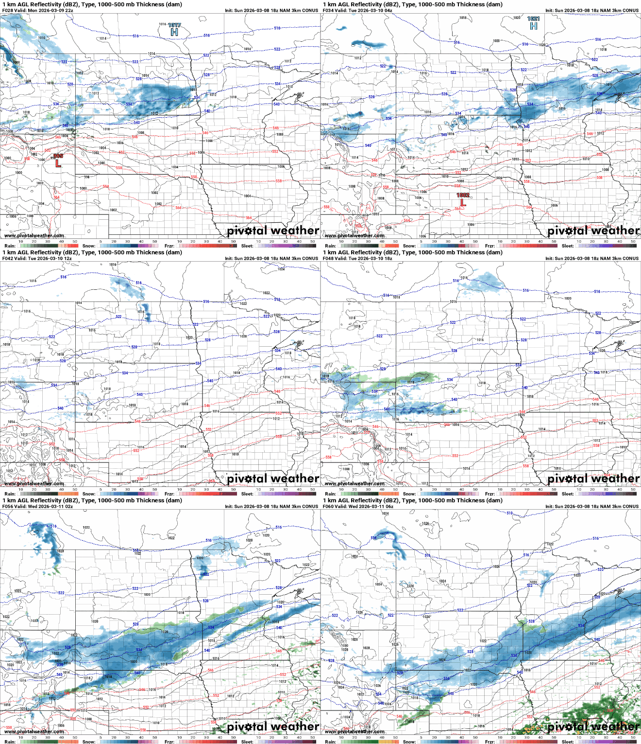
The higher snowfall totals, of potentially several inches, will be confined to the North Shore. Southern Minnesota will likely see at least a slushy coating as well Tuesday night.

Temperatures the remainder of the week will be mostly in the 40s for highs in southern Minnesota with 30s north. Overnight lows will be primarily in the 20s south and 10s north. We have another chance of rain, snow showers Thursday into Thursday night and again over the weekend.
Turn Up Your Support
MPR News helps you turn down the noise and build shared understanding. Turn up your support for this public resource and keep trusted journalism accessible to all.

