
Rain, snow develop Tuesday with snow overnight
Additional rain and snow chances are coming this week

Go Deeper.
Create an account or log in to save stories.
Like this?
Thanks for liking this story! We have added it to a list of your favorite stories.


Rain and snow develop Tuesday afternoon, turning to snow overnight. More rain and snow chances move in Thursday and this weekend. Temperatures will continue to cool off.
Rain and snow develop Tuesday with more chances into the weekend
Portions of north-central Minnesota are waking up to a fresh coating of snow, round one of two with this latest system; 4.5 inches fell in Fergus Falls, 3 inches in Wadena and about 2.2 inches in Duluth.
The morning and midday Tuesday will be mostly dry and we’ll see highs in the 40s and 30s for most of the state.

The second volley of moisture develops Tuesday afternoon and evening with a mix of rain and snow showers that will transition to snow this evening and overnight across central and southern Minnesota into western Wisconsin.
Turn Up Your Support
MPR News helps you turn down the noise and build shared understanding. Turn up your support for this public resource and keep trusted journalism accessible to all.
Snow will develop in west-central Minnesota in the early to midafternoon with rain showers developing in the Twin Cities Tuesday evening, turning to snow well after dark.
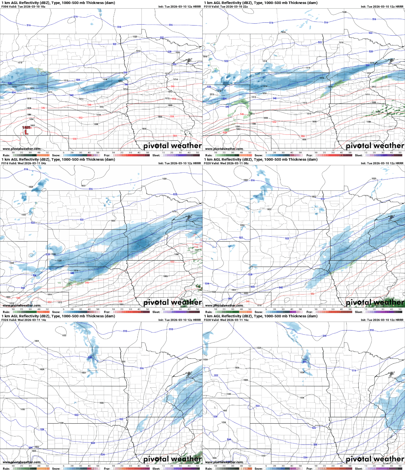
Many of us can expect a coating to as much as an inch or two of snowfall in the overnight hours into early Wednesday morning.

Wednesday will see some lingering snow showers and clouds early but clouds will move out making way for midday and afternoon sunshine. Highs will be in the low 40s to 30s for most so much of the fresh slush will melt.

Another disturbance moves in Thursday into Thursday night bringing another chance of rain and snow. Southern Minnesota looks to see mainly a rain and snow mix while northern Minnesota will see mostly snow.
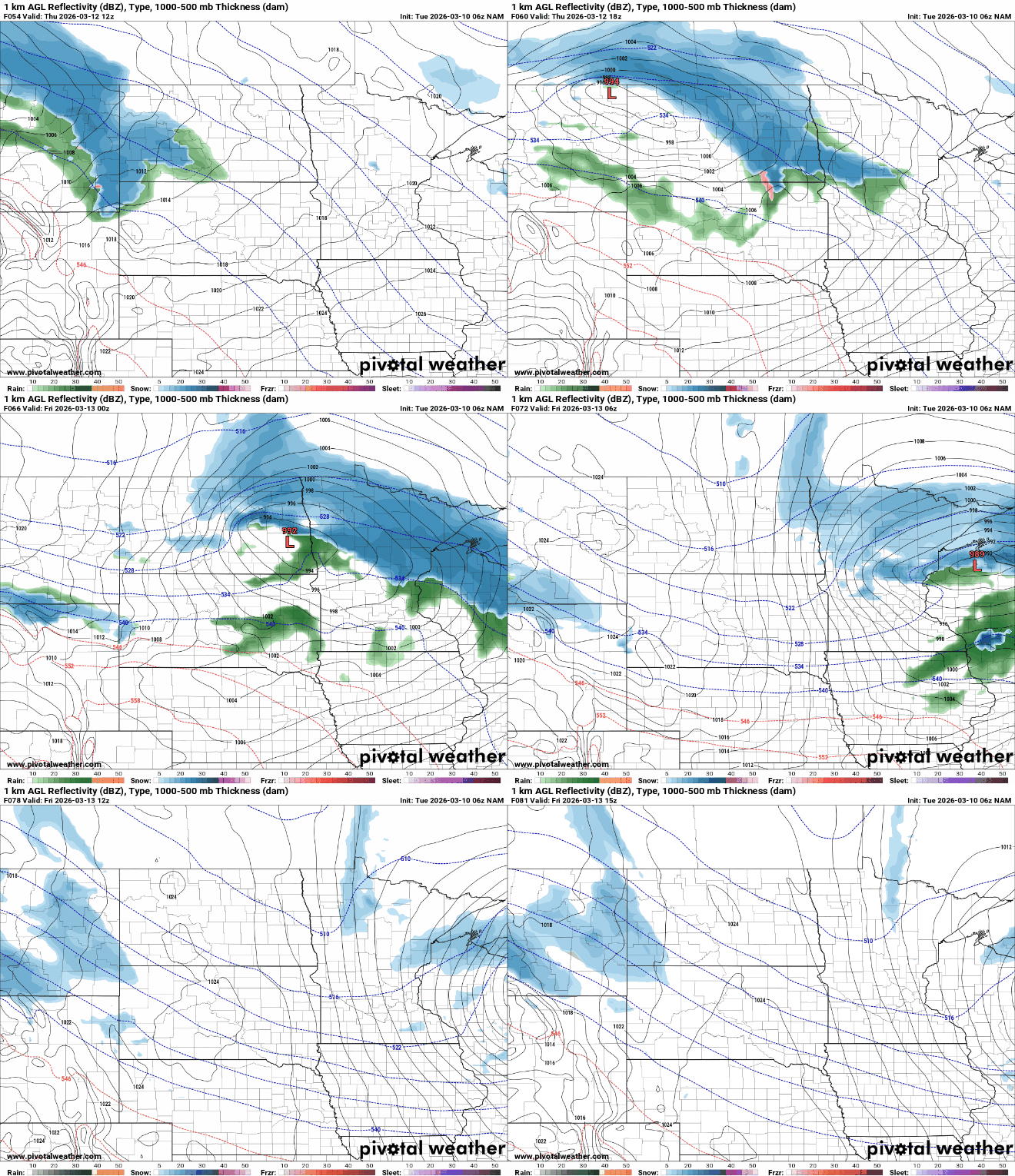
Several or more inches could fall along the North Shore Thursday into Thursday night with much less farther south where it’ll be warmer.

We’re also watching a potentially more significant storm system for the weekend that could deliver much more snowfall to somewhere in the region. Forecast models differ on track, but wherever it lines up, significant snow of more than 6 inches could fall.
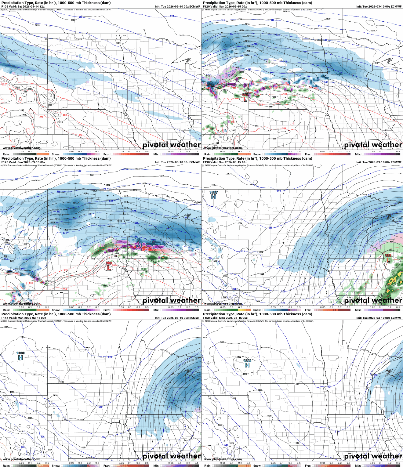
It’ll also be colder behind the weekend system with single digit lows Sunday night in southern Minnesota and potentially subzero readings in northern Minnesota.

