
Heavy snow north, rain south Thursday ahead of weekend storm
Colder air will follow the weekend system

Go Deeper.
Create an account or log in to save stories.
Like this?
Thanks for liking this story! We have added it to a list of your favorite stories.


After some nice sunshine Wednesday, clouds are racing back in Thursday ahead of the next storm system. Heavy snow develops north with rain south. Another system moves in this weekend.
Incoming system brings rain to southern Minnesota, heavy snow for North Shore
Temperatures will be a bit milder Thursday as the next incoming storm system pulls in warm air ahead of it. We’ll see highs in the 50s in southwestern Minnesota with 40s across central Minnesota and 30s north.

Those temperatures will play into precipitation types Thursday. Snow showers will develop northwest by midday and rain showers south Thursday afternoon.
That precipitation will expand east into the evening and overnight. Heavy snow will fall along the North Shore, boosted by Lake Superior.
Turn Up Your Support
MPR News helps you turn down the noise and build shared understanding. Turn up your support for this public resource and keep trusted journalism accessible to all.
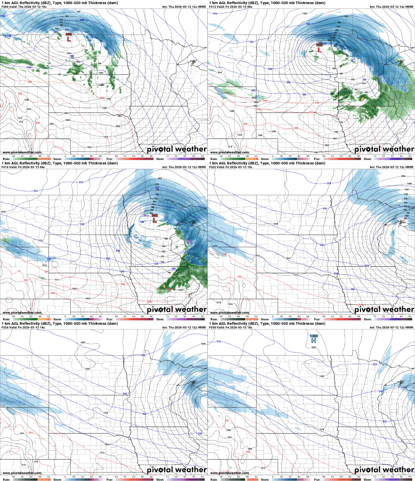
Several inches of snow will fall broadly across northern Minnesota but heavier totals will fall along the North Shore due to lake enhancement.

The other story in addition to precipitation will be some intense winds developing late Thursday into early Friday. The highest wind speeds will be in the overnight hours Thursday night.
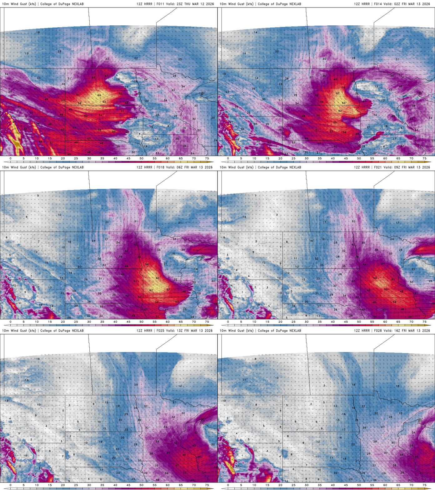
Wind gusts could be as high as 50 mph to even more than 60 mph in western Minnesota.

There are high wind warnings in western Minnesota in addition to blizzard warnings on the North Shore and winter storm warnings for large portions of northern Minnesota.

But wait, there’s more!
We’re still watching another storm system that will affect the region over the weekend. Somewhere from central Minnesota to northern Iowa and into Wisconsin will see significant, heavy snowfall Saturday into Sunday.
As of Thursday morning, the consensus among most forecast models is to put the heaviest snowfall in southeastern Minnesota.

There is variation among the models however, and the track will likely wobble and shift more before the system arrives late Saturday.
Anywhere in southern Minnesota, central and southern Wisconsin and northern Iowa should prepare for potentially significant snowfall greater than 6 inches with some areas potentially receiving more than a foot.

The weekend system will be followed by colder air for early next week too. Highs Monday will just be in the 20s and teens. It will feel more like January with temperatures that will be nearly 20 degrees below normal.

Monday night will bring subzero temps for many in Minnesota with single digits in the Twin Cities through early Tuesday morning.

Don’t blink, temperatures warm rapidly late next week. We’ll likely see 50s and even 60 degrees again.

