
Next winter storm already on the doorstep for the weekend
Temperatures will drop behind the storm to start next week

Go Deeper.
Create an account or log in to save stories.
Like this?
Thanks for liking this story! We have added it to a list of your favorite stories.


We’ll get a break from any precipitation for most of Friday with decreasing clouds. The next winter storm system moves in Saturday, dumping heavy snow across southern Minnesota into Sunday.
Quiet Friday before next winter storm moves in Saturday into Sunday
Blizzard and winter storm warnings persist for portions of Minnesota through early afternoon Friday. Up to another inch or two of snow could fall in Lake and Cook counties.

Heavy snow fell across a swath of northern Minnesota and especially the North Shore Thursday night into early Friday. Hovland has seen 14 inches as of 8:30 a.m. Friday morning. Duluth saw 9 to 11 inches.

Many locations in central and southern Minnesota, including the Twin Cities, have seen wind gusts over 60 mph. This is system No. 2 of the week departing this morning. There were 70 mph gusts in western Minnesota.
Turn Up Your Support
MPR News helps you turn down the noise and build shared understanding. Turn up your support for this public resource and keep trusted journalism accessible to all.

We’ll see lingering snow showers in northeastern Minnesota wind down with additional light accumulations. Clouds will decrease elsewhere, giving way to some afternoon sunshine. Afternoon highs will be in the 30s and 20s.

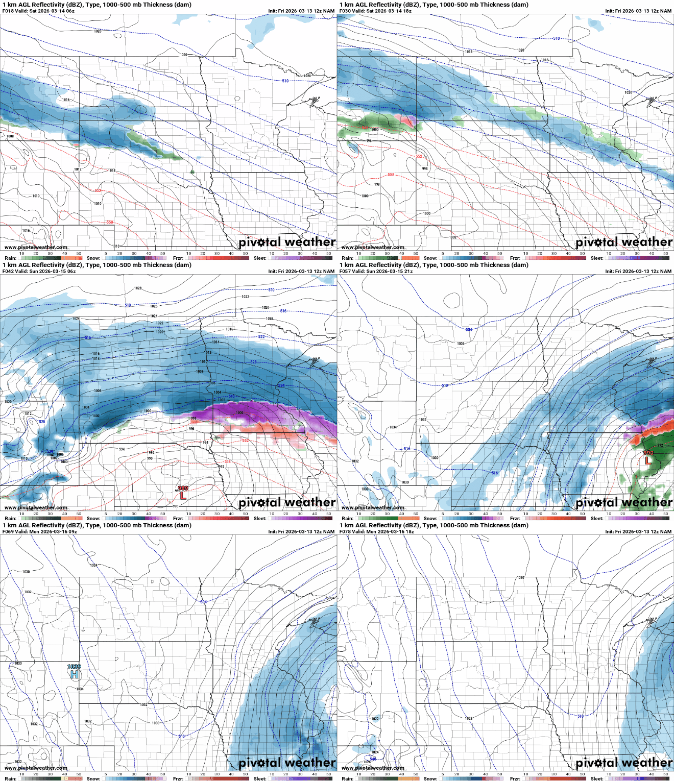
The next storm system will progress slower, pull in more moisture and take a more southerly track than last night’s system. There will be some scattered snow showers Saturday morning, but the main event will fill in for the evening into Saturday night and much of Sunday.
Winter storm warnings are now posted posted for central and southern Minnesota for the incoming weekend storm system Saturday evening through Sunday night.
Significant heavy snowfall is looking increasingly likely.

The heaviest snowfall will stretch across southern Minnesota into central and southern Wisconsin through Sunday night. Some could see more than a foot of snowfall. Here are several different forecast model scenarios:

There will be wobbling in the forecast track of this system over the next 24 hours. Some models are shifting north Friday morning, putting the heaviest snow in central instead of southern Minnesota. That’s why there’s such a large range of possibilities.
The National Weather Service forecast has a big range due to the probable ranges still possible with this system:
On the back side of the system, winds will increase again Sunday but not as high as Thursday night. Winds will be sustained at 15 to 30 mph from the north with 40 to 50 mph gusts.
Colder air is also moving in for the start of next week. It’ll be the coldest air mass since early February — a bizarre drop in temperatures in what’s been an otherwise mild February and early March.
Much of Minnesota could be subzero Monday night before temperatures warm rapidly late next week.


