
Powerful winter storm to slam Upper Midwest with heavy snow and blizzard conditions
50 mph winds create hazardous travel on Sunday

Go Deeper.
Create an account or log in to save stories.
Like this?
Thanks for liking this story! We have added it to a list of your favorite stories.


A powerful late-season winter storm is expected to bring heavy snow, dangerous winds and near-blizzard conditions to parts of Minnesota and western Wisconsin this weekend, with travel becoming nearly impossible on Sunday.
Early Saturday quiet, then snow slams in Saturday night
The weekend forecast is calling for the good, the bad and the ugly. The good news is early Saturday will be quiet, with temperatures in the 20s and 30s, giving people an opportunity to get outside or finish preparations before a strong winter storm moves in later Saturday.

The bad news is snow will begin to develop Saturday afternoon and quickly intensify during the evening. What starts as light snow will become heavier overnight as a strengthening low-pressure system moves toward the Upper Midwest.
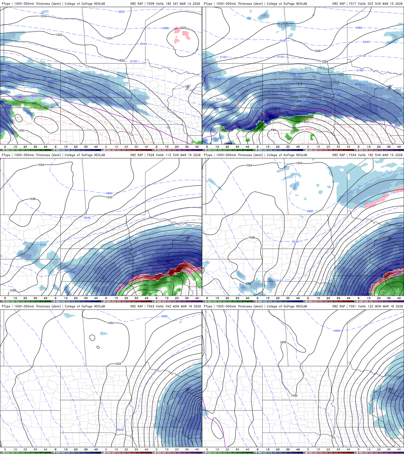
Winter storm warnings will be in effect from 4 p.m. Saturday through 4 a.m. Monday across much of the region. Blizzard warnings have also been issued for southern and southwestern areas, beginning at 10 a.m. Sunday and continuing until 4 a.m. Monday.
Turn Up Your Support
MPR News helps you turn down the noise and build shared understanding. Turn up your support for this public resource and keep trusted journalism accessible to all.

As the storm deepens, bands of heavy snow could produce snowfall rates of two to three inches per hour early Sunday, with thundersnow also possible. A widespread swath of heavy snow is expected to stretch from central Minnesota through the Twin Cities and into western Wisconsin. Many areas within this band could see 10 to 18 inches of snow, with isolated pockets possibly reaching 20 inches.
In far southern Minnesota, slightly warmer air aloft may briefly mix sleet with snow early Sunday morning, particularly along the Interstate 90 corridor. The precipitation is expected to transition back to all snow later, which could slightly reduce total snowfall in this area.
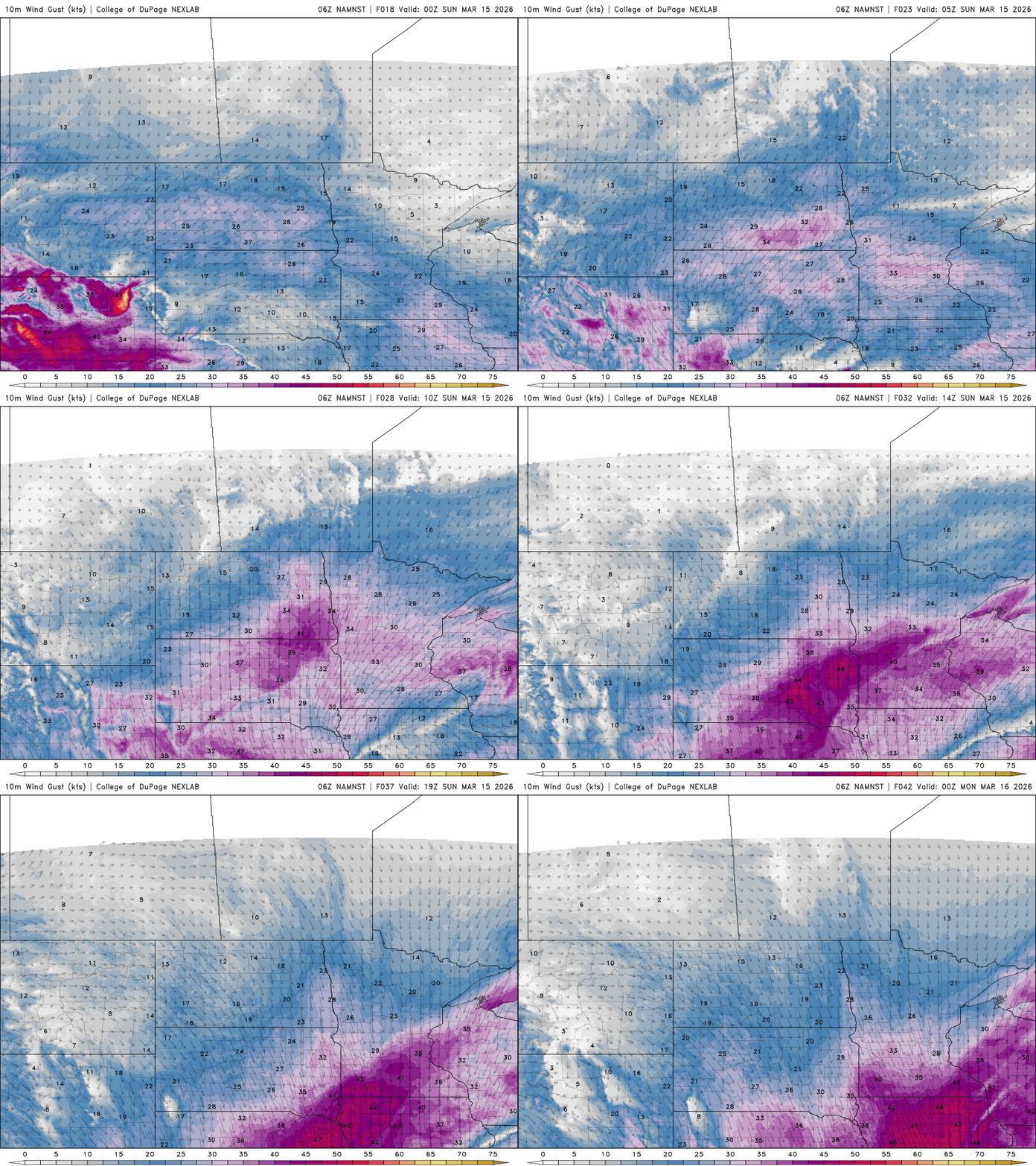
The ugly part of the forecast is that travel conditions are expected to deteriorate rapidly Saturday evening as snowfall intensifies. By Sunday, strong winds combined with falling and blowing snow could make travel extremely hazardous. Even as the snow begins to taper late Sunday, gusty winds are expected to continue, with no travel advised on Sunday.

Wind gusts could reach 45 to 55 mph across southern Minnesota Sunday afternoon, with gusts of 30 to 40 mph possible around the Twin Cities area.
Our Monday morning commute could be tricky, as cleanup is expected to take time due to the heavy, wet snow.
Looking beyond this system, another weaker weather system may bring light snow Tuesday night into Wednesday, with accumulations of one to two inches possible. Otherwise, calmer weather is expected through the remainder of the week, though cooler temperatures may slow snowmelt even as sunshine returns.

