
Fire weather concerns across Minnesota with warm, windy and dry conditions
Quiet weekend ahead with warming temperatures
Go Deeper.
Create an account or log in to save stories.
Like this?
Thanks for liking this story! We have added it to a list of your favorite stories.


A cold start Saturday morning will quickly transition to warm, windy, and very dry conditions by this afternoon, leading to critical fire weather conditions and a Red Flag Warning across the area.
Warm and windy afternoon with red flag warning
After a cold start to the day, conditions across Minnesota are set to change quickly and dramatically. By mid to late morning, winds will shift out of the south and increase rapidly with gusts reaching 35 to 45 mph. Stronger gusts up to 50 mph are possible across western Minnesota.

These strong southerly winds will also help temperatures rebound quickly. Afternoon highs are expected to climb into the 60s across western Minnesota, with mid to upper 50s in the Twin Cities metro and central Minnesota. Cooler 40s will persist in northern Minnesota and the Arrowhead region.

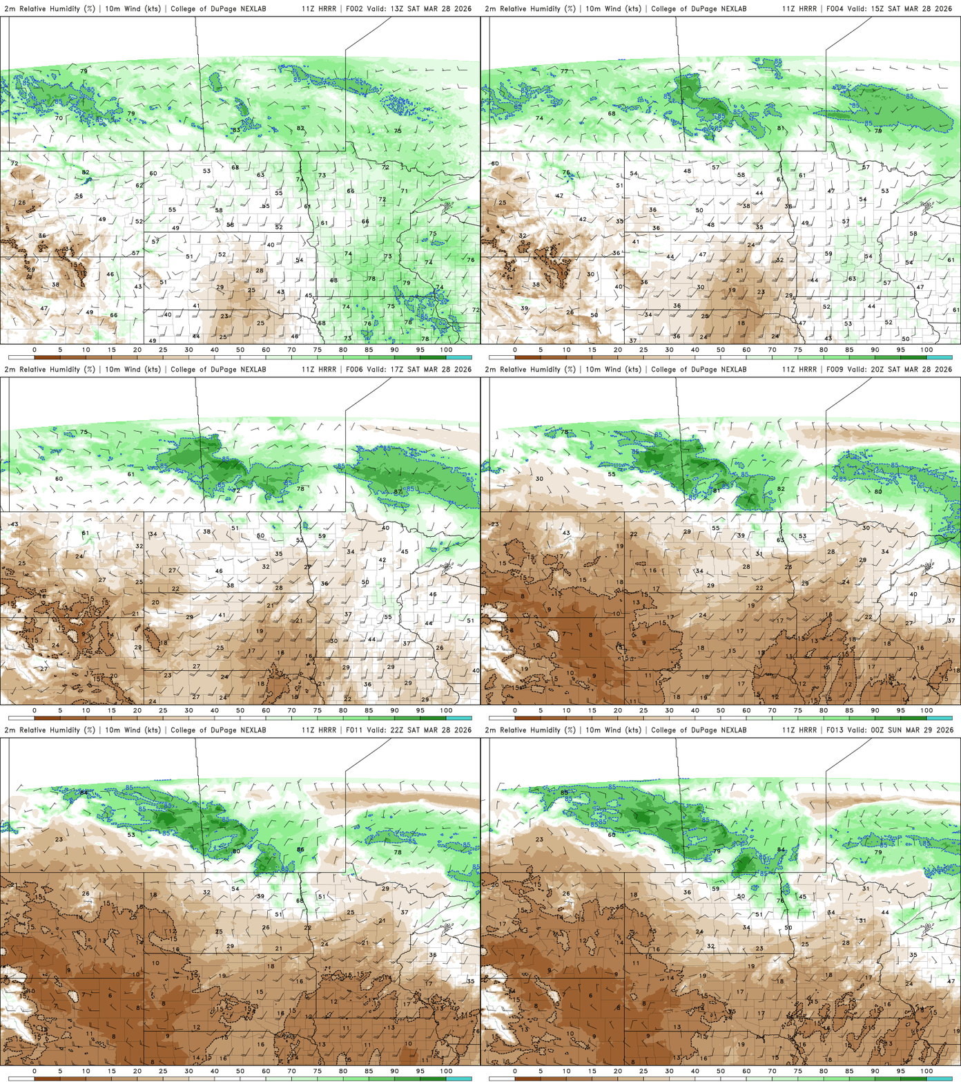
However, the warmth brings a significant concern: extremely dry air. Dew points are expected to fall into the teens across much of the state, and possibly into the single digits in southwestern Minnesota. This will drive relative humidity below 20 percent in many areas, with some spots approaching 10 percent.
The combination of warm temperatures, strong winds, and very low humidity will produce critical fire weather conditions. A red flag warning has been issued for Saturday across the southern two-thirds of the state. Any outdoor burning is strongly discouraged, as fires could spread rapidly under these conditions.

The warm-up continues into Sunday and Monday, with highs in the 60s and 70s, and a few locations in southwestern Minnesota reaching the low 80s.

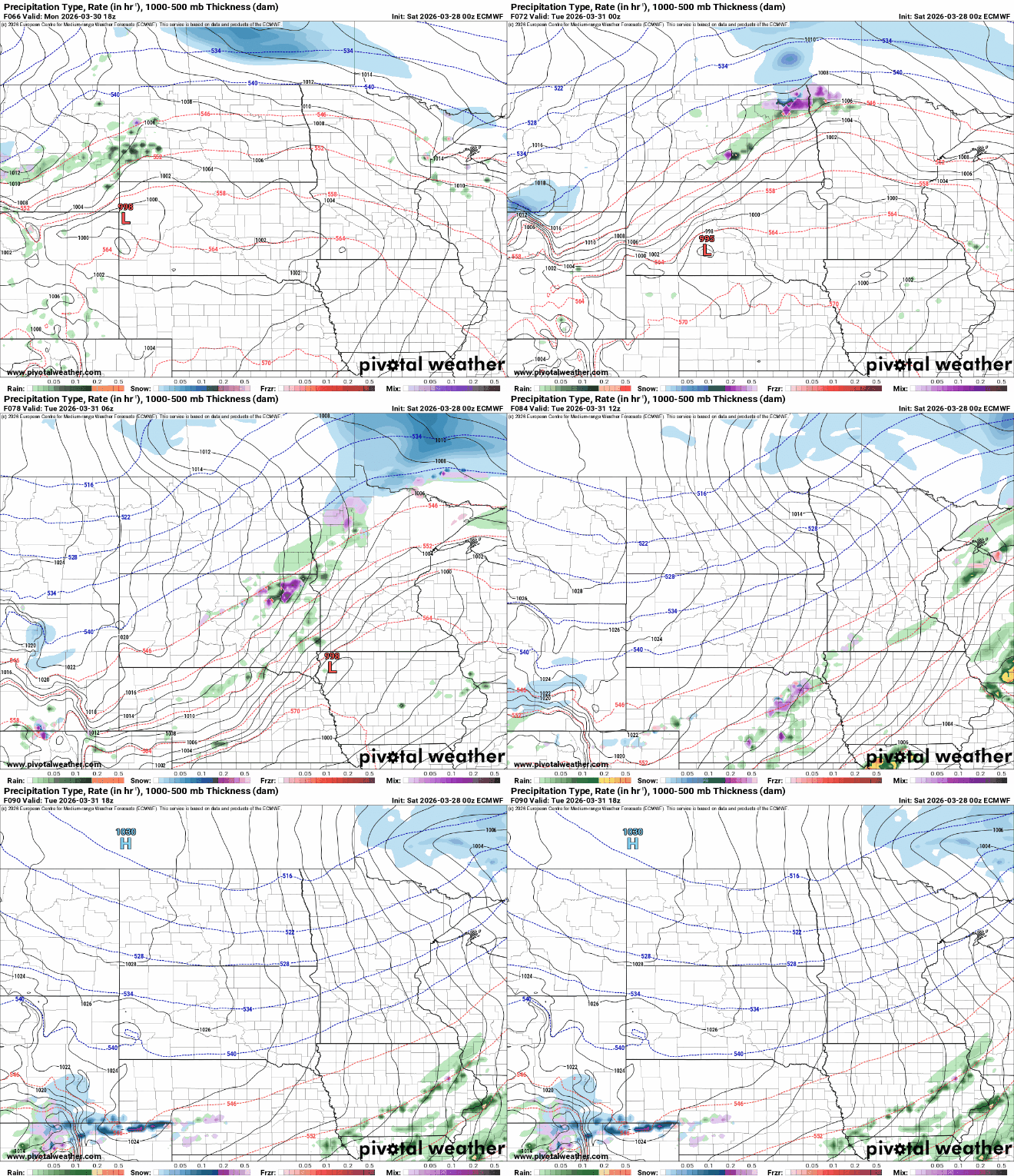
Changes arrive beginning Tuesday as a cold front moves through the region. A more active weather pattern will bring several chances for precipitation next week. Current forecast models indicate that precipitation from Tuesday’s cold front will remain mostly over northern Minnesota.
Turn Up Your Support
MPR News helps you turn down the noise and build shared understanding. Turn up your support for this public resource and keep trusted journalism accessible to all.

