
Spring heat builds before stormy turn
70s and 80s for southern Minnesota with thunderstorm chances
Go Deeper.
Create an account or log in to save stories.
Like this?
Thanks for liking this story! We have added it to a list of your favorite stories.


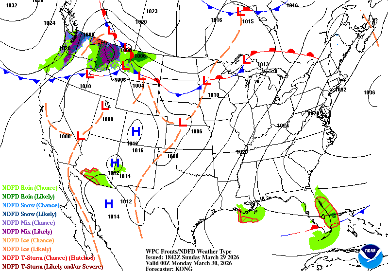
Minnesota will be split in two to start the week, as a nearly stationary front separates warm air from cooler conditions north while bringing increasing chances for showers and thunderstorms.
Tale of two air masses
A nearly stationary front will stretch across Minnesota into Monday, acting as the dividing line between much warmer air to the south and cooler conditions to the north. This boundary will play a key role in both temperature differences and precipitation chances across the state.
Low temperatures Sunday night will drop into the mid-20s north to the low 40s in southern Minnesota.
Turn Up Your Support
MPR News helps you turn down the noise and build shared understanding. Turn up your support for this public resource and keep trusted journalism accessible to all.

The warm front will gradually lift north overnight Sunday into Monday, setting the stage for another unseasonably warm day. Highs are expected to reach the 70s and 80s south of the boundary, while areas north of the front across central and northern Minnesota may remain cooler, with temperatures in the 40s and 50s with more cloud cover.

The next chance for precipitation arrives Monday night into Tuesday as the stalled front becomes the focus for developing weather. A surface low will move east from the Dakotas, bringing a chance of precipitation. The Northland could see a mix of freezing rain and light, slushy snow, with accumulations of a couple of inches possible.
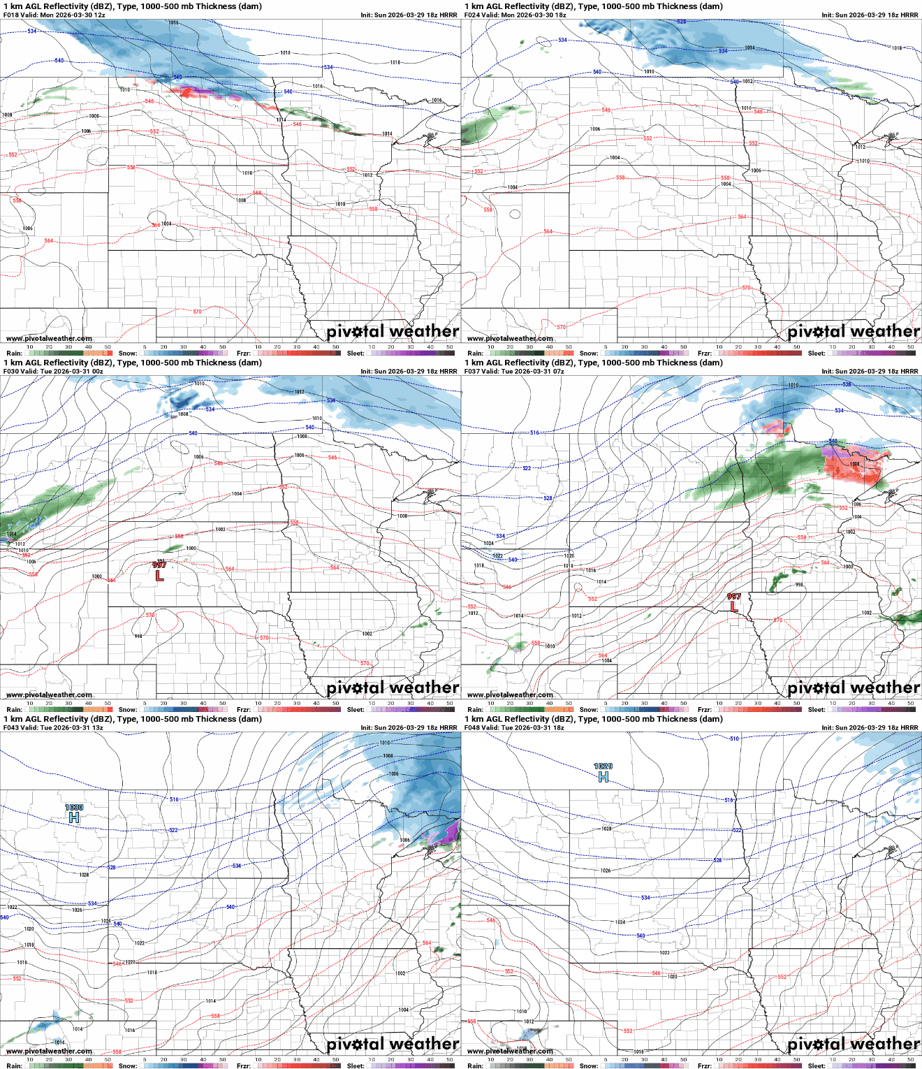
Isolated thunderstorms are likely overnight Monday into Tuesday morning, mainly across southern Minnesota and western Wisconsin. Some storms could produce small hail and gusty winds. The Storm Prediction Center has outlined a marginal risk, or level 1 of 5, for severe weather from southeastern Minnesota into central Wisconsin.

Cooler air returns Tuesday, with highs falling back into the 40s and 50s. Attention then shifts to a potentially more active weather pattern later in the week.

