2 rounds of wet, icy wintry weather on the way
Rain, ice and snow will all affect Minnesota
Go Deeper.
Create an account or log in to save stories.
Like this?
Thanks for liking this story! We have added it to a list of your favorite stories.


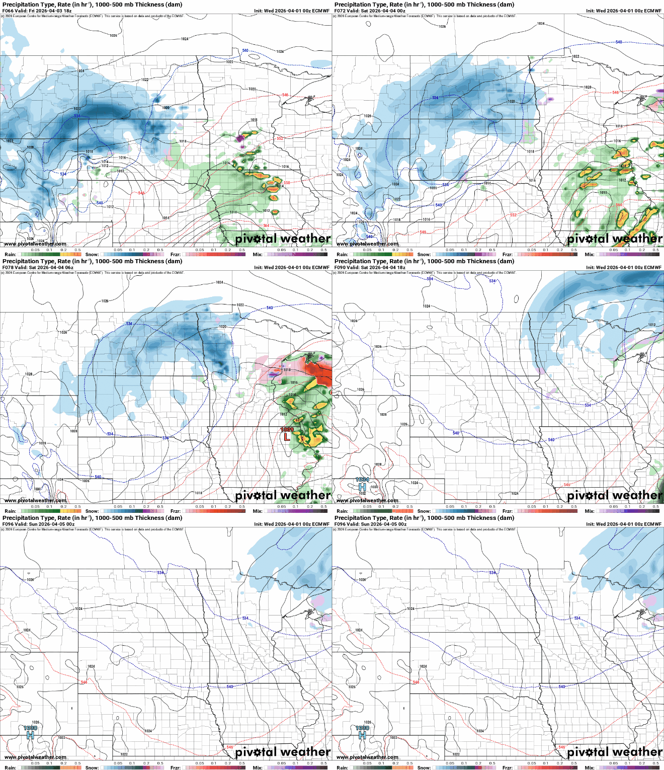
Clouds increase Wednesday, then rain and snow develop later Wednesday into Wednesday night when we’ll see a wintry mix. Wintry precipitation continues into Thursday with another system Friday into Saturday.
2 rounds of wet, wintry weather incoming
We’ll be dry most of Wednesday with clouds increasing through the day. Afternoon highs will be mostly in the 30s and 40s across Minnesota.

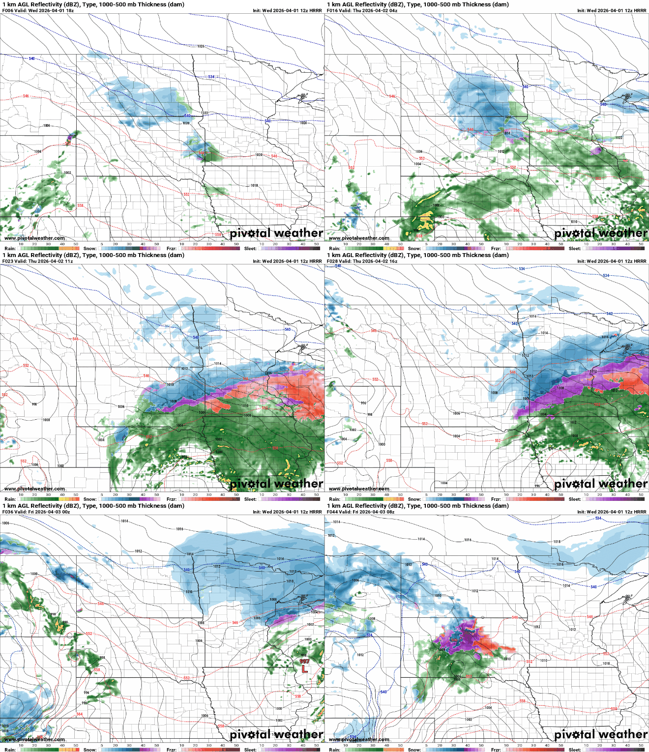
Rain showers will move into southwestern Minnesota Wednesday afternoon and expand north and east into the evening. Snow showers will develop in west-central Minnesota and spread across north-central Minnesota into the evening.
Overnight snow will be the dominant precipitation type in northern Minnesota with a wintry mix in central Minnesota, including freezing rain with mostly rain south.
Turn Up Your Support
MPR News helps you turn down the noise and build shared understanding. Turn up your support for this public resource and keep trusted journalism accessible to all.
Winter storm warnings and winter weather advisories are posted across Minnesota for Wednesday night into Thursday.

Temperatures Wednesday night will be critical in determining precipitation type. Low temperatures will dip to near-freezing in southern Minnesota while rain, sleet and snow are falling.

Here’s a snapshot of precipitation and type roughly by time frame Wednesday night into Thursday evening. Purple is freezing rain, pink or red is sleet or ice pellets, green is rain and blue is snow.

The map below offers a closer view of potential early morning temperatures Thursday.
I’ve highlighted areas that look to be just below freezing, where ice accumulation is likely. This is why the current winter storm warning highlights the south and east metro into southeastern Minnesota and western Wisconsin where temperatures may be cold enough, long enough for ice accumulation.
Any shift of temperatures one degree or another will change the outcome between ice or rain.

Ice accumulation will be possible late Wednesday night into Thursday morning across portions of central and southeast Minnesota, including the Twin Cities. Many areas could see one-quarter inch or more of ice accumulation in the early morning hours Thursday.

The bulk of the snowfall with this second system of the week will fall across central and northern Minnesota and the North Shore.
The Twin Cities will likely see some slushy accumulation, but with precipitation moving back and forth from rain to sleet and freezing rain and snow back to rain we’ll be rather limited.

Another system moves in for Friday into Saturday. It will likely bring another round of wintry precipitation with multiple types. The snowfall looks to follow a similar pattern as Wednesday night’s and Thursday’s system.