
Wintry mix Thursday into Thursday night, then another system Friday
Sunday into early next week looks drier and quieter

Go Deeper.
Create an account or log in to save stories.
Like this?
Thanks for liking this story! We have added it to a list of your favorite stories.


A wintry mix of freezing rain, sleet and snow will continue across much of the region Thursday morning. Most midday and afternoon precipitation will be sleet, rain and snow into Thursday night.
Wintry precipitation Thursday, then a break ahead of next system
It’s a variety show of winter weather Thursday morning in Minnesota.
Freezing rain will continue through midmorning in portions of the region. Sleet and snow will also fall in central Minnesota. Mostly snow will continue north into Thursday night while southern Minnesota turns back to rain. The precipitation will wrap up overnight.
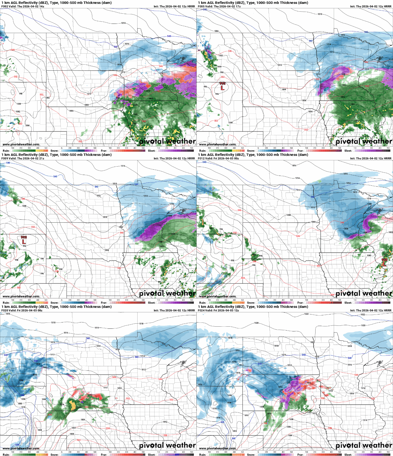
Most roadways are just wet Thursday morning in southern Minnesota. Roads are partially snow covered in central and northern Minnesota.
Turn Up Your Support
MPR News helps you turn down the noise and build shared understanding. Turn up your support for this public resource and keep trusted journalism accessible to all.

What saved our roads was warm ground and roadways, despite the near-freezing or below freezing air temperatures earlier. That’s why ice mostly accumulated on tree branches, cars, rooftops and other surfaces above ground. That heat from recent warm days is still stored in the soils and road surfaces.

Winter storm warnings continue for some areas (in pink on the map below) through late Thursday morning for ice and sleet. Winter weather advisories continue for much of Minnesota and western Wisconsin into Thursday night for snow and a wintry mix.

For the North Shore, the winter storm warning is for heavy snowfall Thursday into Thursday night:

Additional ice accumulation Thursday morning will be confined to areas mostly outside the Twin Cities where temperatures are colder. Ice accumulation will largely stop by late morning as the sun angle becomes higher, even through cloud cover.

Snowfall will be the dominant concern in central and northern Minnesota, especially the North Shore which will see, once again, the heaviest snowfall totals.
We’ll get a short break before the next storm system moves in Friday afternoon into Saturday. It will once again bring a wintry mixed bag of precipitation types with a similar overall track and precipitation pattern.
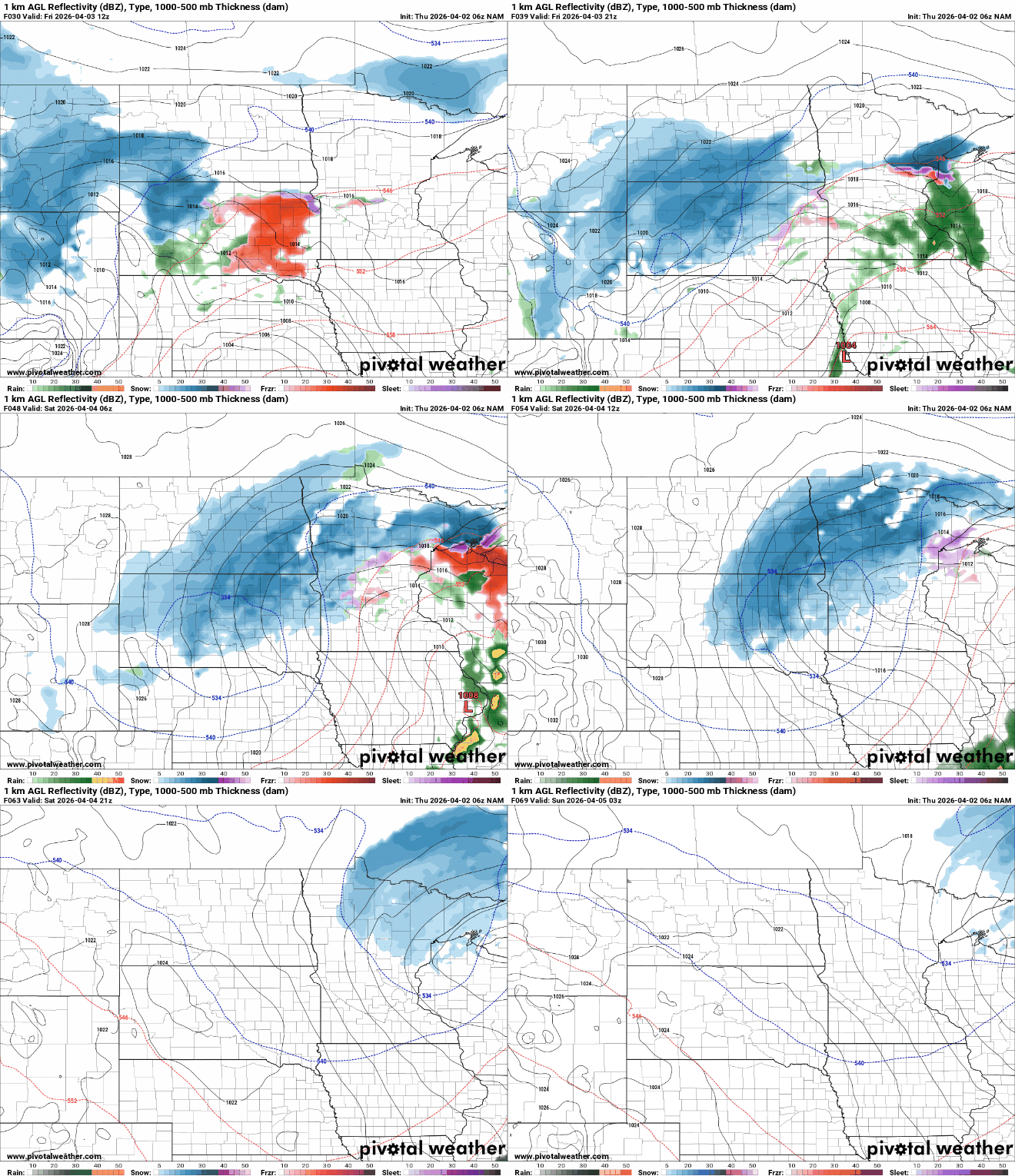
Snowfall with this this next system will once again dominate much of central and northern Minnesota, including the North Shore, with snow wrapping up late Saturday.

Sunday through midweek looks quieter but slightly cooler than normal with sunshine breaking out Sunday. We might see some activity again mid to late next week, but that’s still quite far out in the forecast world.

