
As one system moves out, another moves in Friday into Saturday
A mixed bag again of rain, ice and snow

Go Deeper.
Create an account or log in to save stories.
Like this?
Thanks for liking this story! We have added it to a list of your favorite stories.


As one storm system exits northeastern Minnesota, another will push into western Minnesota Friday. Heavy snow is expected north with a mixed bag south into Saturday.
Next storm system moves in Friday into Saturday
Northern Minnesota got its fill of snowfall over the last day and a half. Some areas saw more than 6 inches of fresh, wet snowfall. Thief River Falls received 8 inches while a broad area from Bemidji and Park Rapids to Cohasset and Duluth received 6 to 7 inches. Finland, on the North Shore received 7.9 inches.

As one system exits, another will move in. We’ll get another several hours of dry weather before the next storm system moves into Minnesota. It’ll be cloudy and breezy Friday with highs in the low 40s east and just 30s west.

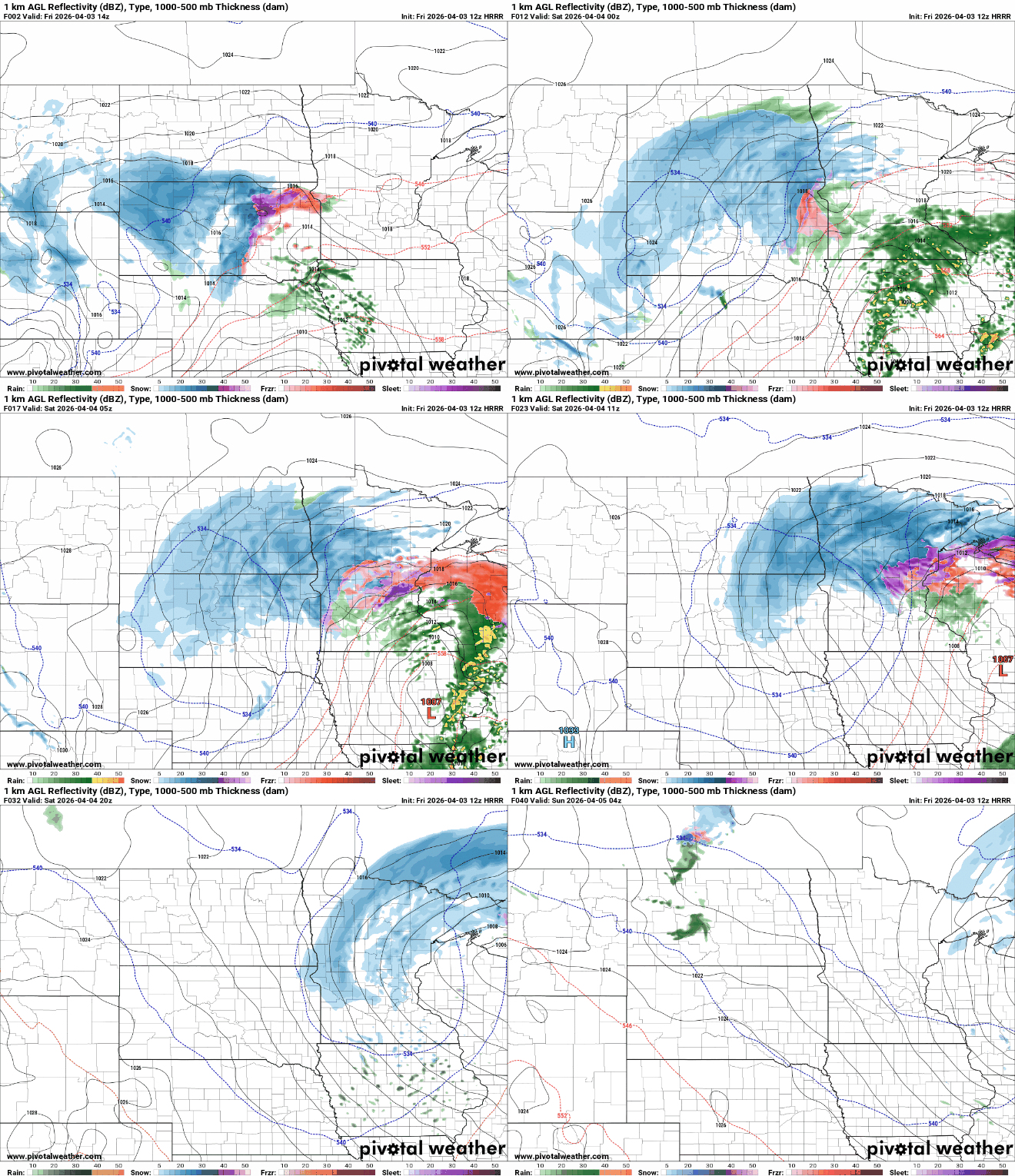
Precipitation will develop in western and southwestern Minnesota later Friday morning with rain on the southern end and a wintry mix with potentially some freezing rain and sleet in west-central Minnesota. That precipitation will then expand east and northeast.
Turn Up Your Support
MPR News helps you turn down the noise and build shared understanding. Turn up your support for this public resource and keep trusted journalism accessible to all.
The rain, potentially mixing with snow flakes, will be more scattered Friday afternoon for the Twin Cities area — so the Twins’ home opener shouldn’t be a total washout.
Central Minnesota will see a mix during the day Friday with freezing rain potential into northwest Wisconsin, changing to mainly snow Friday night.
Northern Minnesota sees all snow into Friday night and Saturday. Southern Minnesota will see mostly rain with an occasional mix and even thunderstorms. We might see a brief period of snow Saturday evening in the Twin Cities and southern Minnesota.
A winter storm warning is posted for northwestern and northern Minnesota with winter weather advisories elsewhere for later Friday into Saturday.

There could be a couple of strong storms even in southeastern Minnesota Friday evening. There’s a marginal risk (level 1 of 5) of severe storms with the primary threat being some hail with elevated thunderstorm activity.

Snow will be heavy for northwestern and north-central Minnesota and the North Shore once again, coming in at more than 6 inches. Totals will once again drop off quickly farther south.
We’ll also watch for the potential for some ice accumulation in western and central Minnesota Friday morning and in other parts of the state and northwest Wisconsin late Friday night and early Saturday morning.

Easter Sunday looks brighter as the system exits Saturday night. Look for scattered clouds Sunday and temperatures just a little bit cooler than normal, mostly in the 40s.

Next week looks quiet overall with cooler-than-normal temperature to start the week, but we could be back to 60 in the Twin Cities and southern Minnesota midweek. If you’re looking for more springlike weather, Wednesday will be your day:

A clipper system is possible late Wednesday into Thursday and potentially a larger system at the end of next week.

