
Chilly start to the week with spring temperatures returning by Wednesday
We’ll have precipitation chances Wednesday and this weekend

Go Deeper.
Create an account or log in to save stories.
Like this?
Thanks for liking this story! We have added it to a list of your favorite stories.


Temperatures will start the week below normal. Springlike temperatures are back by Wednesday. We’ll have chances of showers Wednesday with a clipper system and weekend thunderstorms possible.
Chilly start to the week; spring temps return midweek
After near-normal temperatures Sunday, it’ll be a chilly start to the week. Temperatures Monday will average 15 to 20 degrees colder than normal with highs mostly in the 30s and 20s with a mix of clouds and sun.

Overnight we could see some subzero readings in far northern Minnesota. Most overnight lows will range from near 20 south to near zero north.

Tuesday will again be cool with highs mostly in the 40s and 30s, but we see a return of warmer weather Wednesday. Highs will be in the 60s across southern Minnesota.
Turn Up Your Support
MPR News helps you turn down the noise and build shared understanding. Turn up your support for this public resource and keep trusted journalism accessible to all.

We do have some precipitation chances with a clipper system Tuesday night into Wednesday bringing rain and snow showers to Minnesota. Snow showers are likely north while mainly just rain showers are likely south.
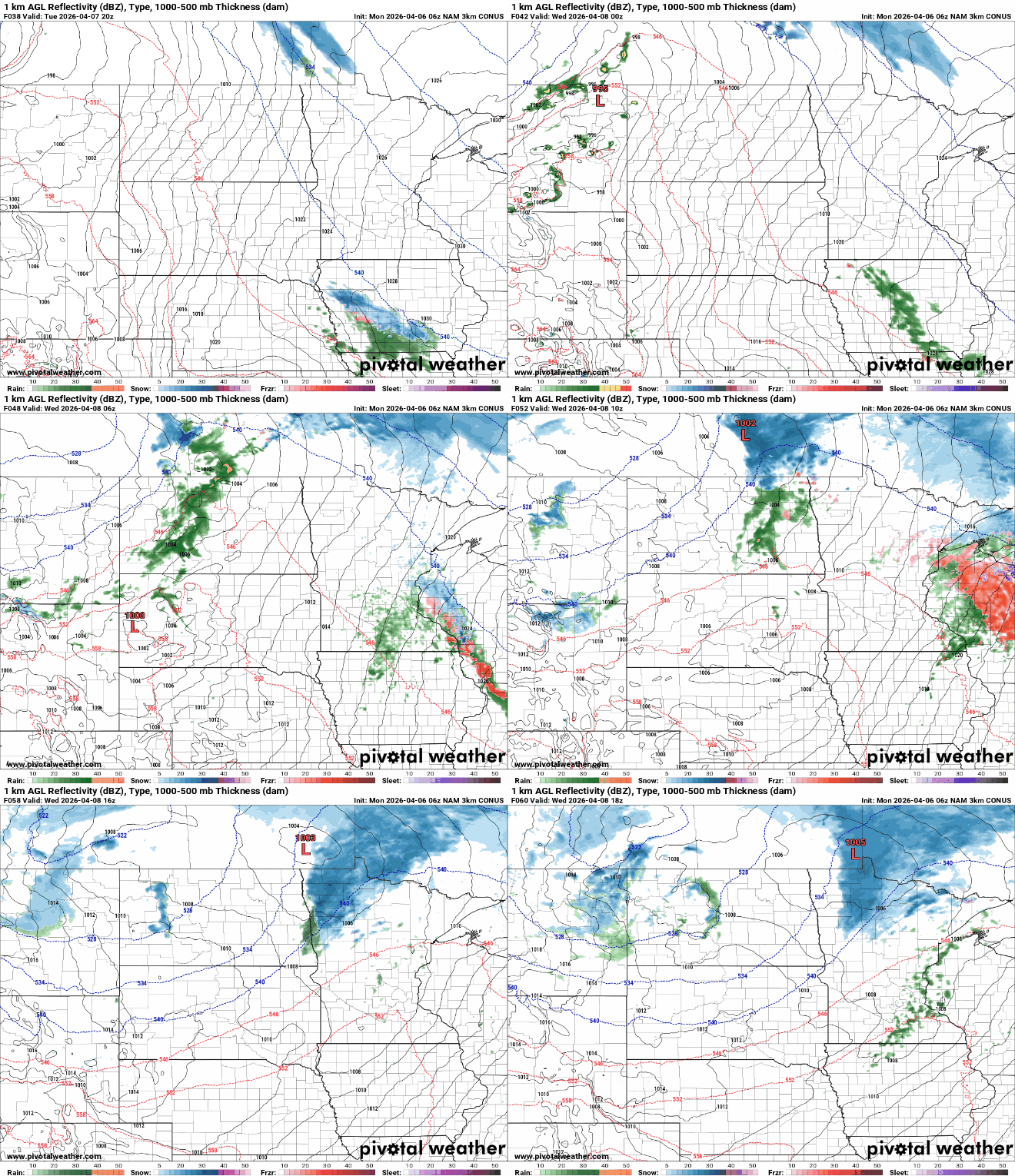
Snowfall will be fairly modest north. Most areas will just see a slushy coating but up to 1 or 2 inches will be possible for some spots in far northern Minnesota and in the Arrowhead region.

The weekend will bring another chance at rain with perhaps thunderstorms and maybe even our first chance of severe weather. Temperatures will warm to 70 degrees by Sunday with dew points increasing into the 50s, sufficient enough moisture for potentially bumpy weather.
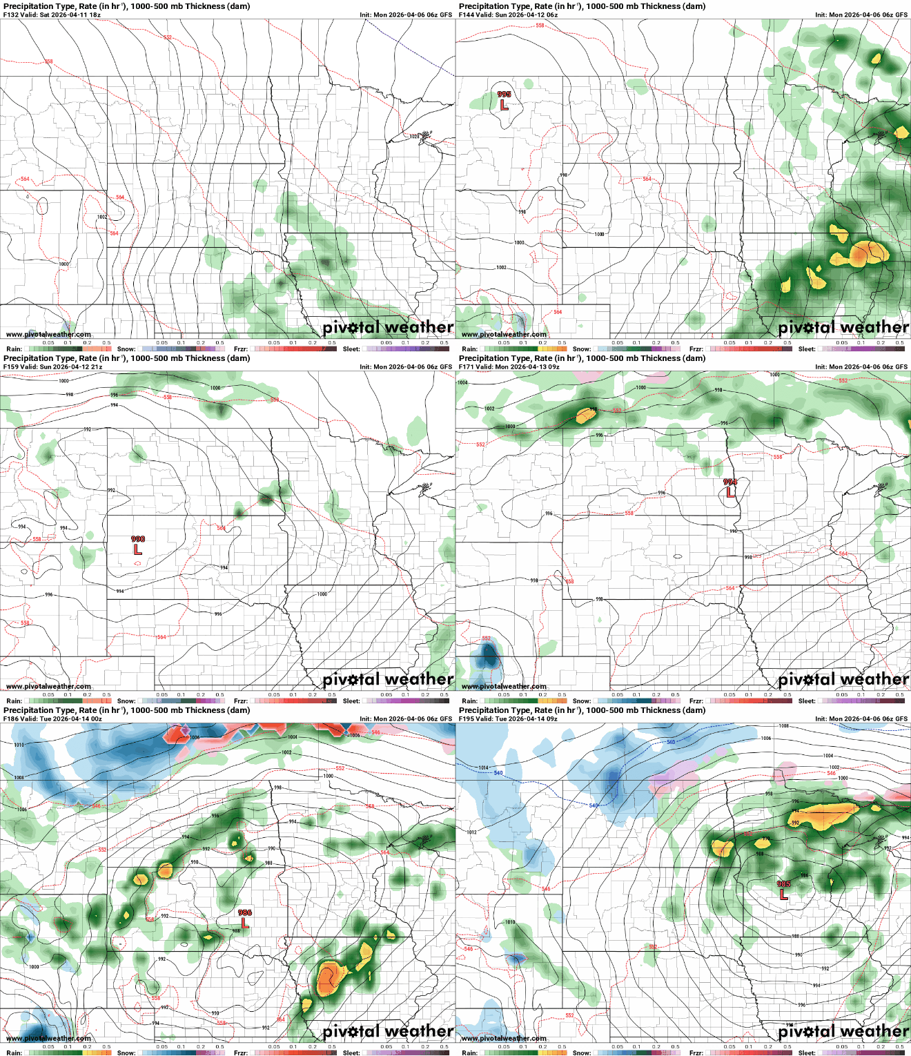
We could be looking at some impressive multiday rainfall totals with the weekend system lingering into early next week.


